

Latest Weather Blog
Thursday PM Forecast: tropical moisture keeps scattered storms for another afternoon
Tropical moisture has pushed into the region causing an uptick in the number of showers and thunderstorms. While the rain is needed, some thunderstorms could produce gusty wind.
A * HEAT ADVISORY* is in effect from 10am to 7pm Friday for all of southeast Louisiana and southwest Mississippi, as feels-like temperatures over 108 degrees are expected. Hot temperatures will combine with moderate humidity and could possibly cause heat illnesses. Drink plenty of fluids, and when possible, stay in an air-conditioned rooms, avoid afternoon sun, and check up on relatives and neighbors.
Tonight & Tomorrow: Lingering showers and thunderstorms will fall apart after dusk. Some clearing is expected as low temperatures settle in the upper 70s. Again on Friday, there will be enough moisture in the region to squeeze out scattered precipitation. Any thunderstorms that develop will be capable of gusty wind, frequent lightning and downpours. Early sun will cause high temperatures to soar into the upper 90s by early afternoon before the onset of clouds, showers and thunderstorms.
Up Next: The moisture that supported a brief uptick in showers and thunderstorms will slowly dry up Saturday and especially Sunday. Daily coverage will scale back to spotty or isolated. On Monday, a weak front will push through the Metro Area causing a minor dip in humidity and low temperatures as well. A drier and more comfortable warmth is pegged for Tuesday and Wednesday. We will also be able to get low temperatures back to average in the low 70s. On the other hand, since drier air warms up more efficiently than humid air, we will keep high temperatures rather hot. The heat index may just be a tad more muted than previous days.
Trending News
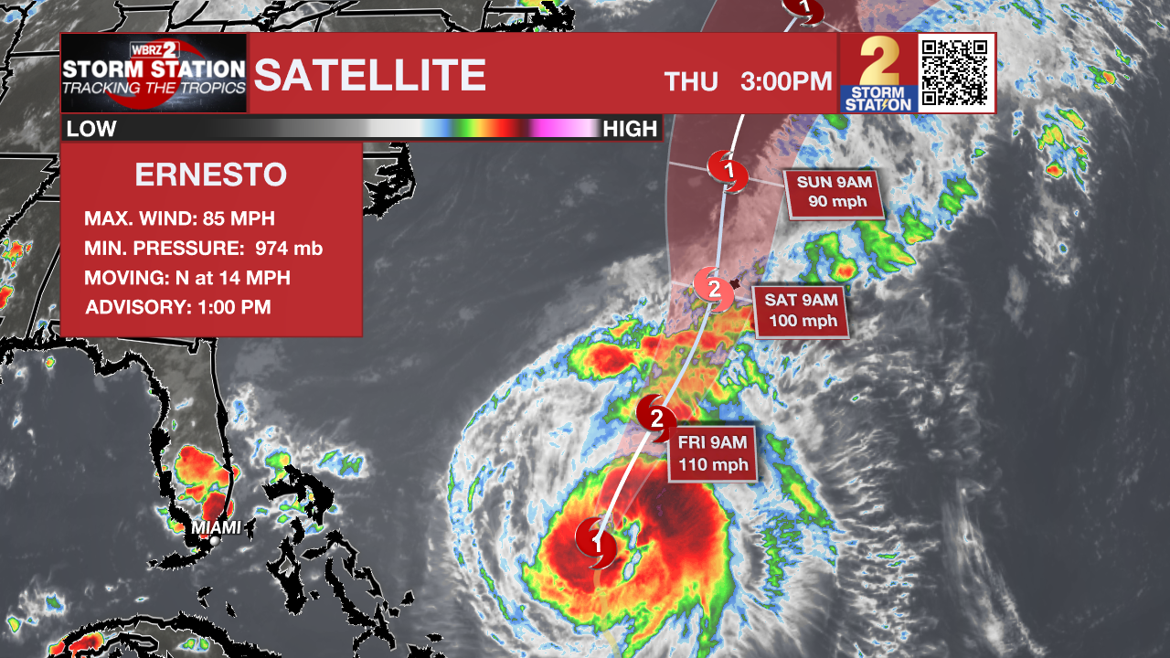
The Tropics: Hurricane Ernesto is expected to steadily strengthen over the Atlantic Ocean, prompting a hurricane warning for Bermuda. As of 4pm Thursday, Ernesto had maximum sustained winds of 85mph and was moving north at 14mph. Ernesto will continue north or northeast on Friday at a slightly slower forward speed while getting larger strengthening toward major hurricane status. The storm will be close to Bermuda this weekend.
Get the latest 7-day forecast and real time weather updates HERE.
Watch live news HERE.
– Josh
The Storm Station is here for you, on every platform. Your weather updates can be found on News 2, wbrz.com, and the WBRZ WX App on your Apple or Android device. Follow WBRZ Weather on Facebook and Twitter for even more weather updates while you are on the go.
More News
