

Latest Weather Blog
Saturday AM Forecast: more of the same heat this weekend, a few storms possible
More of the same Louisiana heat is expected this weekend with highs in the upper 90's. A few pop up storms cannot be ruled out in the afternoon and evening hours.
A *HEAT ADVISORY* is in effect from 10am to 7pm Saturday for all of southeast Louisiana and southwest Mississippi, as feels-like temperatures up to 111 degrees are expected. Hot temperatures will combine with moderate humidity and could possibly cause heat illnesses. Drink plenty of fluids, and when possible, stay in an air-conditioned rooms, avoid afternoon sun, and check up on relatives and neighbors.
Today & Tonight: We will start off the day mostly sunny, and stay that way until the afternoon. By that time, clouds will begin to build, and some of those could form in thunderstorms. Yesterday was a good indication that coverage of storms will not be that high today. Only about 30% of the viewing area will pick up measurable rainfall. Get ready for some more hot conditions. Highs will get into the upper 90's, with high humidity making it feel up to 111 degrees. Tonight, any lingering storms will quickly dissipate. Lows will be near 78 degrees under mostly clear skies.
Up Next: It will be rinse and repeat in the weather department for Sunday. The only difference is lower chances of pop up storms. Some changes will occur in the weather starting early next week. A weak front will approach, and move through the area on Monday. Before the front, some storms will be possible. Once it passes through, lots of dry air will filter in. This will do three things: shut off rain chances through the middle of the week, create lower humidity levels, and cause lows to be in the lower 70's. It will still be hot, but the lower humidity will make the upper 90's more tolerable.
Trending News
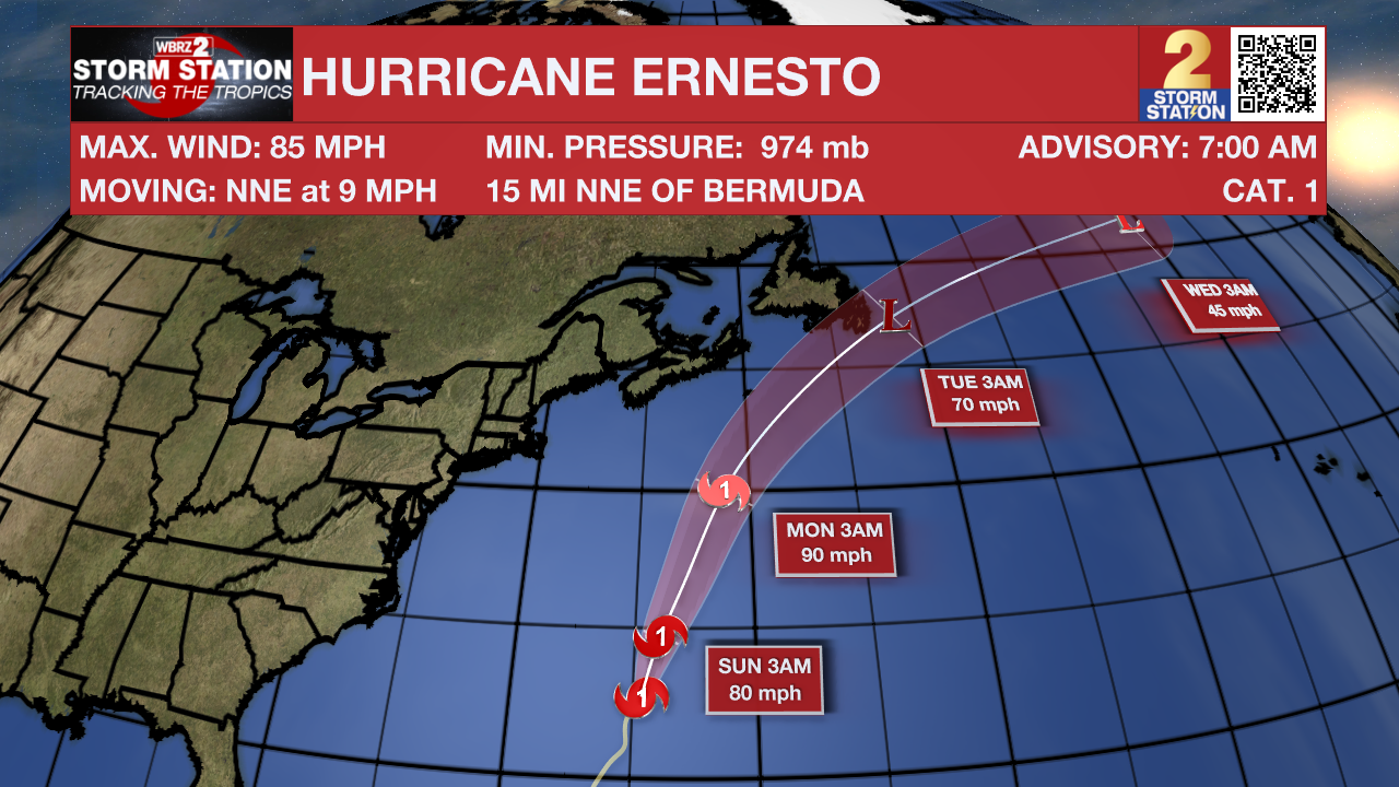
The Tropics: Hurricane Ernesto's center is now pulling away from Bermuda. As of 8am, Ernesto has 85 mph winds, and is moving NNE at 9 mph. Ernesto might slowly strengthen again as it moves north. This will be short lived, as it will eventually hit the cooler waters of the Atlantic Ocean. The system should become a strong non-tropical low early next week.
Get the latest 7-day forecast and real time weather updates HERE.
Watch live news HERE.
– Balin
The Storm Station is here for you, on every platform. Your weather updates can be found on News 2, wbrz.com, and the WBRZ WX App on your Apple or Android device. Follow WBRZ Weather on Facebook and Twitter for even more weather updates while you are on the go.
More News
