

Latest Weather Blog
Saturday PM Forecast: heat index nearing 120 degrees tomorrow, eyes on next front
A very hot day is expected tomorrow, with temperatures nearing 100 degrees. Some relief is on the way, as we have eyes on our next front.
An *EXCESSIVE HEAT WARNING* is in effect from 10am to 7pm Sunday for almost all of southeast Louisiana and southwest Mississippi, as feels-like temperatures up to 120 degrees are expected. Hot temperatures will combine with high humidity and could possibly cause heat illnesses. Drink plenty of fluids, and when possible, stay in an air-conditioned rooms, avoid afternoon sun, and check up on relatives and neighbors.
Tonight & Tomorrow: A very muggy night is expected. Lows will be near 79 degrees under partly cloudy skies. Tomorrow will be very hot. Humidity will be in the extreme category, causing feels like temperatures up to 120 degrees! Actual temperatures will approach 100 degrees. This is unlikely to break the record of 102 degrees set last year. Cool down showers will be hard to come by, and should stay spotty in nature.
Up Next: Clouds should increase in coverage Sunday night because of an upper level disturbance. This should also cause a few storms to be possible. More storms will occur on Monday ahead of a weak front. Coverage has been kept at isolated for now, but further adjustments may need to be made. The front should pass through late Monday and behind it, much drier air. This will keep humidity in check, and also limit rain coverage for most of the week. Unfortunately, highs will stay in the mid to to upper 90's. Lows on the other hand, will reach into the lower 70's for multiple nights in a row.
Trending News
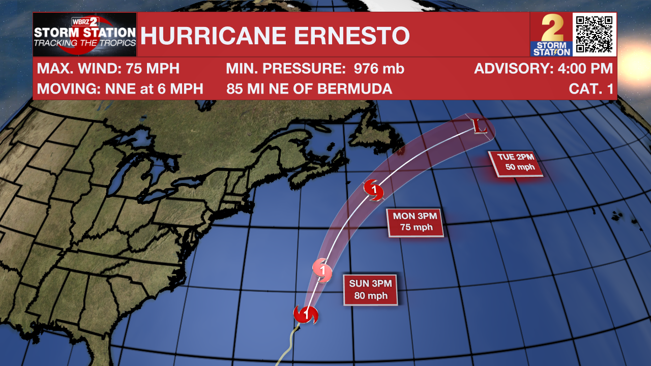
The Tropics: Hurricane Ernesto is slowly inching away from Bermuda. As of 5pm, Ernesto has weakened to a minimal hurricane with 75 mph winds, and is moving NNE at 6 mph. The foward speed should pick up over the next several days as it continues north. By Monday, the cooler waters of the northern Atlantic will begin to impact this system. Ernesto should become a strong non-tropical low before mid-week.
Get the latest 7-day forecast and real time weather updates HERE.
Watch live news HERE.
– Balin
The Storm Station is here for you, on every platform. Your weather updates can be found on News 2, wbrz.com, and the WBRZ WX App on your Apple or Android device. Follow WBRZ Weather on Facebook and Twitter for even more weather updates while you are on the go.
More News
