

Latest Weather Blog
Wednesday AM Forecast: Scattered showers tonight and Thursday bring slight relief from extreme heat
Above average heat continues all week, though slightly higher rain coverage will keep temperatures closer to average on Thursday. Temperatures peak again by the weekend.
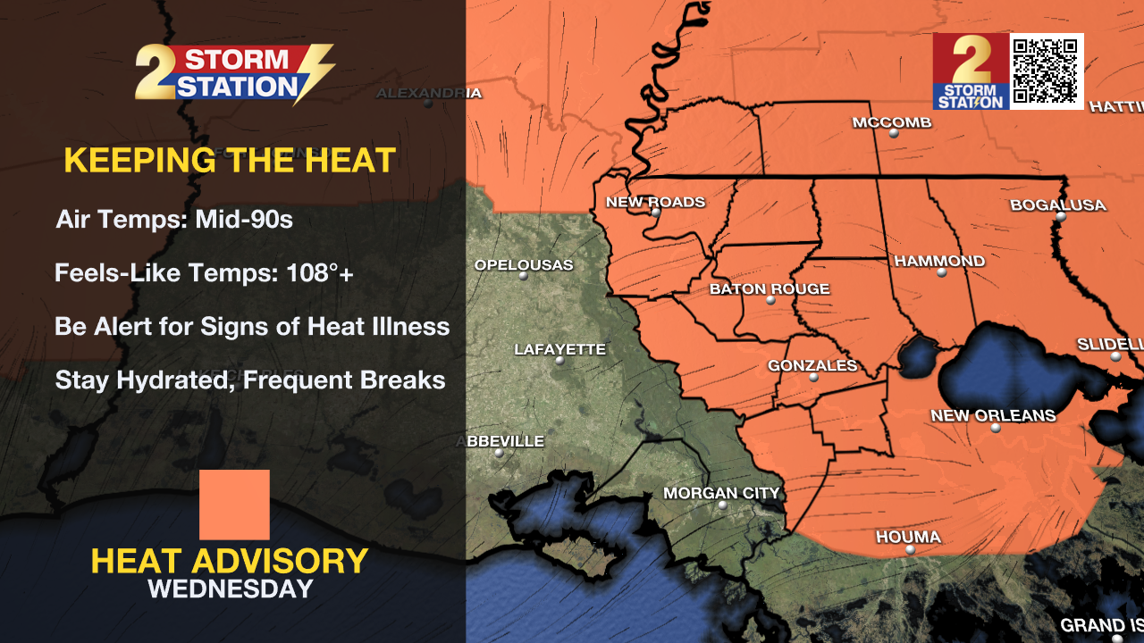
Today & Tonight: The 3rd consecutive heat advisory of the week goes into effect at 10am Wednesday morning when feels-like temperatures will already be nearing the 100° mark. With a mix of sun and clouds during the day, temperatures for most will soar into the middle-90's with humidity creating feels-like temperatures of 108°+ during peak heating hours. Also, expect isolated showers around southern Louisiana today with plenty of moisture in the air to support the development.
Wednesday evening and overnight will likely see scattered showers and storms that are motivated by a disturbance in the atmosphere that will move through the state.
Up Next: The disturbance will motivate scattered showers on Thursday as well, keeping temperatures slightly cooler, closer to 90° Thursday afternoon. This disturbance will be replaced by upper level ridging that brings back very hot conditions for the weekend, and keeps rain coverage limited to daily afternoon isolated chances. Friday through Sunday should see a mix of sun and clouds with temperatures in the mid to upper-90's each afternoon. The well above average heat looks to continue into the first week of July as well.
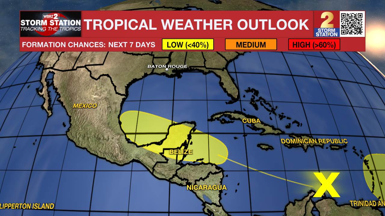
The Tropics: A tropical wave moving into the central Caribbean Sea is producing limited showers and thunderstorms. While development is not expected in the next few days, slow development will become possible once the wave reaches the western Caribbean late this week. For now, the system has a low chance of becoming something greater in the next week.
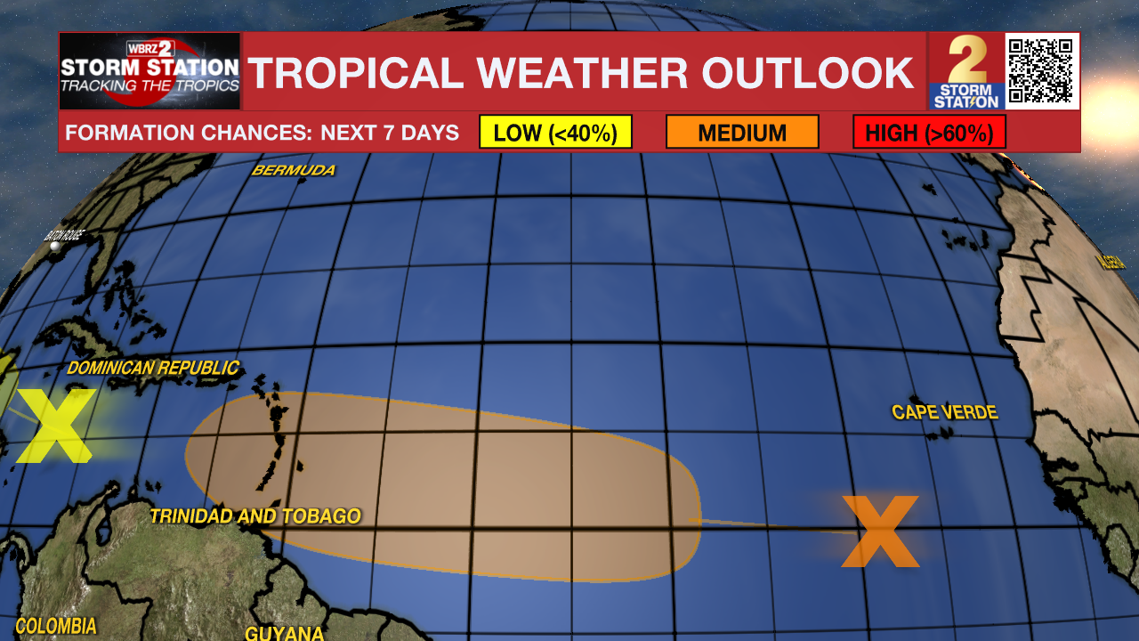
Another tropical wave centered a few hundred miles south-southwest of the Cabo Verde Islands is producing disorganized showers and thunderstorms Wednesday afternoon. Some slow development of this system is possible late this week into early next week. It currently holds a medium (40%) chance of tropical development.
Trending News
 |
 |
Get the latest 7-day forecast and real time weather updates HERE.
Watch live news HERE.
- Emma Kate Cowan
The Storm Station is here for you, on every platform. Your weather updates can be found on News 2, wbrz.com, and the WBRZ WX App on your Apple or Android device. Follow WBRZ Weather on Facebook and Twitter for even more weather updates while you are on the go.
More News
