

Latest Weather Blog
Thursday PM Forecast: Back to the summer sizzle over the weekend
Isolated pop-up storms during the heat of the day continue for the foreseeable future. In addition, the capital area is set to return to the summer sizzle over the weekend.
Tonight & Tomorrow: Even though Thursday was much drier than originally anticipated, a few storms are possible into the early evening hours on a spotty basis. There's even a signal for hit-or-miss overnight storms, especially south of the interstate and near the coast. Many will get through the night dry, however. Look for an overnight low in the mid-70s. A spotty shower or two can't be ruled out in select spots on Friday morning. However, a slightly greater rain coverage is expected into the afternoon in response to daytime heating and a return of moisture to the region. The net result will be isolated afternoon storms along with a high in the mid-90s and plenty of humidity.
Up Next: Isolated afternoon storms remain a common theme in the Storm Station 7-Day forecast into the weekend and next week. The heat ramps back up, also. By Sunday, look for a high temperature in the upper-90s. Factor in the humidity, and feels-like temperatures will be pushing 110° once again. The intense heat sticks around into next week, with feels-like temperatures perhaps nudging even higher on Monday and Tuesday. A feels-like of 108°+ would prompt a Heat Advisory, whereas 113° would prompt an Excessive Heat Warning. A few more heat alerts could be issued as we turn the calendar page next week. Fortunately, there are opportunities to cool off each day given the isolated storm chances.
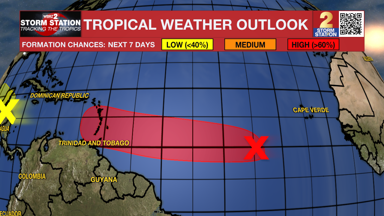
The Tropics: A tropical wave located between the African Coast and the Lesser Antilles continues to produce disorganized shower and thunderstorm activity. Environmental conditions are forecast to be favorable over the coming days for tropical development. Our next tropical depression or tropical storm is likely to form this weekend a few hundred miles east of the Windward Islands while racing westward at 15-20 mph. Impacts in the Lesser Antilles are possible early next week, but it is still too soon to know where the system will go afterward. While there is no cause for concern yet for Louisiana with regard to this disturbance, the Storm Station is keeping an eye on it.
Trending News
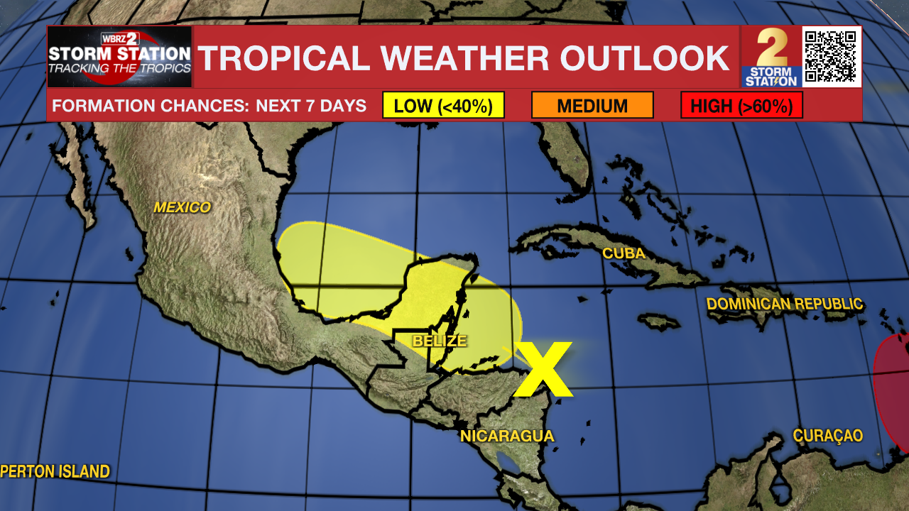
Another broad area of low pressure over the western Caribbean Sea is still fairly disorganized. Some development of the system is possible over the northwest Caribbean Sea or southwest Gulf of Mexico in the next few days. However, overall odds of the system acquiring tropical characteristics is low per the latest outlook. Regardless, Louisiana will see no impacts from this system.
Get the latest 7-day forecast and real time weather updates HERE.
Watch live news HERE.
-- Meteorologist Malcolm Byron
The Storm Station is here for you, on every platform. Your weather updates can be found on News 2, wbrz.com, and the WBRZ WX App on your Apple or Android device. Follow WBRZ Weather on Facebook and Twitter for even more weather updates while you are on the go.
More News
