

Latest Weather Blog
Wednesday PM Forecast: Disturbance brings uptick in rain, dip in temperatures
A temporary dip in temperatures follows an upper-level disturbance. That same system will bring higher rain changes Wednesday night into Thursday.
Tonight & Tomorrow: Unlike recent days where rain faded away after sunset, an upper-level disturbance will help sustain thunderstorms on Wednesday night. While not raining at every point, scattered to numerous thunderstorms will be possible during the evening and overnight hours. The severe weather threat appears slim, but a few storms could bring gusty winds. It will otherwise be warm and muggy with a low near 77°.
Lingering rain cannot be ruled out early Thursday morning. That said, rain coverage should generally diminish after sunrise as the upper-level disturbance pulls away. The capital region will be left with isolated storms through the rest of the day, and especially during the afternoon. All of this should be enough to take temperatures down by a few notches. Look for a high in the low-90s in Baton Rouge.
Up Next: Rain coverage lessens on Friday and over the weekend, but doesn't go away entirely. Isolated afternoon pop-up storms are a common theme in the Storm Station forecast past Friday. In addition, a strong upper-level ridge, which is essentially an expansive heat dome, takes over. This will allow temperatures to return to the upper-90s beginning on Sunday, and continuing into the first week of July. Taking the humidity into account, there's a chance for a few more heat alerts as we turn the calendar page.
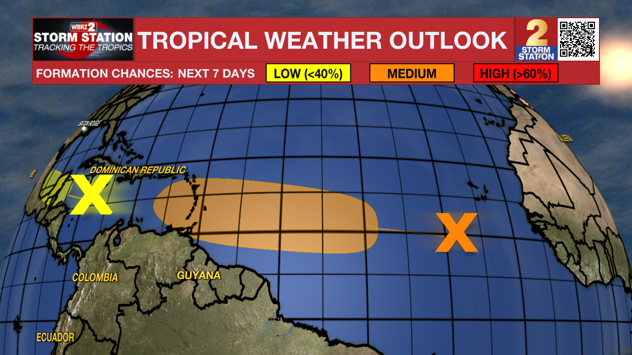
The Tropics: A tropical wave located a few hundred miles southwest of the Cabo Verde Islands is moving westward at 15 to 20 mph. Some development is possible over the next several days. A tropical depression could form over the tropical Atlantic by the end of the week or this weekend. For now, the system has a 40% (medium) chance of development in the next week. The system does not appear to pose a threat to Louisiana at this time.
Trending News
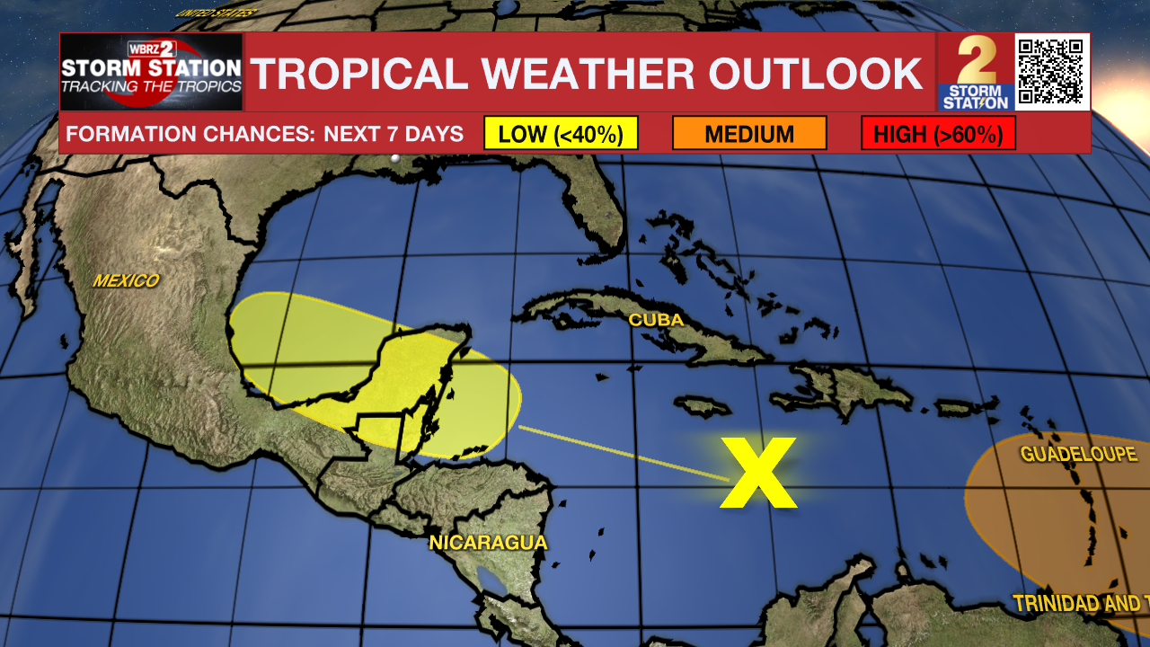
Another tropical wave located over the central Caribbean Sea is moving quickly toward the west at 25 mph. Conditions may allow for gradual development over the western Caribbean Sea in the next few days or southwestern Gulf of Mexico this weekend. For now, this system appears to have a 20% (low) chance of acquiring tropical characteristics and does not appear to be a problem locally.
Get the latest 7-day forecast and real time weather updates HERE.
Watch live news HERE.
-- Meteorologist Malcolm Byron
The Storm Station is here for you, on every platform. Your weather updates can be found on News 2, wbrz.com, and the WBRZ WX App on your Apple or Android device. Follow WBRZ Weather on Facebook and Twitter for even more weather updates while you are on the go.
More News
