

Latest Weather Blog
Thursday AM Forecast: Daily pop-up storms remain, Heat ramps back up by weekend
Temperatures will reside closer to average to end what has been a very hot workweek. The heat ramps back up for the weekend and first week of July.
Today & Tonight: The brunt of the rain early Thursday will stay mainly over coastal parishes, while a few spotty showers and storms hang around the rest of southeast Louisiana. Overall, the morning hours will be a bit groggy, with humid air, mainly cloudy skies and temperatures in the 70's. Thursday afternoon will see some breaks in the clouds allowing the sun to heat temperatures near 92° this afternoon. Similar to each day this week, we expect to see isolated summertime pop-ups around the Capital Region this afternoon begin to fade after nightfall. Temperatures reside into the 70's overnight.
Up Next: As we trek towards the weekend and first week of July, temperatures will gradually climb each day, with high's likely in the mid to upper 90's through the next week. Partly sunny skies each day paired with ample amounts of moisture in the atmosphere will allow for humid conditions to stick around and for the nuisance afternoon isolated storm chances to be found every day on the 7-day Storm Station forecast.
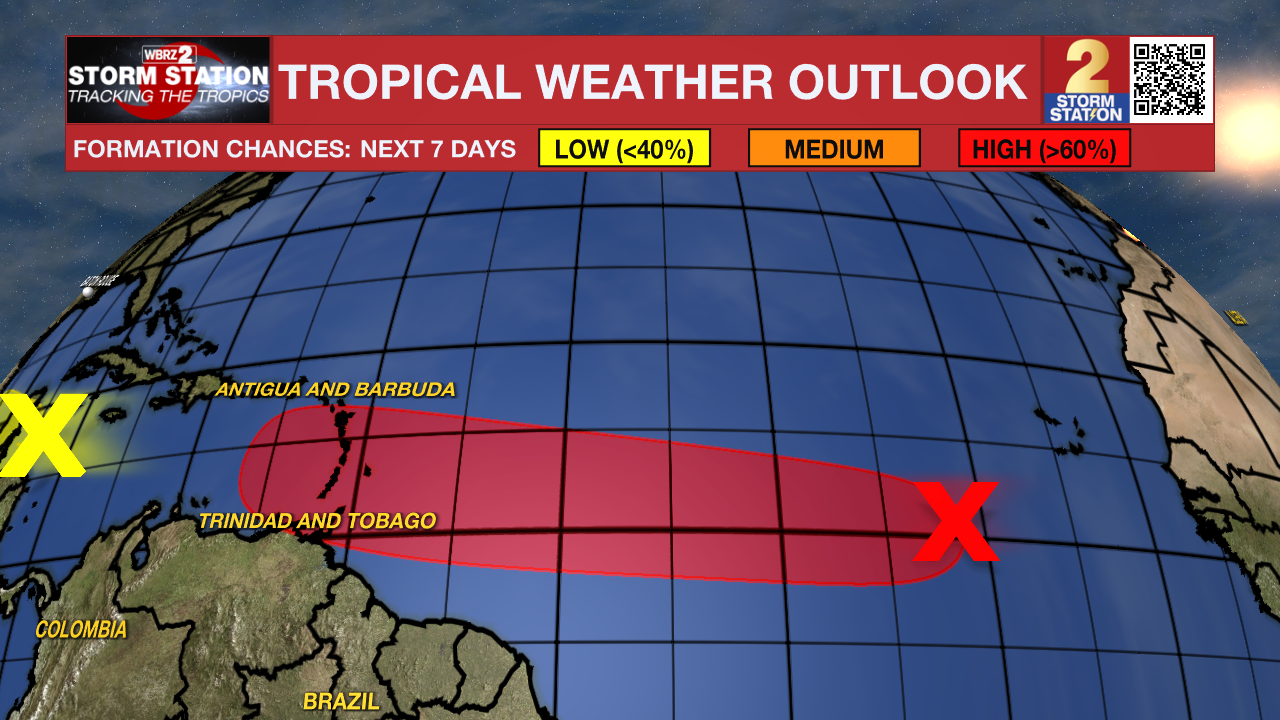
The Tropics: A tropical wave located a few hundred miles southwest of the Cabo Verde Islands is moving westward at 15 to 20 mph. Environmental conditions are forecast to be unusually conducive for late June across the central and western
tropical Atlantic, and further development of this system is anticipated. A tropical depression or tropical storm is likely to
form over the next few days, several hundred miles east of the Windward Islands. The system does not appear to pose a threat to Louisiana at this time.
Trending News
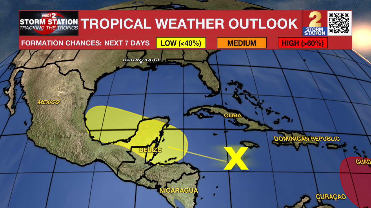
Another tropical wave located over the central Caribbean Sea is moving quickly toward the west at 25 mph. Conditions may allow for gradual development over the western Caribbean Sea in the next few days or southwestern Gulf of Mexico this weekend. For now, this system appears to have a 20% (low) chance of acquiring tropical characteristics and does not appear to be a problem locally.
Get the latest 7-day forecast and real time weather updates HERE.
Watch live news HERE.
- Emma Kate Cowan
The Storm Station is here for you, on every platform. Your weather updates can be found on News 2, wbrz.com, and the WBRZ WX App on your Apple or Android device. Follow WBRZ Weather on Facebook and Twitter for even more weather updates while you are on the go.
More News
