

Latest Weather Blog
Saturday PM Forecast: First excessive heat warning of the year issued for Sunday
An excessive heat warning has been issued for the Capital Area on Sunday. Heat index values, or how it will feel, could exceed 113°; this would create dangerous conditions for some, especially elderly groups, young children, and those that are sick.
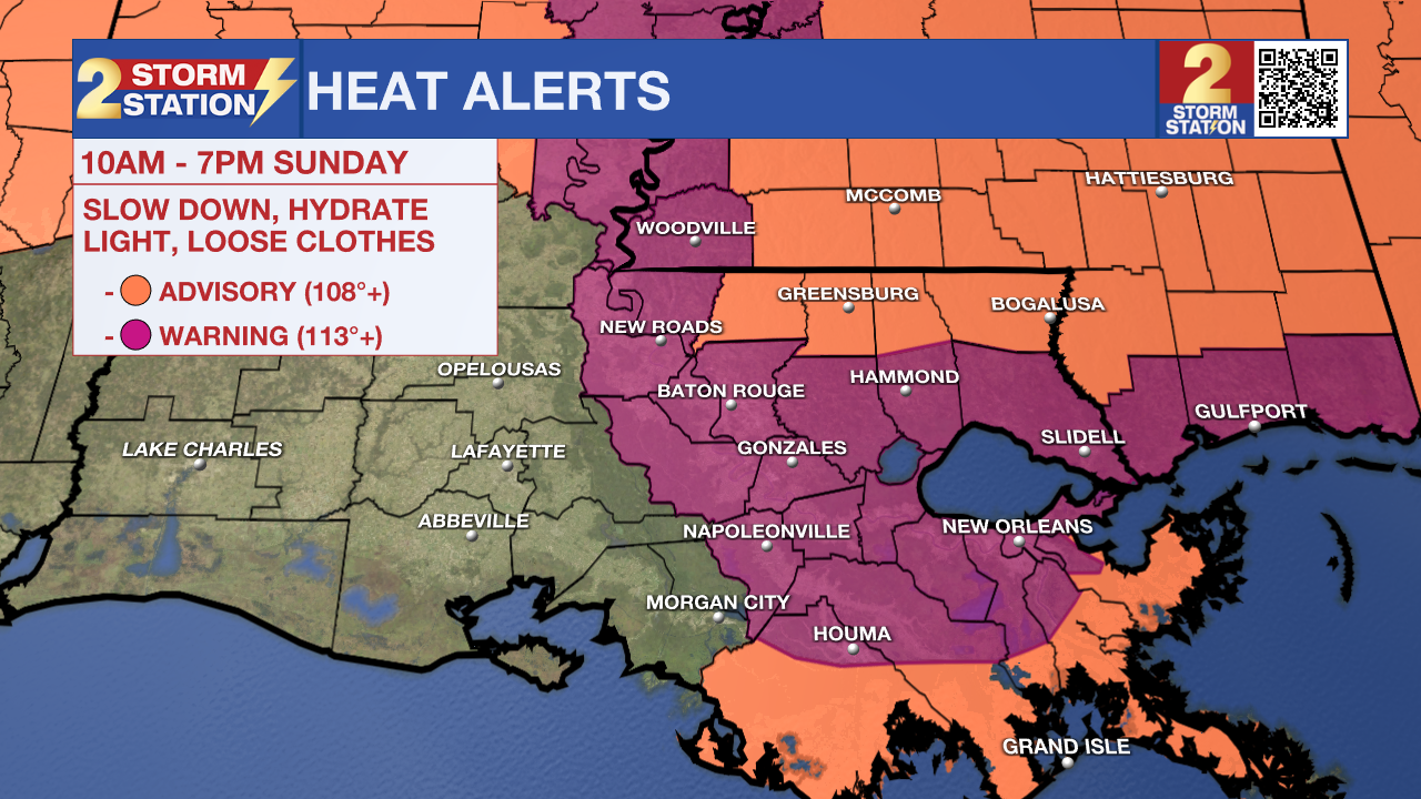
Tonight and Tomorrow: Post-sunset rain chances are slim to none as the loss of daytime heating will help eliminate convection. Partly cloudy skies overnight with high humidity levels keep temperatures warm, struggling to get lower than 80° in some areas. Sunday afternoon will crank up the heat even higher with a high temperature that will near 98° in Baton Rouge. An excessive heat warning has been issued from 10am to 7pm Sunday for much of the Capital Area as feels-like temperatures will likely exceed 113° at times tomorrow afternoon. This can be extremely dangerous for some, especially for children and elderly groups, so make sure you are checking in on friends and family as well as staying extra hydrated. The only relief in sight will come from afternoon pop-up storms that will appear in an isolated nature on Sunday. While short-lived, those storms will cool temperatures slightly.
Up Next: The first week of July includes the same extreme heat we saw over the weekend with little relief in sight. Monday through Friday will feature morning lows that barely dip into the 70's followed by extremely hot afternoons in the mid and upper 90's. A few more heat alerts will likely be issued during the next week as high humidity levels will not let up, resulting in heat index values way past 100° each day. Isolated to scattered storms will pop-up each afternoon, possibly giving quick relief from the heat. This July 4th may be the warmest in years with a forecast high of 97°. Any storms that afternoon will likely diminish just in time for the annual WBRZ Fireworks on the Mississippi show.
Trending News
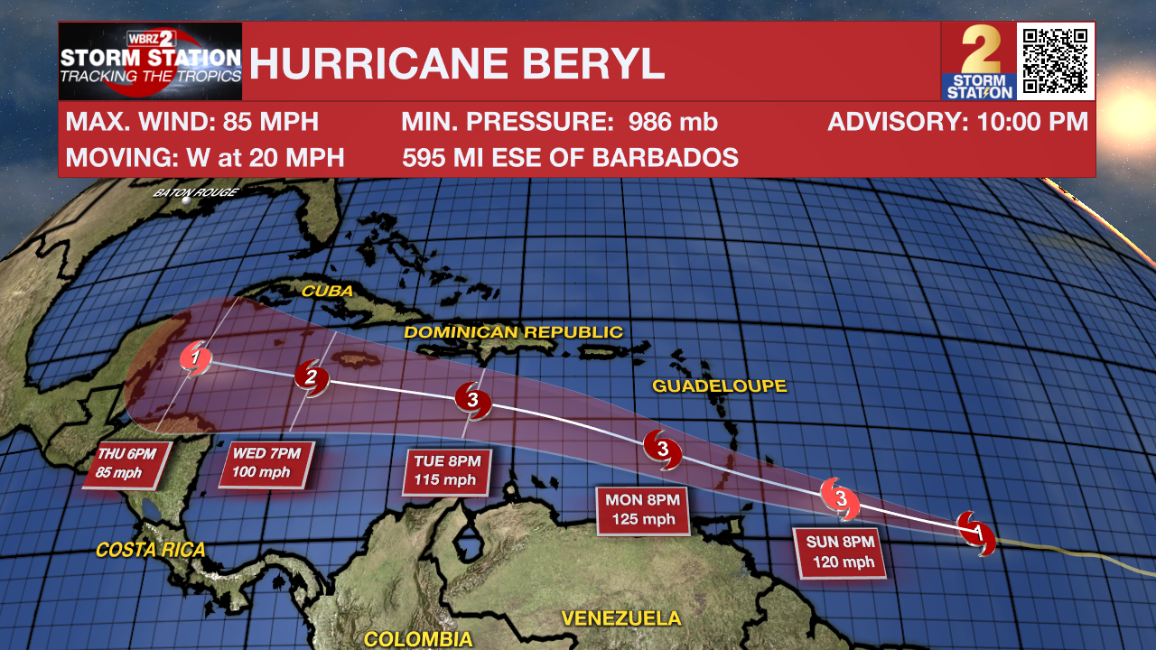
The Tropics: Hurricane Beryl has formed in the Atlantic around 700 miles east of Barbados and continues to strengthen as it moves westward over the coming days. It is forecast to become a category 3, major hurricane before reaching the Windward Islands late Sunday or Monday. It is then expected to continue westward, gradually losing intensity as it approaches the gulf of Mexico.
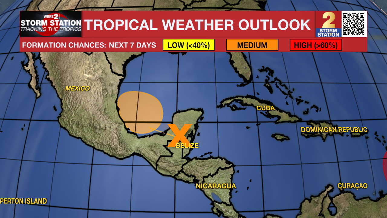
Another area of low pressure over the western Caribbean Sea continues to produce widespread storm activity. This disturbance will move over the Yucatan Peninsula and emerge over the Bay of Campeche this weekend. As of now, there is a medium chance of this system becoming a tropical depression before moving inland into Mexico over the next week. Regardless, heavy rainfall is likely over portions of Central America and Mexico.
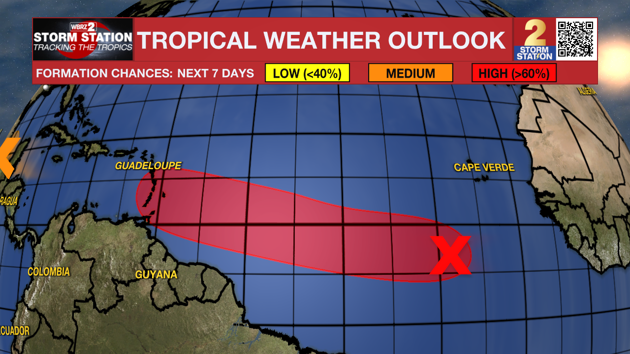
An area of low pressure located several hundred miles southwest of the Cabo Verde Islands is producing an area of disorganized showers and thunderstorms Saturday evening. Environmental conditions appear conducive for additional development of this system, and a tropical depression could form by the middle of next week. This system looks to take a very similar track to Hurricane Beryl.
Get the latest 7-day forecast and real time weather updates HERE.
Watch live news HERE.
- Emma Kate Cowan
The Storm Station is here for you, on every platform. Your weather updates can be found on News 2, wbrz.com, and the WBRZ WX App on your Apple or Android device. Follow WBRZ Weather on Facebook and Twitter for even more weather updates while you are on the go.
More News
