

Latest Weather Blog
Saturday AM Forecast: Heat alerts in place all weekend, Only relief will be from pop-up storms
The oppressive heat returns this weekend bringing with it heat alerts. Remind yourself and others to stay hydrated, wear sunscreen, and take breaks in air conditioned areas if spending time outside.
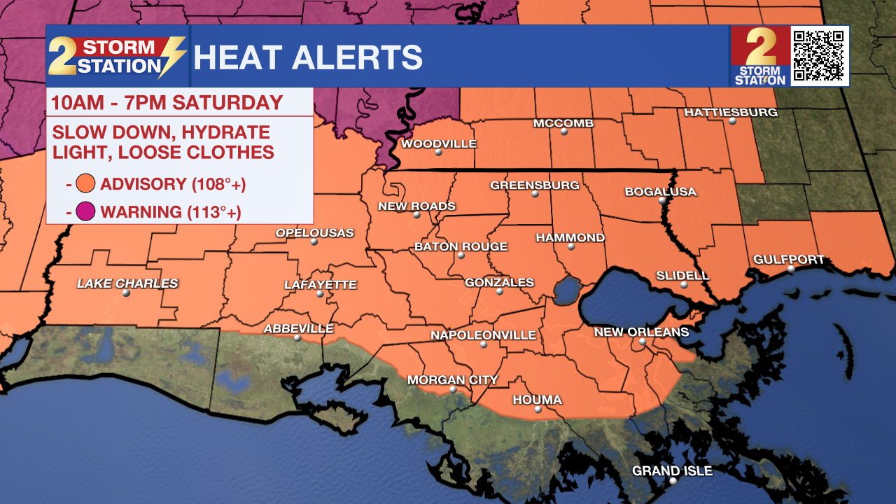
Today & Tonight: A heat advisory for the Capital Region will be in effect from 10am to 7pm Saturday as forecasted temperatures in the low to mid 90's this afternoon will likely feel like +108° thanks to high humidity levels. This extreme heat can cause many heat related illnesses if one does not prepare by staying hydrated and limiting time outdoors. The only relief we can hope for from the heat will be thanks to afternoon pop-up rain storms that will become scattered during the afternoon and evening hours on Saturday. While some storms could disturb outdoor activities with heavier downpours and gusty winds, they should be quick moving and leave behind relatively cooler air. We are expecting around 50% of the Capital Region to see a shower or storm on Saturday.
Tonight, after sunset, conditions will turn much drier, while temperatures are only likely to fall into the upper-70's. Partly cloudy skies and high dew points will maintain the muggy, summerlike conditions.
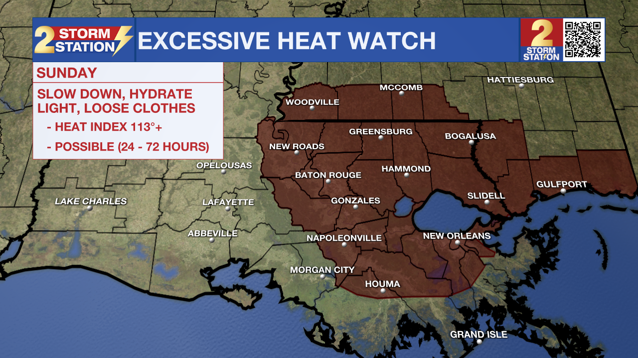
Up Next: Heat will continue to rise on Sunday, with a forecasted high of 98° in Baton Rouge. Peak feels-like temperatures could push past 113° and in result, for the first time this year, the National Weather Service has issued an Excessive Heat Watch for much of the area. If this forecast remains unchanged, then the Watch will likely get upgraded to a Warning sometime Saturday. This is extremely dangerous heat, especially for younger and older groups, and should be taken seriously.
The high heat will continue to be the main story for the first week of July, each day carrying high temperatures in the upper-90's with isolated to scattered opportunities for "cool-down" rain showers each afternoon. That would be about the only way to see any relief from the heat. The fourth of July forecast looks much of the same, though any pop-up storm activity should dissipate just in time for fireworks that night.
Trending News
The Tropics: Hurricane Beryl has formed in the Atlantic around 700 miles east of Barbados and continues to strengthen as it moves westward over the coming days. It is expected to become a major hurricane before reaching the Windward Islands late Sunday or Monday. You can read the latest on this system HERE .
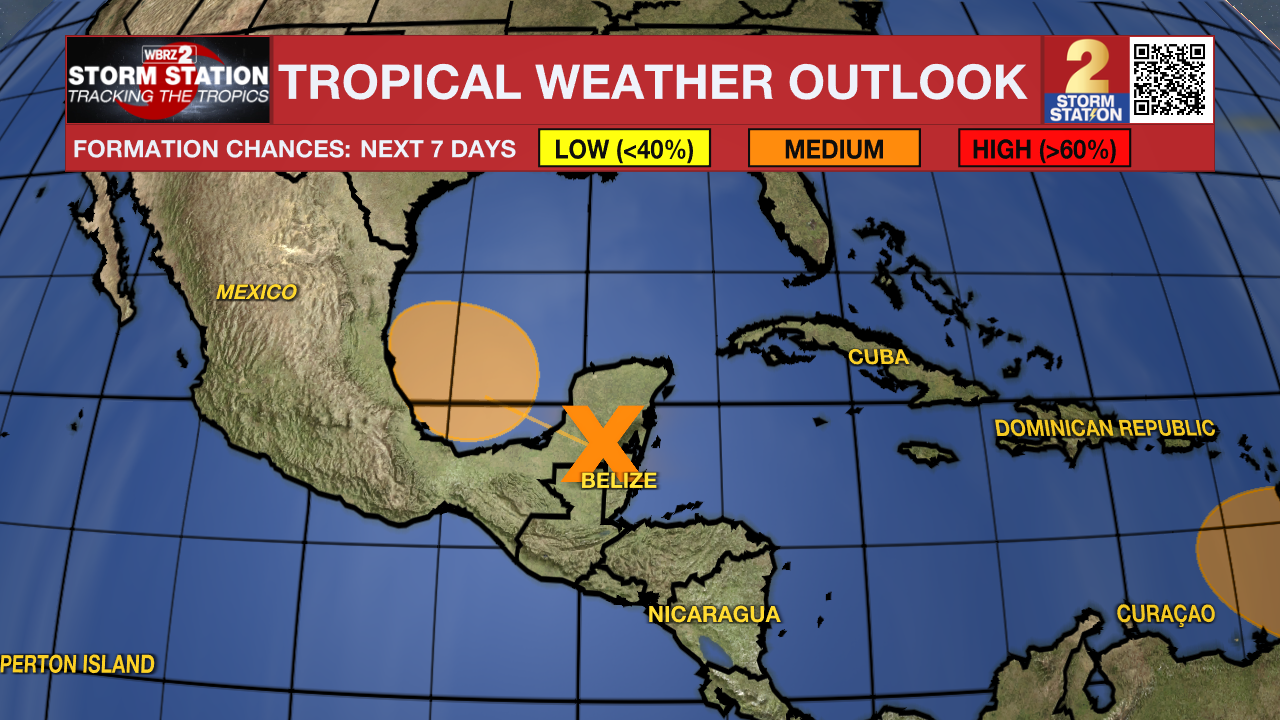
Another area of low pressure over the western Caribbean Sea continues to produce widespread storm activity. This disturbance will move over the Yucatan Peninsula and emerge over the Bay of Campeche this weekend. As of now, there is a medium chance of this system becoming a tropical depression before moving inland into Mexico over the next week. Regardless, heavy rainfall is likely over portions of Central America and Mexico.
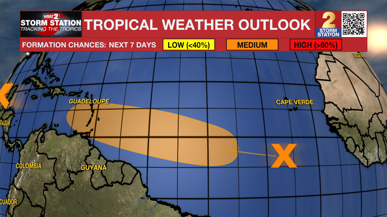
Another tropical wave located several hundred miles southwest of the Cabo Verde Islands remains disorganized. Slow development of this system is possible as it moves westward across the tropical Atlantic in the footsteps of Tropical Storm Beryl. There is a medium (60%) chance that this develops into a tropical depression by the middle of next week.
Get the latest 7-day forecast and real time weather updates HERE.
Watch live news HERE.
- Emma Kate Cowan
The Storm Station is here for you, on every platform. Your weather updates can be found on News 2, wbrz.com, and the WBRZ WX App on your Apple or Android device. Follow WBRZ Weather on Facebook and Twitter for even more weather updates while you are on the go.
More News
