

Latest Weather Blog
Thursday AM Forecast: Hottest days of week yet to come, Rain returns on Father's Day
We will conclude the workweek and head into the weekend with the hottest temperatures of the week and possibly of the year so far. As rain chances return to the forecast on Sunday, we will see temperatures trend a bit cooler next week.
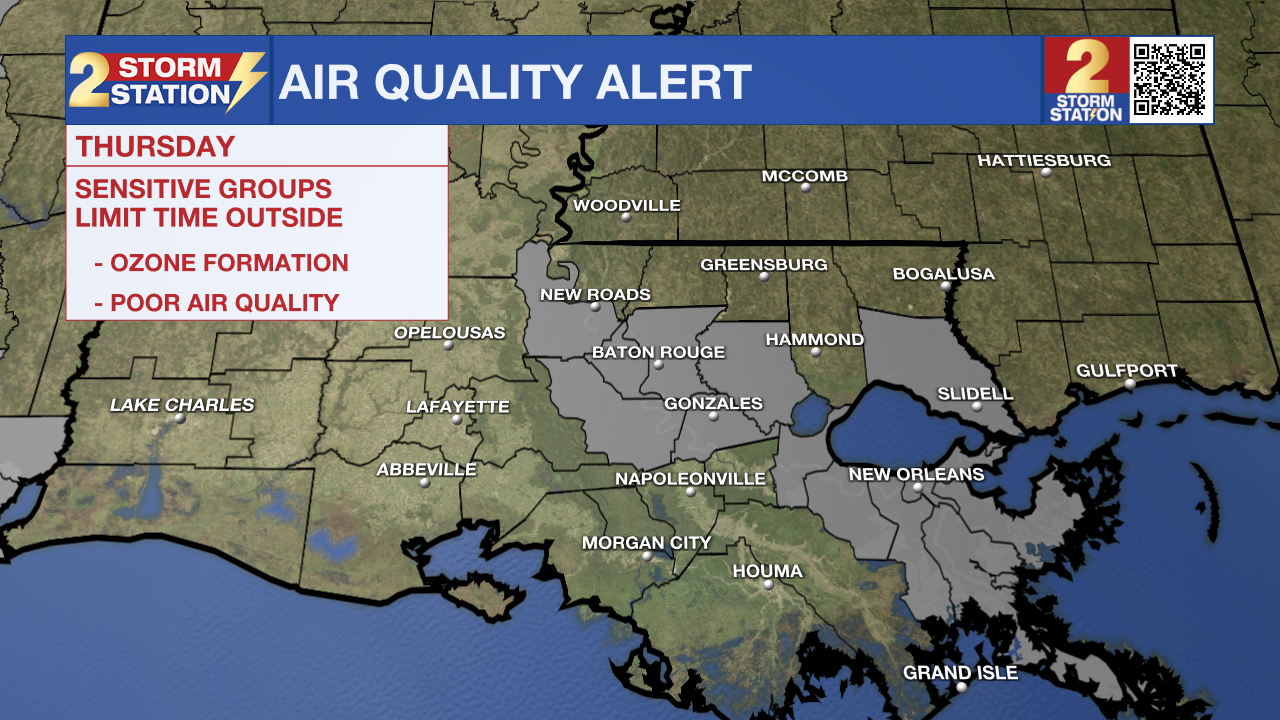
Today & Tonight: Thursday will be sunny, dry, and hot. Temperatures this afternoon will warm near 94° in the Capital Area with slightly lower humidity values than normal for this time of year. An Air Quality Alert has been issued for much of southeast Louisiana today due to an expected elevated amount of ground ozone formation. This will not be an issue for the majority, but could cause some issues for those with breathing sensitivities.
Tonight, temperatures will fall back into the low-70's with mainly clear skies and light winds.
Up Next: Though each morning over the weekend will begin in the 70's, afternoon temperatures Friday and Saturday will be very hot. A forecasted high of 98° on Friday and 99° on Saturday will mark two of the warmest days of the year so far. Heat index values both day's will top out over 100° so be extremely cautious if spending excess time outdoors this weekend. Drinking extra water, wearing light clothing, and taking many breaks inside to cool off are all recommended to avoid heat-related injuries.
On Father's Day, we will see a shift in weather conditions as a tropical surge of moisture inches near our part of the Gulf coast. Sunday brings a chance for scattered showers and an increase in clouds to the area, dropping temperatures back into the low-90s in result. The daily rain chances hang on into the next workweek as high temperatures will shift to being slightly lower than average for this time of year, in the upper-80's. Timing of rain and exact details are far from set in stone at this point, so be sure to stay in touch with the Storm Station as we get closer.
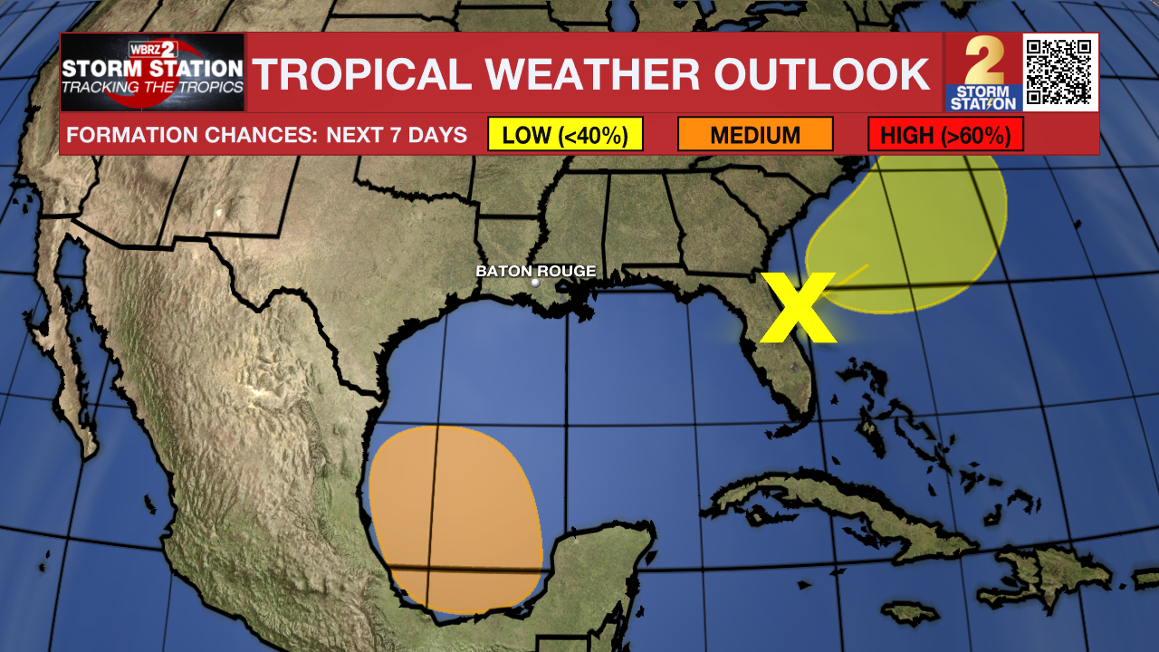
The Tropics: There are currently two areas to monitor. The first is situated just to the east Florida Thursday morning and continues to produce a large area of disorganized showers and storms. While the environment isn't the most favorable, slow development of the system is possible as it pulls offshore and away from the U.S. Southeast coast. The disturbance now appears to have a low chance of acquiring tropical characteristics in the next week. Regardless of development, heavy rainfall is likely to continue over portions of Florida over the next couple of days. The system will not be an issue in Louisiana.
Trending News
Another broad area of low pressure could form over the weekend in the southwestern Gulf of Mexico. The environment appears conducive for slow development of the disturbance early next week while the system slowly moves northwestward. Looking long-term, our team of Storm Station meteorologists believes that this system will not pose problems for Louisiana at this point.
Get the latest 7-day forecast and real time weather updates HERE.
Watch live news HERE.
- Emma Kate Cowan
The Storm Station is here for you, on every platform. Your weather updates can be found on News 2, wbrz.com, and the WBRZ WX App on your Apple or Android device. Follow WBRZ Weather on Facebook and Twitter for even more weather updates while you are on the go.
More News
