

Latest Weather Blog
Monday PM Forecast: High humidity returns, heat alerts follow suit
Any sort of relief from the peak steam dwindles for the rest of the workweek. High heat and humidity continue to be a common theme in the Storm Station 7-Day Forecast.
Tonight & Tomorrow: The few afternoon pop-up storms that do exist will rain themselves out on Monday night. The capital area will be left with mostly clear skies. Higher humidity takes over most locations, resulting in higher overnight lows. Look for a morning low near 78° in Baton Rouge.
Even though areas north of I-10/12 saw slightly less humidity on Monday, that will not be the case on Tuesday. The full summer steam will be back for everyone. Look for a high temperature in the upper-90s with a peak feels-like temperature up to 112°. The afternoon feels-like readings will surpass Heat Advisory criteria (108°+), and another one has been issued for Tuesday from 10 a.m. to 7 p.m.. The same common sense heat safety that everyone has already been practicing still applies - drink lots of water and take breaks during strenuous outdoor activities. A spotty storm or two isn't out of the question, but most will not benefit from a rain-cooling shower.
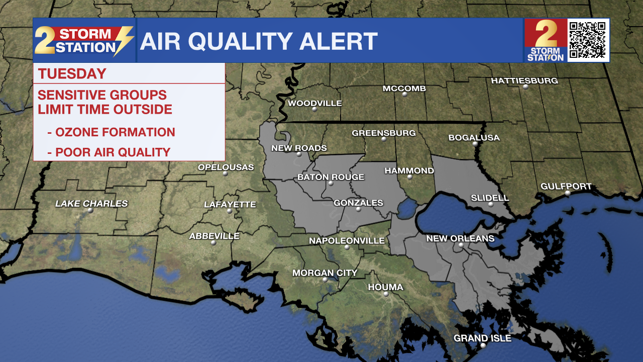
An *AIR QUALITY ALERT* will be in effect from 6am Tuesday through midnight. The Louisiana Department of Environmental Quality is forecasting an Ozone Advisory Day for East Baton Rouge, West Baton Rouge, Livingston, Ascension, Iberville, and Pointe Coupee Parishes for the rest of today and again on Tuesday. The Air Quality Index indicates that ozone will be at the Orange level, which is unhealthy for sensitive groups. Increasing ozone levels may cause unhealthy air quality during afternoon hours. Active children and adults, the elderly, and people with respiratory
diseases such as asthma should avoid prolonged outdoor exertion. Please take whatever voluntary steps you can to reduce emissions that contribute to ozone formation. Drive less and make sure your automobile is in good working condition. Make sure your gas cap is tight. Wait until after 6 PM to refuel your vehicle and use gas powered lawn equipment.
Trending News
Up Next: Simply put, the forecast doesn't change much from day-to-day beyond Tuesday. The capital region is in for another streak of hot and steamy days with spotty pop-up afternoon storms. With the humidity remaining at extreme levels for the remainder of the week, more heat alerts are likely.
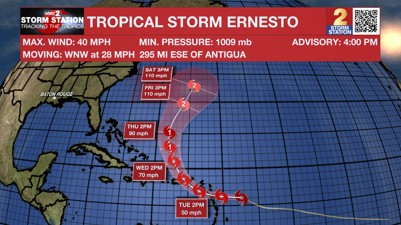
The Tropics: The National Hurricane Center determined Tropical Storm Ernesto has formed a few hundred miles east of the Lesser Antilles. Ernesto will approach the Leeward Islands on Monday night and then take aim at Puerto Rico, with tropical storm conditions beginning there late Tuesday. Afterward, the system will curve out to sea while strengthening and could become a major hurricane. The Storm Station does not anticipate any impacts in Louisiana at this time. For that matter, direct impacts to the continental United States are unlikely.
Get the latest 7-day forecast and real time weather updates HERE.
Watch live news HERE.
-- Meteorologist Malcolm Byron
The Storm Station is here for you, on every platform. Your weather updates can be found on News 2, wbrz.com, and the WBRZ WX App on your Apple or Android device. Follow WBRZ Weather on Facebook and Twitter for even more weather updates while you are on the go.
More News
