

Latest Weather Blog
Wednesday PM Forecast: Mixture of heat and rain-cooling showers for the 4th of July
Heat and humidity will stick around on the 4th of July, and over weekend. Scattered showers remain possible each day, potentially bringing some rain-cooled air to help knock temperatures down.
Tonight & Tomorrow: Afternoon showers will dissipate as the capital area loses daytime heating. Lows will drop to near 80° under partly cloudy skies. A spotty overnight shower or two is not of the question.
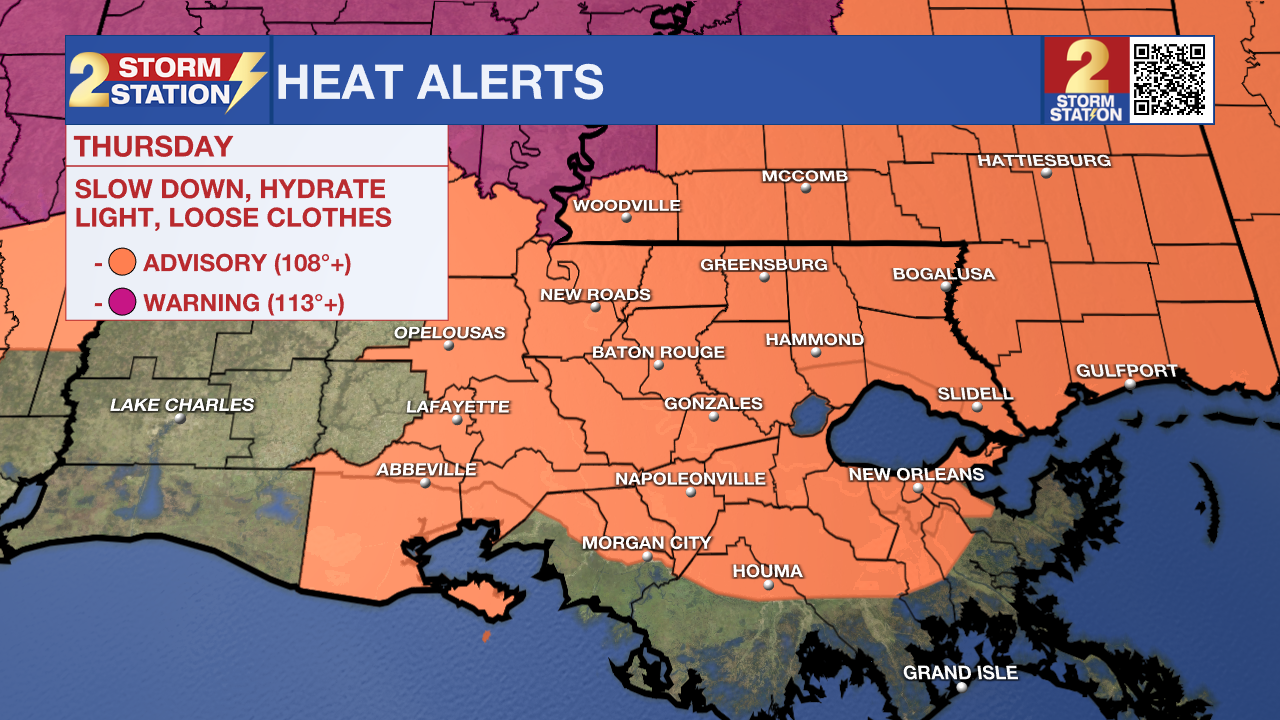
The 4th of July holiday will be similar to Wednesday, but perhaps a touch cooler. Look for a high near 96° with the humidity placing feels-like temperatures near 110° at peak heating. This has prompted a Heat Advisory for the entire area. Be sure to stay hydrated and take frequent breaks to avoid heat-related illnesses, especially if engaging in strenuous activity for longer stretches.
Scattered showers will also be popping in the heat of the day, with roughly 50% of the area seeing measurable rain. By fireworks time, rain should be coming to an end as temperatures fall into the mid-80s. The weather should cooperate for WBRZ's Fireworks on the Mississippi.
Up Next: The Storm Station expects a similar weather after the 4th into this weekend. Moisture will linger, causing scattered afternoon thunderstorms each day. While none have been issued yet, a few more heat alerts will be possible. Into next week, expect highs to be in the middle and upper-90s. Storms are not a guarantee each day, but lucky spots might benefit from a rain-cooling shower.
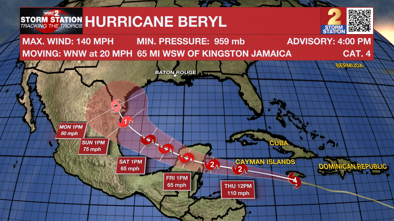
If planning on going to any of the beach destinations along the Gulf Coast, expect similar weather conditions. It will be hot and humid, with afternoon thunderstorms firing. While water temperatures and wave heights look suitable for swimming, there is a high rip current risk over the weekend. This is an indirect impact from Hurricane Beryl, which will send lots of energy in the form of swells toward the entire Gulf Coast.
Trending News
The Tropics: Beryl continues to gradually weaken. Although the system still maintains Category 4 status, maximum sustained winds dropped to 140 mph as of 4 p.m. Wednesday. Hurricane-force winds reached Jamaica on Wednesday afternoon. In addition, life-threatening storm surge and heavy rainfall are likely in the region. The storm will then continue west through the Caribbean, brushing the Cayman Islands. Another landfall will occur in the Yucatan Peninsula on Thursday night. Beryl will then emerge over the southwest Gulf of Mexico this weekend. The storm might briefly regain hurricane status before making landfall along the western Gulf of Mexico. The latest data indicate a low chance of direct impacts for Louisiana. However, those along the Mexico and Texas coasts have a higher chance of seeing impacts and should monitor the system closely. Regardless, the Storm Station is continuing to keep a watchful eye on the storm.
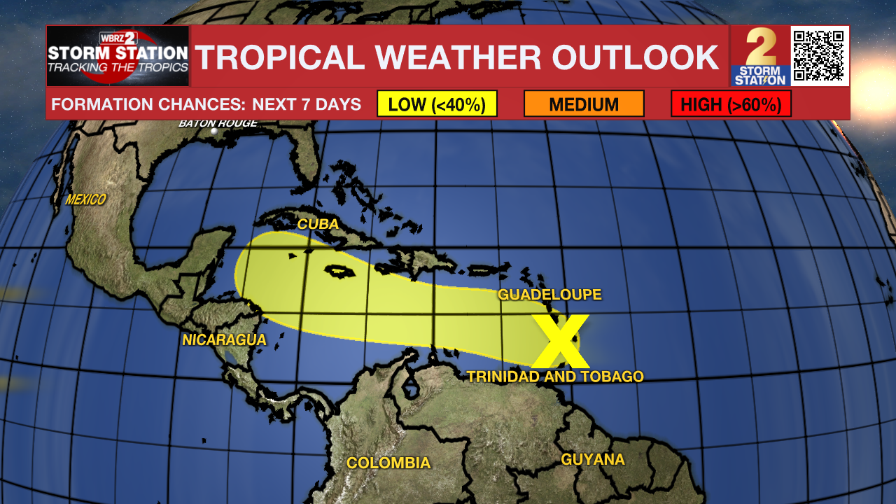
Another tropical wave trailing behind Hurricane Beryl is located near the Windward Islands. The thunderstorms associated with this wave continue to become less organized. Tropical development appears unlikely with this disturbance. Regardless, heavy rain and gusty winds are possible in the Lesser Antilles through Wednesday evening.
Get the latest 7-day forecast and real time weather updates HERE.
Watch live news HERE.
-- The Storm Station
The Storm Station is here for you, on every platform. Your weather updates can be found on News 2, wbrz.com, and the WBRZ WX App on your Apple or Android device. Follow WBRZ Weather on Facebook and Twitter for even more weather updates while you are on the go.
More News
