

Latest Weather Blog
Thursday AM Forecast: Isolated storms sending out rain-cooled air on the 4th of July
Although scattered to numerous showers and storms will put a damper on some 4th of July events, many will at least benefit from some rain-cooled air. Conditions will be more bearable and much drier by the time fireworks begin to pop over the Mississippi River, however.
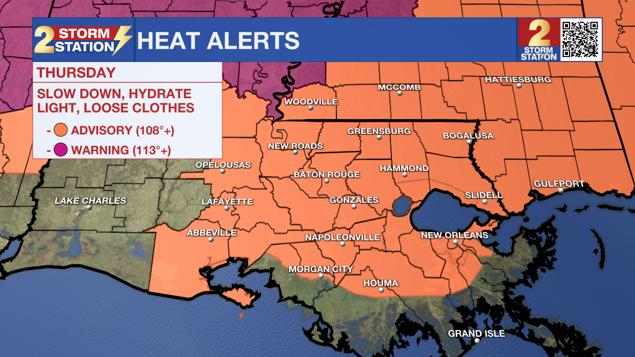
Today & Tonight: A few storms will be around early Thursday morning with coverage becoming more scattered in nature by afternoon hours. Overall, the 4th of July holiday will be hot and steamy before rain arrives. Heat index values could climb near 108°+ for drier locations, which has prompted another Heat Advisory for much of Southern Louisiana. With typical holiday celebrations anticipated, continue to prioritize hydration to help prevent heat-related illnesses!
By fireworks time, rain should be coming to an end as temperatures fall into the mid-80s. The weather should cooperate for WBRZ's Fireworks on the Mississippi. Skies will remain partly cloudy overnight as temperatures return near 80° for Friday morning's low.
Up Next: The entire holiday weekend continues the trend of warm and muggy mornings, hot afternoons (possibly with more heat alerts issued) and afternoon scattered, pop-up storms. High temperatures are expected in the mid to upper 90's through Sunday with a mix of sun and clouds when the storms are not around. Storms are not a guarantee for all each day, but lucky spots might benefit from a rain-cooling shower.
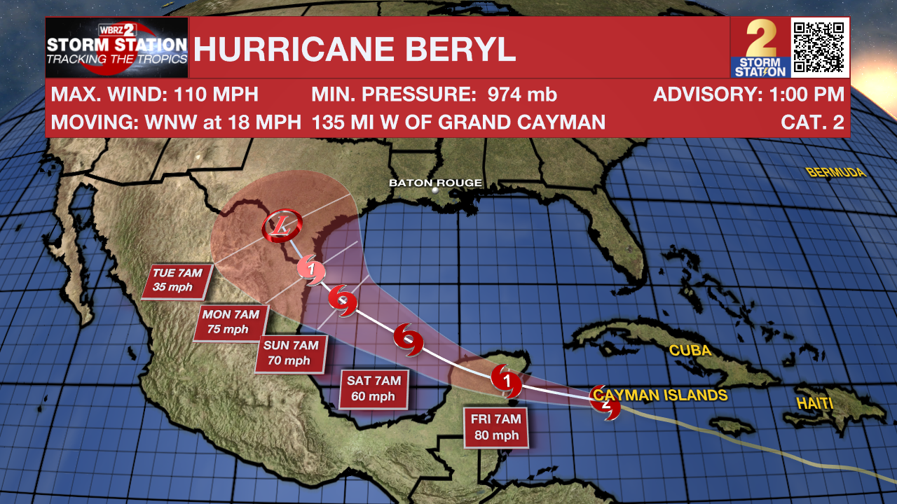
If planning on going to any of the beach destinations along the Gulf Coast, expect similar weather conditions. It will be hot and humid, with afternoon thunderstorms firing. While water temperatures and wave heights look suitable for swimming, there is a high rip current risk over the weekend. This is an indirect impact from Hurricane Beryl, which will send lots of energy in the form of swells toward the entire Gulf Coast.
Trending News
The Tropics: Beryl continues to gradually weaken. As of early Thursday afternoon, Beryl has sustained winds of 110 mph, which means Beryl is now a Category 2 storm. The storm will pull away from the Cayman Islands today as it moves toward the Yucatan Peninsula. By Thursday night, the storm will make another landfall in the Yucatan Peninsula as a Category 1 hurricane. Beryl will then emerge over the southwest Gulf of Mexico this weekend. The storm might briefly regain hurricane status before making landfall along the western Gulf of Mexico. The latest data indicate a low chance of direct impacts for Louisiana. However, those along the Mexico and Texas coasts have a higher chance of seeing impacts and should monitor the system closely. Regardless, the Storm Station is continuing to keep a watchful eye on the storm.
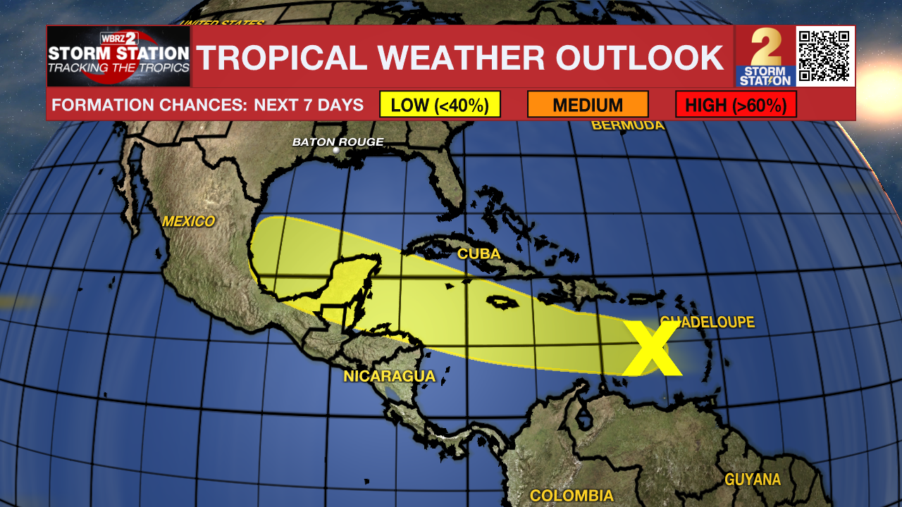
The tropical wave trailing behind Hurricane Beryl continues to hold a low chance of development over the next week. Regardless of tropical development, thunderstorms associated with this wave will continue to bring heavy rains and storm surges to islands that were just impacted by Hurricane Beryl over the next several days.
Get the latest 7-day forecast and real time weather updates HERE.
Watch live news HERE.
- Emma Kate Cowan
The Storm Station is here for you, on every platform. Your weather updates can be found on News 2, wbrz.com, and the WBRZ WX App on your Apple or Android device. Follow WBRZ Weather on Facebook and Twitter for even more weather updates while you are on the go.
More News
