

Latest Weather Blog
Friday AM Forecast: Heat and afternoon storms continue, Beryl approaching SW Gulf of Mexico
The holiday weekend remains hot & humid with summertime storms becoming scattered to numerous across the Capital Region each afternoon.
A *HEAT ADVISORY* is in effect again on Friday as feels-like temperatures up to 109° are expected across Metro Baton Rouge and points to the south and east. Hot temperatures and high humidity may cause heat illnesses. Drink plenty of fluids, and when possible, stay in an air-conditioned rooms, avoid afternoon sun, and check up on relatives and neighbors.
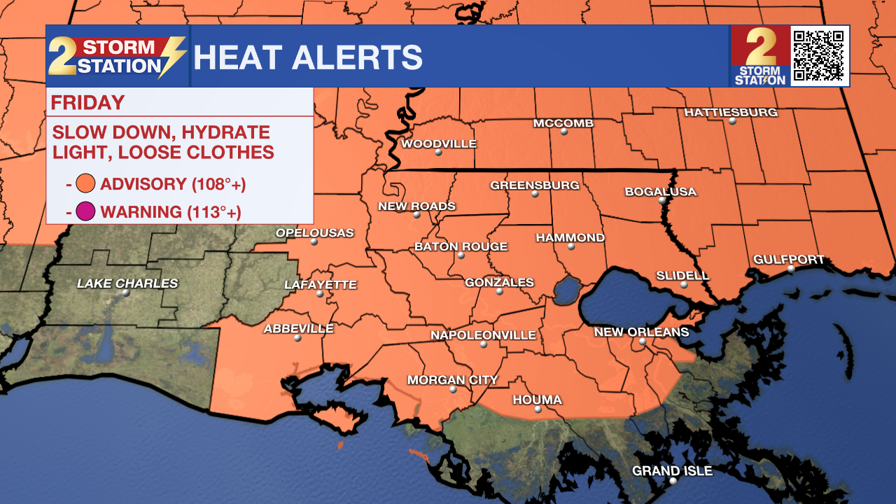
Today & Tonight: With dry conditions and sunshine Friday morning, temperatures will quickly warm, likely peaking in the early afternoon hours near 94° in Baton Rouge. Again, with extremely humid conditions in the region this week, we could see feels-like temperatures that max out close to 110° today. Friday afternoon looks to be a bit of a soggy one, with numerous storms expected to continue on-and-off throughout the afternoon and evening hours. With a busy radar anticipated, make sure you are checking in with the Storm Station app and live radar before heading outside for any plans this afternoon. Some of the storms could contain gustier winds and pockets of heavy rain.
Some spotty showers may linger into Friday night as some rain-cooled regions could fall into the lower-80's before others. Overall, Friday night into early Saturday will be warm and muggy with lows barely dipping into the 70's. \
Up Next: This weekend, the ridge that has resulted in the extreme heat over the past week finally begins to break down. As it does, temperatures will back-off slightly, especially as we head into next week. Without high pressure dominating and plenty of tropical moisture in place, isolated to scattered storms will continue to play a part in the forecast each afternoon. Make no mistake, early in the day, and locations where it does not rain, will still be plenty hot and humid with lows in the upper 70s, highs in the mid 90s and peak feels-like temperatures over 105 degrees. Of the two days, Saturday looks slightly more active than Sunday.
Early next week, the same general pattern will continue with the only potential caveat being some increased moisture in the atmosphere from the tropics. Should this occur, daily rain coverage may need to trend up from the current forecast.
Trending News
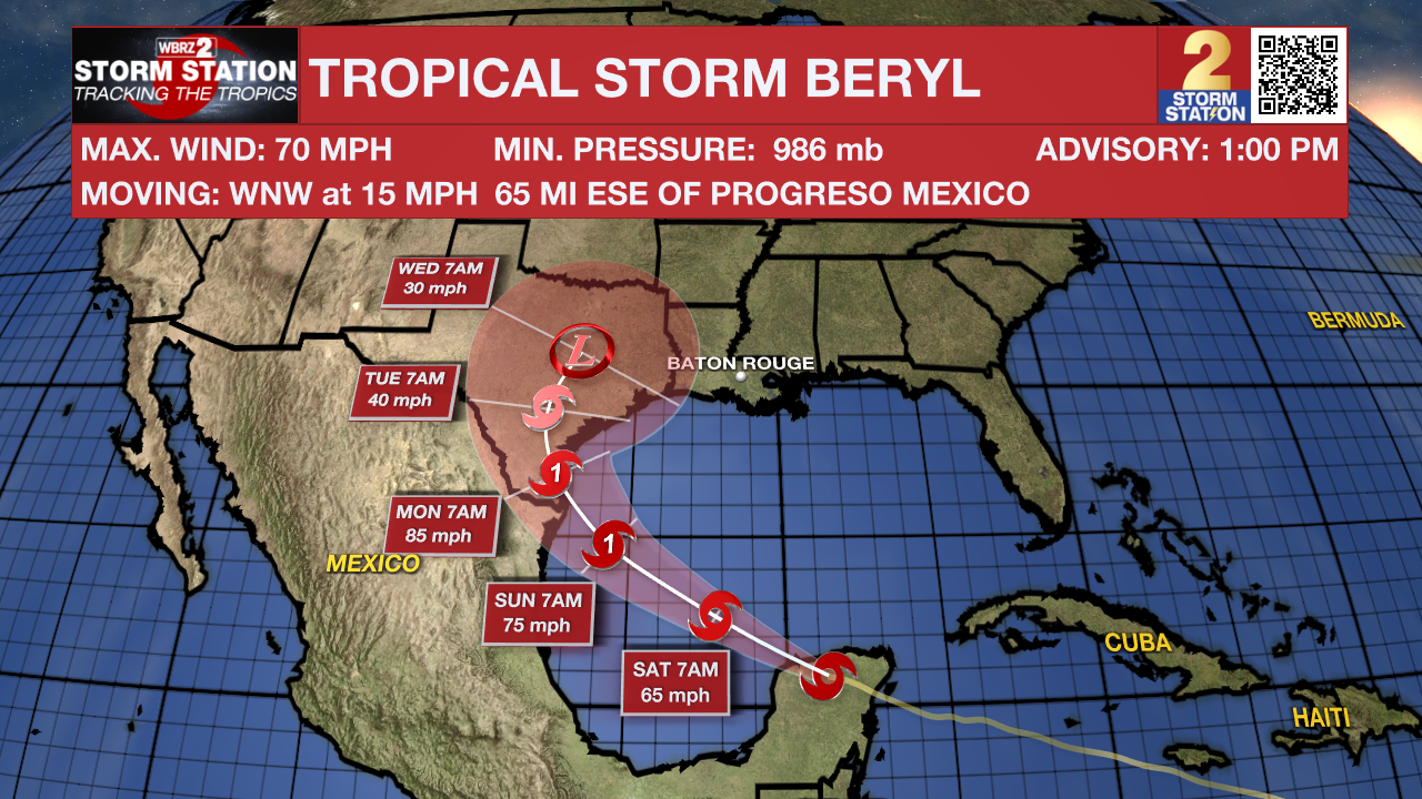
The Tropics: After making landfall in the Yucatan Peninsula of Mexico early Friday morning, Beryl is now a Tropical Storm as it moves towards the Gulf of Mexico. Beryl is forecast to regain hurricane strength by Sunday before making one final landfall across portions of southern Texas early next week. Regardless of strength, Beryl will bring heavy rains, winds, and storm surges to parts of south Texas, as well as create dangerous rip current conditions across the entire gulf coast this weekend. The storm is then forecast to take a northeasterly jog across the state as is loses intensity inland.
Get the latest 7-day forecast and real time weather updates HERE.
Watch live news HERE.
– Emma Kate Cowan
The Storm Station is here for you, on every platform. Your weather updates can be found on News 2, wbrz.com, and the WBRZ WX App on your Apple or Android device. Follow WBRZ Weather on Facebook and Twitter for even more weather updates while you are on the go.
More News
