

Latest Weather Blog
Thursday AM Forecast: Surge of moisture increases end of workweek storm chances
Relief from the heat each day may be closer than originally anticipated! A deep pocked of tropical moisture moves over the state to end the week, elevating rain coverage Thursday and Friday afternoons. The scattered showers may cool things down, but could also impact evening commutes and afterschool practices .
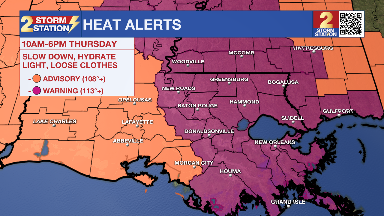
A *Excessive Heat Warning* is in effect from 10am to 6pm Thursday for the majority of southeast Louisiana. Heat index values, or how it will feel, could exceed 113°; this would create dangerous conditions for some, especially elderly groups, young children, and those that are sick. Drink plenty of fluids, and when possible, stay in an air-conditioned rooms and avoid afternoon sun.
Today & Tonight: Thursday will see mostly sunny and hot conditions for the majority of the day but afternoon storms should bring quick relief from the heat for many. Scattered coverage of afternoon pop-up storms is likely with around 60% of the Storm Station forecast area expected to see rain today. Although good for cooling off temperatures, some of the storms could be on the stronger side, impact evening commutes home as well as any afternoon outdoor activities. Make sure to monitor the radar during afternoon hours to ensure no storms are nearby.
Tonight, any rain activity will dissipate after sunset, leaving very warm and sticky conditions. Overnight temperatures will slowly fall back into the upper 70's under mostly clear skies.
Up Next: We conclude the workweek with more hot conditions. Friday will feature an afternoon high temperature near 97° with more scattered showers and thunderstorms popping up by mid-afternoon. Over the weekend, mornings will stay quite muggy with temperatures in the 70's and afternoons hot in the upper-90's. We will likely see more heat alerts issued in the coming days so remember to stay hydrated and keep cool when possible. With a decent amount of moisture in the atmosphere on Saturday, isolated storms will begin to pop-up during the afternoon hours, some could be on the stronger side, while Sunday will only see one or two spotty showers. Next week, the Storm Station is tracking a possible front that, if progressing far enough south, could bring relief from the humidity. Check back in daily for the latest.
Trending News
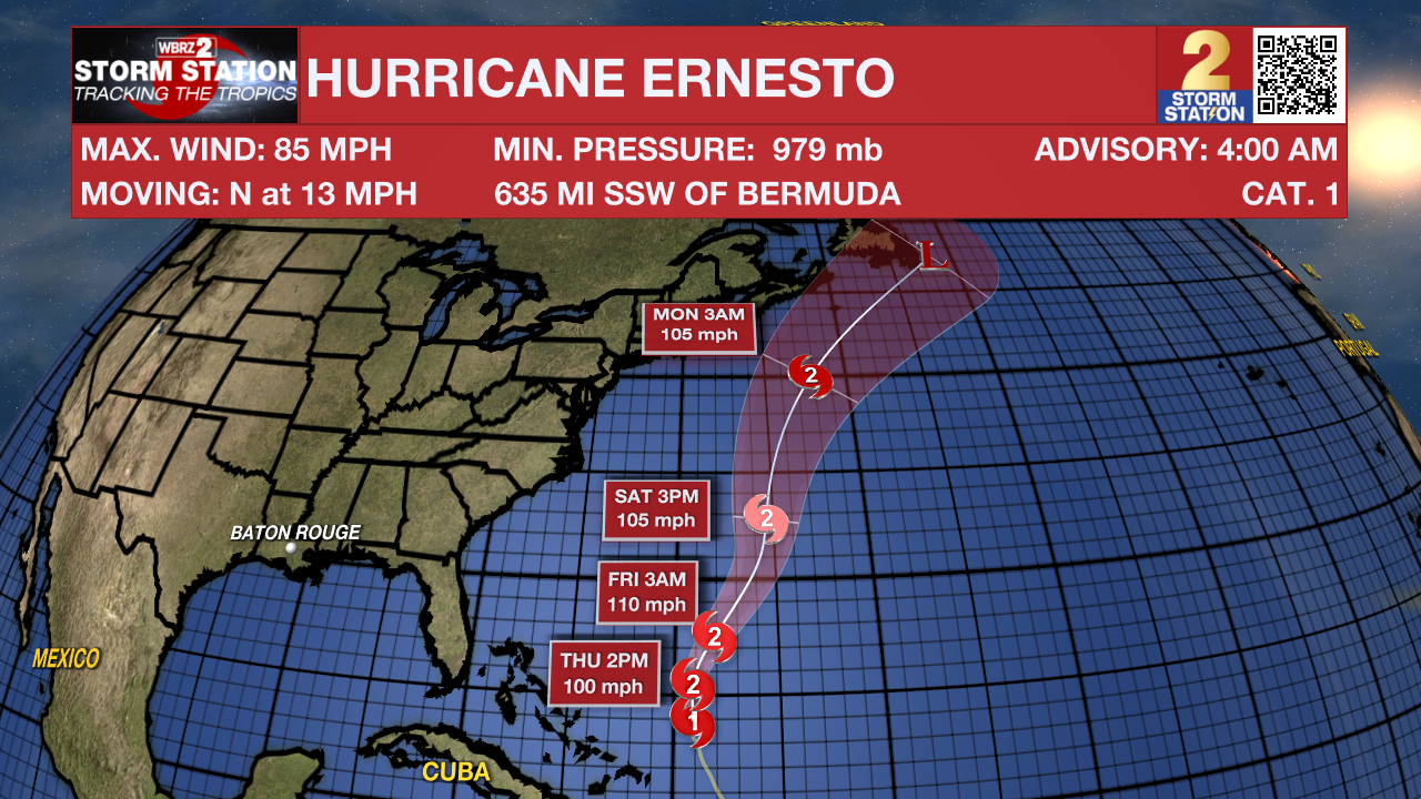
The Tropics: As Hurricane Ernesto continues to move north across the Western Atlantic, it will gradually gain strength and likely become a category 2 strength storm over the next 24 hours. While thankfully there will be no direct impacts to the mainland United States from this system, Hurricane watches have been issued for Bermuda ahead of landfall over the weekend.
Get the latest 7-day forecast and real time weather updates HERE.
Watch live news HERE.
– Emma Kate C.
The Storm Station is here for you, on every platform. Your weather updates can be found on News 2, wbrz.com, and the WBRZ WX App on your Apple or Android device. Follow WBRZ Weather on Facebook and Twitter for even more weather updates while you are on the go.
More News
