

Latest Weather Blog
Thursday AM Forecast: Back to typical summertime conditions through the weekend
Our typical gulf coast summertime pattern kicks into high gear as we head towards the weekend. Expect lots of sunshine, hot afternoons, humid air, and a chance for afternoon pop-up storms.
Today & Tonight: Thursday will feature a mix of sun and clouds with less breezy conditions than we saw on Wednesday, with winds topping out around 5-10 mph. Temperatures will push into the low and middle 90's this afternoon as a high area of pressure builds over much of the country today. While rain chances will be relatively low, there will still be plenty of moisture to support spotty showers and storms this afternoon. Tonight, under mainly clear skies and light winds, temperatures will sink back into the 70's.
Up Next: This pattern will continue through the weekend will sunshine and hot temperatures dominating. Afternoon high's all weekend will be in the middle to even upper 90's for some, with feels like temperatures expected +103° each day. During peak heating hours, a spotty shower or storm may be spotted around southern Louisiana although the entire weekend as a whole will be mainly dry. Similar conditions will continue into the beginning of the next workweek.
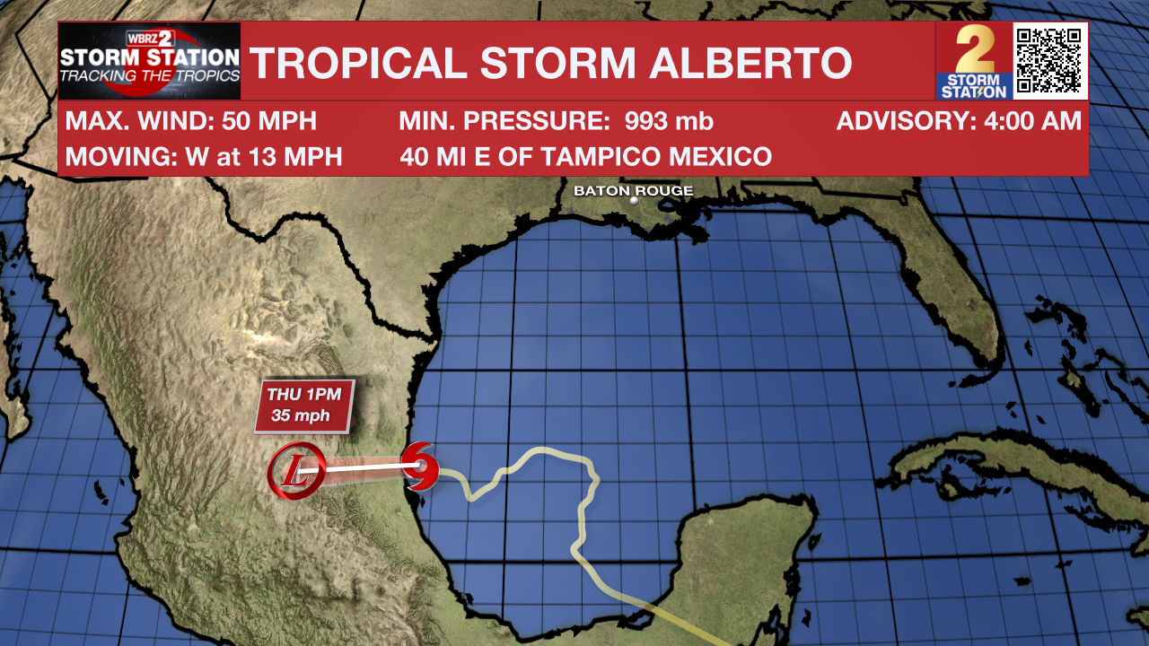
The Tropics: Tropical Storm Alberto is still ongoing in the Gulf of Mexico. No direct impacts are anticipated for south Louisiana, but Tropical Storm Warnings are in effect for portions of northern Mexico and southern Texas. This storm is tracking west around 13 mph with maximum sustained winds of 50mph.
Trending News
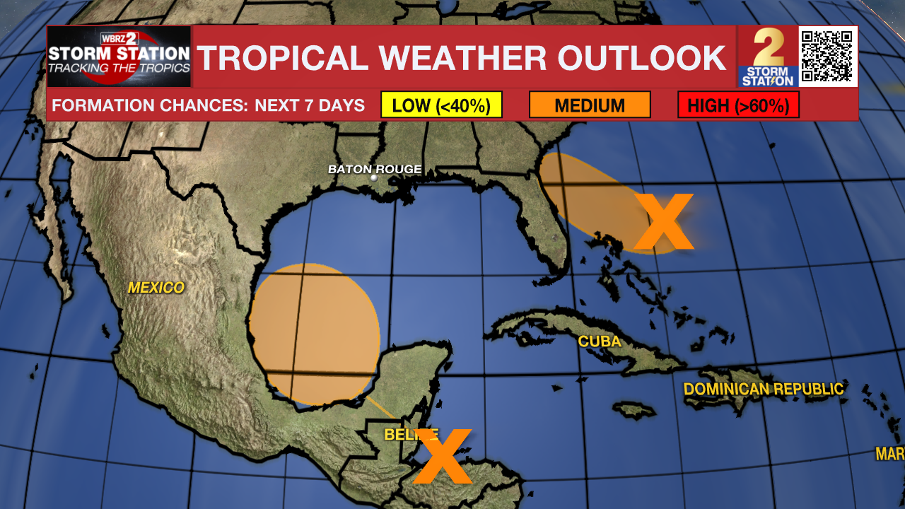
Another broad area of low pressure to watch in the southwestern Gulf of Mexico near Tropical Storm Alberto location, having a medium chance to organize over the next several days. Environmental conditions appear to be not as favorable for the disturbance but will be an area to watch as we head into next week.
The area of broad low pressure north of the Bahamas now has a medium chance of tropical development over the next week.
- Emma Kate Cowan
More News
