

Latest Weather Blog
Tracking the Tropics: New radar in Hammond gives Capital area clearer picture of weather threats
When stormy weather threatens, radar acts as our eyes. With hurricane season upon us, the National Weather Service in Slidell made a move that greatly benefits the Capital Area. They moved their radar down I-10 to Hammond. This will give us a clearer view of any weather threats.
After months of construction, the radar from Slidell was resurrected at the Hammond airport. Most of the original parts were used, with only the dome of the radar needing replacement. Kevin Gilmore, a National Weather Service meteorologist, explains that one big reason this move helps us, is that now the radar will be scanning lower over the area.
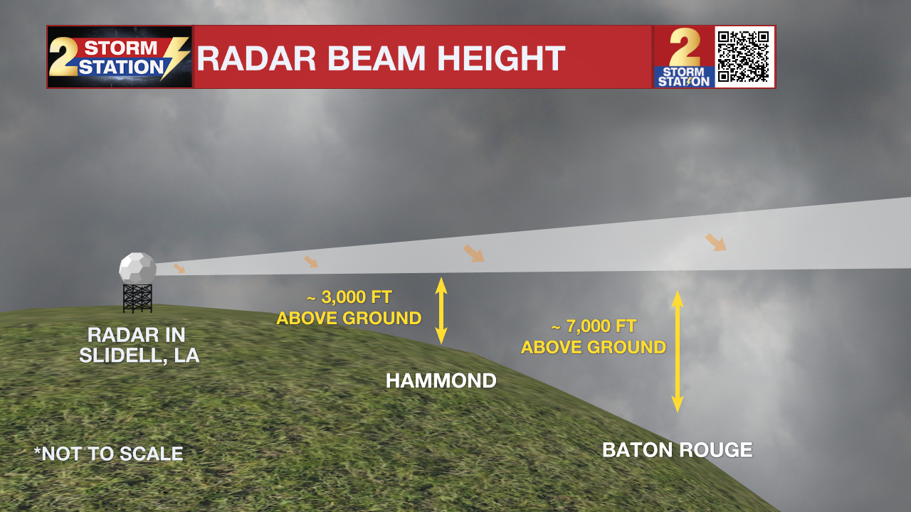
When the radar was in Slidell, it scanned 5000-7000 feet above the surface, potentially missing key features in storms. Now, the radar will scan 1000-2000 feet above the surface. This has huge benefits for the area. One of those benefits is better predicting tornadoes.
This is not just a severe weather season problem, but also a hurricane season problem. Landfalling tropical cyclones often can produce tornadoes in the outer rain bands. The rotation is usually much shallower than we see in severe weather season. Scanning too high in the storm can sometimes potentially miss the rotation, and a tornado could touch down unwarned. With the radar now moved, we no longer face that problem in the Capital Area.
For more resources from the Storm Station, click here.
More News
