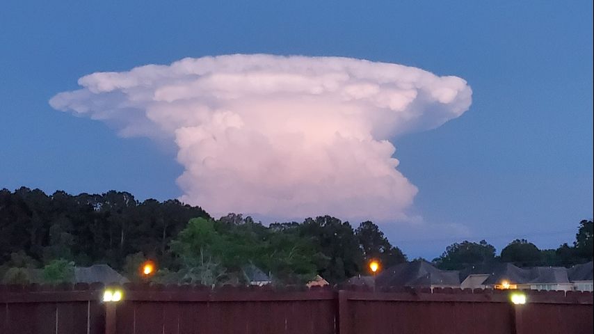
Lone storm cloud strikes pose in Baton Rouge Area skies
A single thunderstorm garnered a lot of attention on Thursday evening. This particular cloud was eye catching on an otherwise cloud free and quiet evening. So why was it so unique looking?
What you were seeing was a cloud formation present almost daily along the Gulf Coast in the warm season. This was a cumulonimbus cloud, the technical term for a thunderstorm cloud. Usually though, summer skies are filled with all varieties of high and low clouds, making it hard to see the full structure of a thunderstorm cloud.
The most notable feature was the anvil shape at the top of the cloud. This occurs when the rising air that forms the storm cloud, reaches the top of the troposphere, the part of our atmosphere where weather happens. The next layer is called the stratosphere. That layer is warmer and more stable and so instead of rising further, the air spreads out horizontally.
Storm Station radar captured that lone storm cell that formed over Lake Maurepas just after 8pm on Thursday. With the sun setting, those west of the cloud in East Baton Rouge, Livingston, and Ascension parishes saw a particularly well lit cloud and pictures poured into WBRZ email inboxes.
This storm, and others like it, look very interesting but present no greater threat than any other. They are capable of downpours, frequent lightning, hail and gusty wind.
Any time you see weather happening, send a picture to weather@wbrz.com or tweet @WBRZweather. You can also submit directly to us through the free WBRZ WX App on your Apple or Android device.


