

Latest Weather Blog
Friday night video forecast
Related Story
The National Weather Service has expanded the Flood Watch farther south, while removing a few parishes to the north. A will be in effect FLOOD WATCH for East Baton Rouge, West Baton Rouge, Iberville, East Feliciana, Ascension, Assumption, Livingston, St. Helena, St. James, and Tangipahoa Parishes until Noon Saturday.
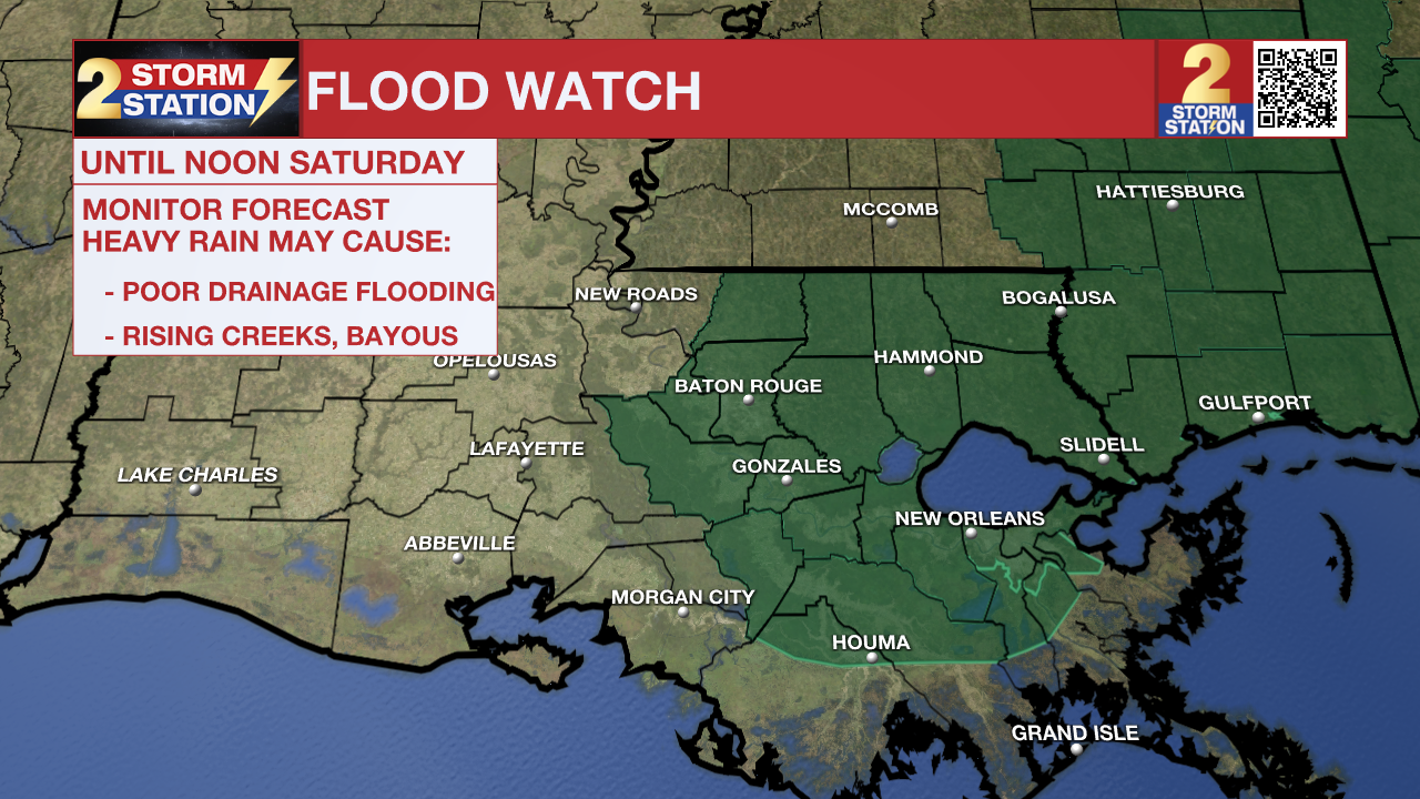
A FLOOD WATCH means conditions may develop that lead to flash flooding. Flash flooding is a very dangerous situation. Be on the lookout for threatening weather conditions and listen for later statements and possible warnings. For more on flooding safety, CLICK HERE.
Another round of showers and storms will move through on Friday night. Up to 2" of additional rainfall with locally higher amounts are possible, enhancing the flash flooding threat.
Remember that the WBRZ WX App. is *free* on Apple and Android devices and can be used for breaking weather information, live radar, and forecast details. You can also use it to watch live coverage if power or broadcast signal is ever lost. For even more, connect with the Storm Station on Twitter and Facebook. Stream WBRZ+ for continuous information as it becomes available.
Tonight & Tomorrow: As the night wears on, clusters of showers and thunderstorms will pass through the Capital Area. While a strong thunderstorm or two can't totally be ruled out, the overall threat will be much lower as compared to recent days. The lower threat is in response to a cold front pushing through from west to east, taking the severe weather threat along with it.
Nevertheless, repeated rounds of heavy rain with this round could enhance the potential for flooding. Up to 2" of additional rain is possible along a narrow corridor which is expected to set up south and east of Baton Rouge. Look for an overnight low in the upper 60s to low 70s.
Up Next: Lingering showers will be possible for the first part of Saturday, especially near the coast. Fortunately, rain coverage will decrease throughout the day. By Saturday afternoon, much more sunshine will be available though, and high temperatures will be pumped into the upper 80s. Sunday through early next week will be warm and muggy with highs near 90° and lows near 70°.
Get the latest 7-day forecast and real time weather updates HERE.
Watch live news HERE.
Click HERE to watch WBRZ streaming live online
Click HERE for the WBRZ weather page.
Click HERE to see how to download the WBRZ weather app.
Posts below are from the WBRZ Weather X account. Monitor for weather warnings below.
News
