Tuesday PM Forecast: tracking the next rainmaker, wet weather for Halloween
After more than a month without rain in many neighborhoods, the Storm Station is tracking our next impact. While needed, in a bout of unfortunate timing, showers and thunderstorms are expected to return to the area on Halloween.
Tonight & Tomorrow: The same breezes noticed on Tuesday will remain in place overnight to mitigate widespread fog formation. Instead, mainly clear skies will give way to some low clouds near dawn as low temperatures stop just below 70 degrees. Wednesday will be breezy, muggy, and warm with high temperatures approaching 90 degrees. Skies will be partly sunny with a spotty shower possible during the afternoon.
Up Next: A slow-moving and weakening cold front will move into the region on Halloween. With lots of humidity in place, the front will help to set off scattered showers and thunderstorms. The morning hours will be dry with some breaks of sun. By afternoon, thermometers will sneak into the low to mid 80s as showers and thunderstorms develop. The commute home on Thursday could be messy in some cases and if you are heading out for trick-or-treating, plan on taking rain gear. As of now, it appears the thunderstorms activity will be diminishing close to nightfall, but make sure to have the Storm Station Weather App activated for nearby lightning notifications, just in case.

The front will fall apart through the day on Friday, but still be intact enough to cause mostly cloudy skies and isolated showers and thunderstorms. The weekend is looking primarily dry, warm and unseasonably muggy with highs in the upper 80s and lows in the upper 60s.
Trending News
Get the latest 7-day forecast and real time weather updates HERE.
Watch live news HERE.

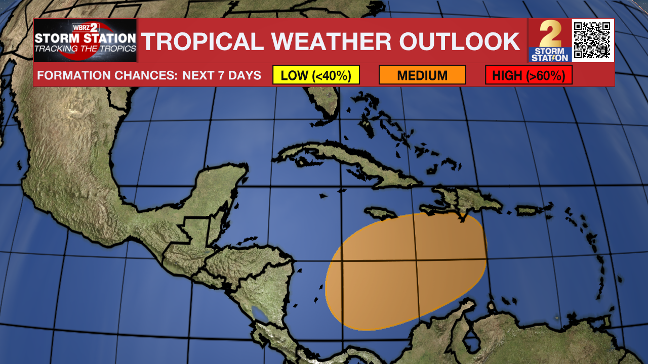
The Tropics: A broad area of low pressure is likely to develop over the southwestern Caribbean Sea in a couple of days. Gradual development is possible thereafter, and a tropical depression could form over the weekend while the system begins to drift northward or northeastward toward the central Caribbean Sea.
– Josh
The Storm Station is here for you, on every platform. Your weather updates can be found on News 2, wbrz.com, and the WBRZ WX App on your Apple or Android device. Follow WBRZ Weather on Facebook and Twitter for even more weather updates while you are on the go.


