

Latest Weather Blog
Monday AM Forecast: Extreme heat presses on, Category 4 Hurricane Beryl strikes Windward Islands
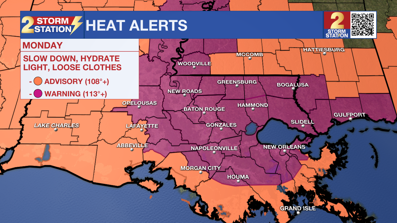
July arrives with more heat alerts; the 2nd Excessive Heat Warning of the year has been issued for the Capital Area on Monday. With no relief from the extreme heat in sight, make sure to prioritize hydration and staying cool in the coming days.
Today & Tonight: With peak feels-like temperatures forecast to top out as high as 115-117° Monday afternoon, another extreme heat warning has been issued for parts of southern Louisiana from 10am-7pm on Monday. Parishes not included in the warning are still under a Heat Advisory today. Similar to conditions over the weekend, Monday will see a mix of sun and clouds along with the heat and humidity. The only relief one can hope for will be from passing afternoon storms that will arrived in a scattered fashion today.
Tonight, temperatures will reside in the upper-70's once again, continuing the streak of warm and muggy mornings.
While it is summer in Louisiana, temperatures this warm are not common this early in the year. Make sure to beat the heat by prioritizing hydration, checking in on vulnerable groups, and taking breaks from the heat when spending extended periods of time outdoors. Just as a reminder, heat related illnesses are the leading cause of weather-related deaths in the United States and is why heat warnings are not to be taken lightly.
Up Next: More heat alerts will likely be issued during the first week of July as there is no relief from the above average temperatures in sight. The Capital Area has been placed under an Extreme Heat Watch for Tuesday, which will likely be upgraded to a warning sometime on Monday. Fortunately, isolated to scattered storms will pop up each afternoon providing the only form of heat relief. The heat may back off a little bit by midweek, but not by much. The Storm Station forecast shows the Fourth of July looks like a standard summer day with heat, humidity, and pop-up afternoon storms.
Trending News
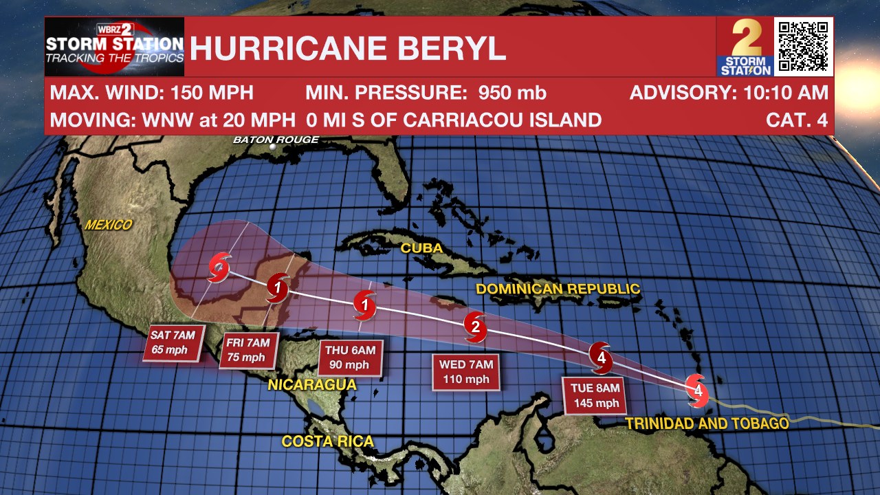
The Tropics: As of 10:10 a.m. Monday, Hurricane Beryl made landfall on Carriacou Island, which is part of Grenada in the southern Windward Island chain. It made landfall as a strong Category 4 hurricane with maximum winds at 150 mph. Although the storm weakened Monday morning after completing an eyewall replacement cycle, it quickly intensified before making landfall. The storm will continue west through the Caribbean Sea this week, gradually losing steam as it does so. The latest forecast track shows the storm moving mainly west and becoming a tropical storm by the time it reaches the southwest Gulf of Mexico. For now, the Storm Station doesn't see any major signal for local impacts. That said, the Storm Station will also be monitoring this system very closely.
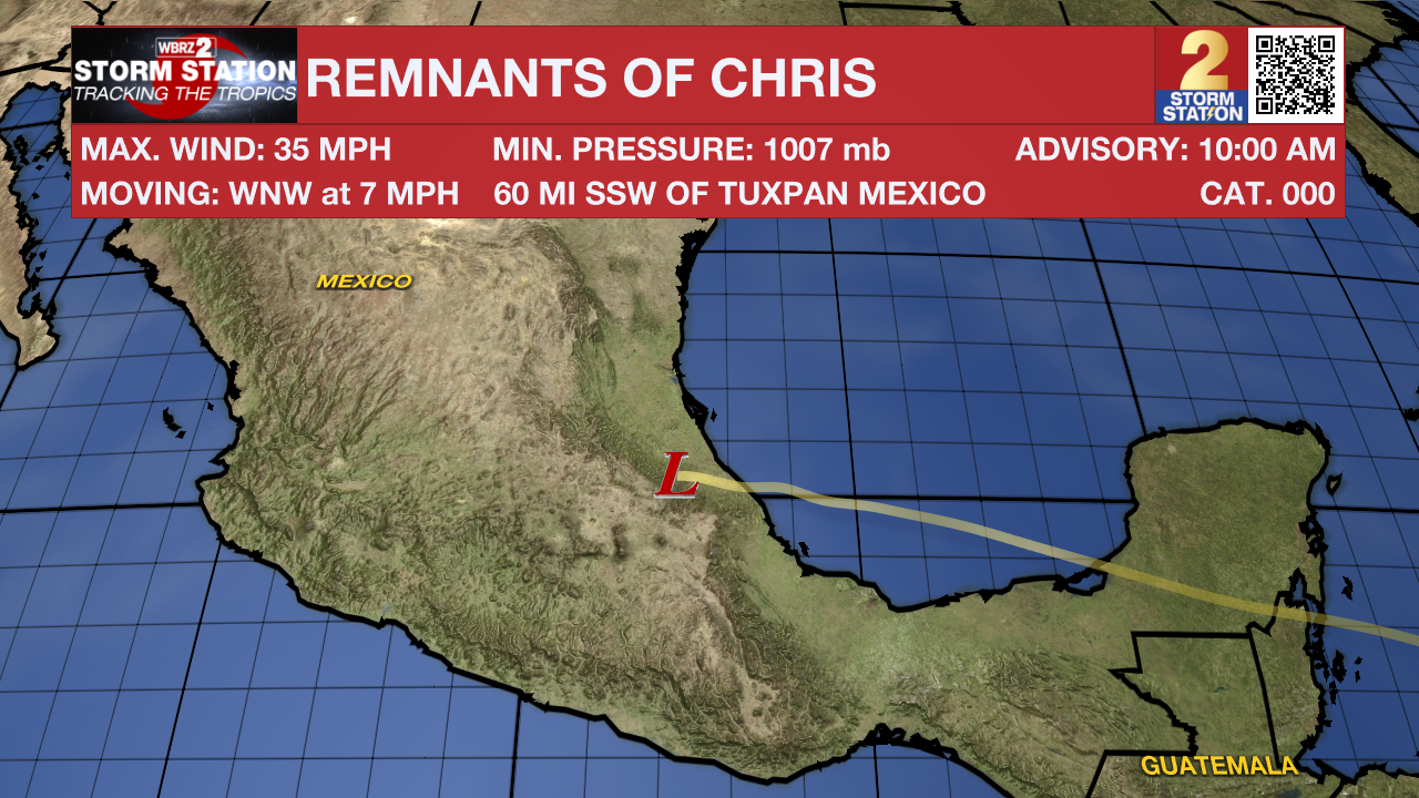
Chris made landfall in Mexico on Sunday night and has since weakened. The National Hurricane Center has issued its final update on the system.
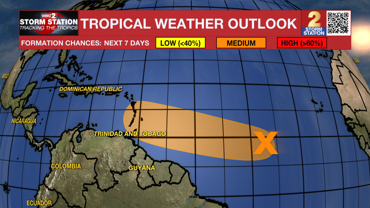
Another tropical wave located several hundred miles southwest of the Cabo Verde Islands has a medium chance of development in the next 7 days. A tropical depression could form by the middle of this week as it moves quickly to the west at 15-20 mph. It is worth noting that this system is following in the footsteps of Beryl.
Get the latest 7-day forecast and real time weather updates HERE.
Watch live news HERE.
- Emma Kate Cowan
The Storm Station is here for you, on every platform. Your weather updates can be found on News 2, wbrz.com, and the WBRZ WX App on your Apple or Android device. Follow WBRZ Weather on Facebook and Twitter for even more weather updates while you are on the go.
More News
