

Latest Weather Blog
Wednesday Evening Video Forecast
Related Story
The heat kicks into high gear through the end of the week before peaking on Saturday. A cooldown will follow as a surge of tropical moisture moves into the area.
Tonight & Tomorrow: While the capital area was rain-free on Wednesday, a few pop-up storms were confined to the coast. Those will dissipate as the daytime heating fades away. Expect mainly clear skies for the overnight stretch with a low temperature in the mid-70s.
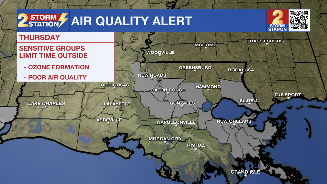
Thursday will be another dry day with lots of sun. Look for a high temperature in the middle-90s. Humidity levels will dip slightly on Thursday before rebounding in the days to follow. With sunshine and warm temperatures, there could be some ground ozone formation. There is an Air Quality Alert for Thursday as a result. This will not be an issue for the majority, but could cause some issues for those with breathing sensitivities.
Up Next: Be prepared to sweat for the first half of Father's Day weekend. The continuation of the sunny and dry pattern will result in temperatures climbing even higher. The latest Storm Station forecast calls for highs in the upper-90s on Friday and Saturday, which is a few degrees shy of the record value (100°) for both days. The forecast takes a different course beginning on Father's Day as a tropical surge of moisture takes aim at our part of the Gulf coast. This could result in a period of unsettled weather, with a few rounds of showers and a notable dip in temperatures into next week. Details are far from set in stone at this point, so be sure to stay in touch with the Storm Station as we get closer.
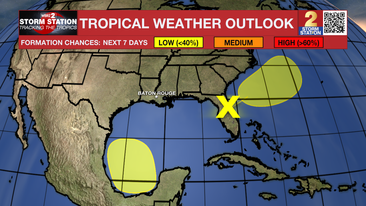
The Tropics: There are currently two areas to monitor. The first is situated over Florida and continues to produce a large area of disorganized showers and storms. While the environment isn't the most favorable, slow development of the system is possible as it pulls offshore and away from the U.S. Southeast coast. The disturbance now appears to have a low chance of acquiring tropical characteristics in the next week. Regardless of development, heavy rainfall is likely over portions of Florida. The system will not be an issue in Louisiana.
Another broad area of low pressure could form over the weekend in the southwestern Gulf of Mexico. The environment appears conducive for slow development of the disturbance early next week while the system slowly moves northwestward. Looking long-term, our team of Storm Station meteorologists believes that this system will not pose problems for Louisiana at this point.
Get the latest 7-day forecast and real time weather updates HERE.
Watch live news HERE.
-- Meteorologist Malcolm Byron
The Storm Station is here for you, on every platform. Your weather updates can be found on News 2, wbrz.com, and the WBRZ WX App on your Apple or Android device. Follow WBRZ Weather on Facebook and Twitter for even more weather updates while you are on the go.
News
