Tuesday Midday Video Forecast
Related Story
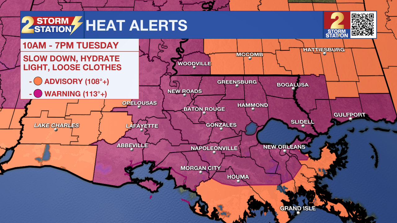
The high temperatures and heat remains strong today. To be expected, the humidity sticks around prompting feels-like temperatures to reach 113°+ and yet another Excessive Heat Warning for southeast Louisiana.
Today & Tonight: The heat unfortunately does not let up today. Temperatures will be in the upper 90s through most of the day time hours but peak at 100°. The moisture and humidity will allow peak feels-like temperatures to range between 113-115°. With that, another Excessive Heat Warning will be in place through 7pm tonight. Dry conditions are expected throughout the majority of the day, while one or two pop-up showers may develop in the afternoon hours. However, throughout the duration of the night it will be dry. Temperatures tonight will struggle to cool as overnight lows remain in the upper-70s.
The level of heat and humidity are reaching a point that can be dangerous and put health at risk. Keep hydrating and taking breaks when outside for longer durations. Heat-related illnesses tend to become more common with each passing day in a hot streak since heat stress accumulates over time.

Up Next: Temperatures scale back slightly on Wednesday, but not by much. This will be in response to higher rain chances which could offer a little more heat relief. Even so, storms will be operating on a scattered basis on Wednesday. The Fourth of July is looking hazy, hot, and humid with the garden variety pop-up afternoon storms. With the loss of daytime heating, those storms should fade away after dark, which aligns nicely with fireworks time. More of the same is expected into the weekend.
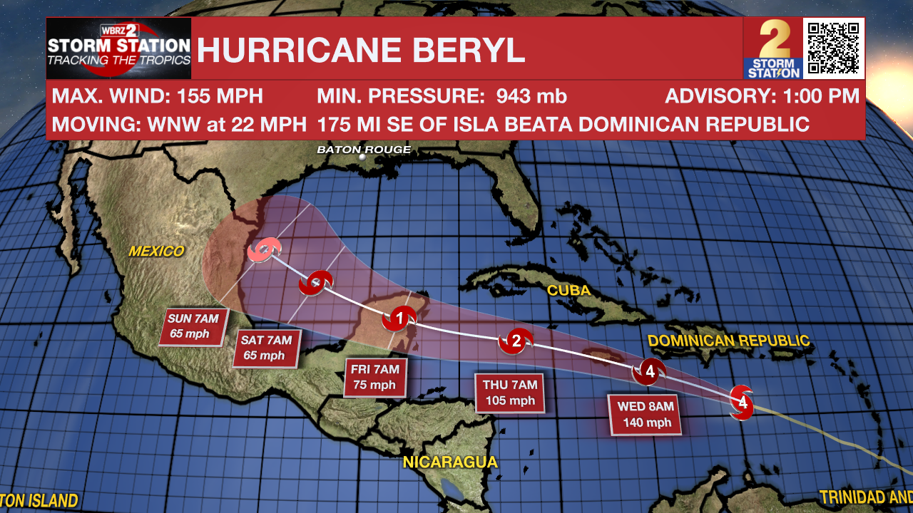
The Tropics: After making history on Monday night as the earliest recorded Category 5 hurricane, a slight weakening trend took place on Tuesday morning. Beryl was downgraded to a high-end Category 4 storm at 1 p.m. Tuesday with maximum sustained winds at 155 mph. While there is a fair amount of uncertainty with how strong Beryl will be in the coming days, the system will exhibit a gradual weakening trend as it continues west through the Caribbean at 20-25 mph.
The latest forecast from the National Hurricane Center suggests a possible landfall in Jamaica as a major hurricane. The storm will then brush the Cayman Islands before making yet another landfall in the Yucatan Peninsula on Thursday night. Further weakening is anticipated while the storm is over land. However, Beryl will emerge over the southwest Gulf of Mexico over the weekend before taking a northward turn. How extreme this turn will be depends on a few factors: the strength and placement of an upper-level ridge and the strength of Beryl after hitting the Yucatan Peninsula. These details should come into better agreement by the weekend. Parts of northern Mexico and south Texas should monitor the progress of this storm closely. Given the question marks surrounding the long-term prospects of Beryl, Storm Station is continuing to keep a watchful eye on this storm.

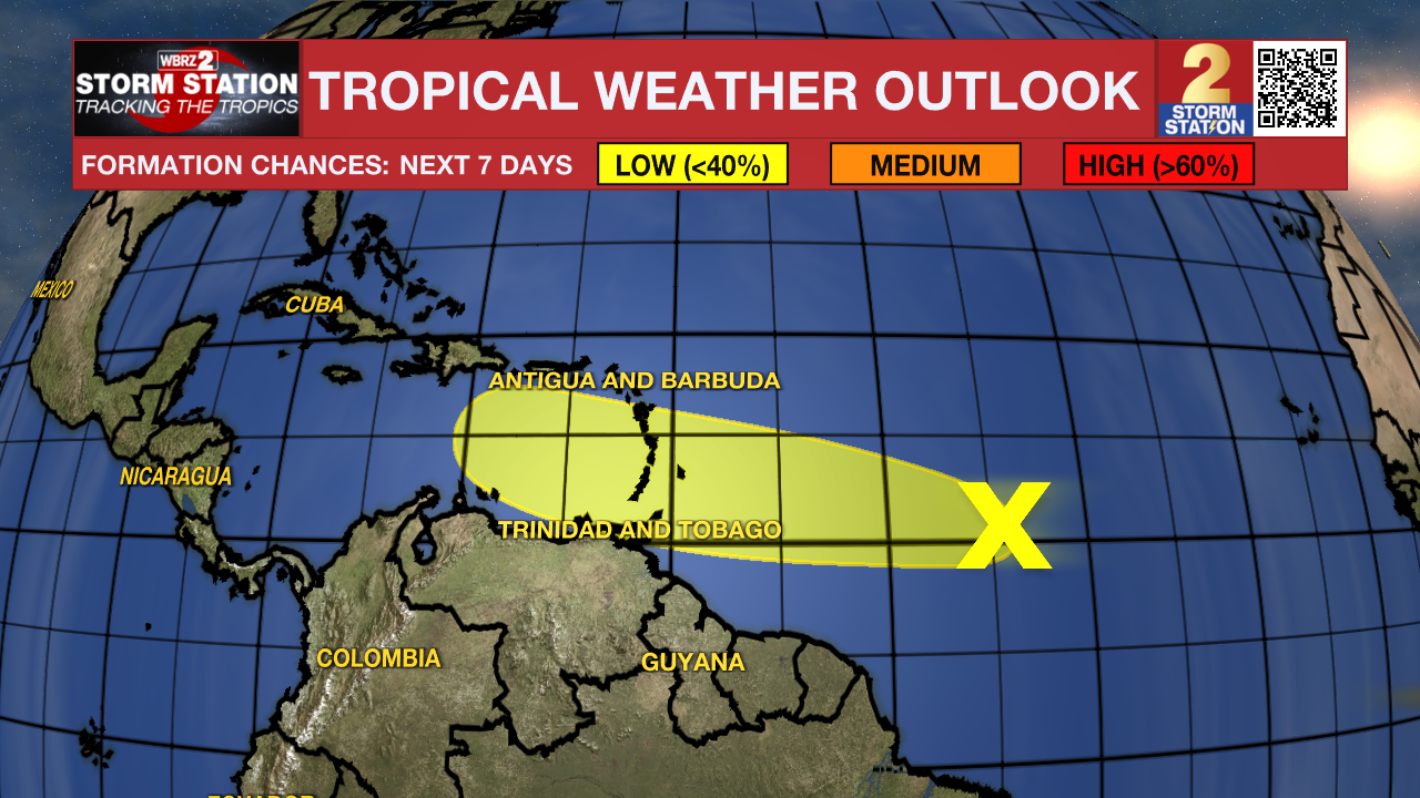
Another tropical wave is located over 1000 miles east-southeast of the Windward Islands, following in the footsteps of Beryl. This system now has a lower chance of development, but the Storm Station will continue to monitor it's progression over the next week. Those in the Lesser Antilles, even some areas affected by Beryl, should monitor the progress of this wave.

Get the latest 7-day forecast and real time weather updates HERE.
Watch live news HERE.
- Emma Kate Cowan, Malcolm Byron
The Storm Station is here for you, on every platform. Your weather updates can be found on News 2, wbrz.com, and the WBRZ WX App on your Apple or Android device. Follow WBRZ Weather on Facebook and Twitter for even more weather updates while you are on the go.


