

Latest Weather Blog
Tuesday Evening Video Forecast
Related Story
Tropical moisture will soon push westward, allowing a pattern more typical of summer to take over. Drier, warmer, and sunnier days are ahead.
Tonight & Tomorrow: Remaining showers will fizzle out with the loss of daytime heating on Tuesday night. We'll keep mostly cloudy skies overnight with mild temperatures. Look for a low temperature near 76°. The stream of tropical moisture from recent days will nudge westward on Wednesday. This will result in some degree of sunshine peeking through the clouds. The added sunshine will push highs into the low-90s. Enough moisture will be present to spark isolated afternoon showers and storms. However, much of the day will be dry and not all spots will see rain.
Even though soon-to-be Alberto (see The Tropics section) will remain well to the southwest, the system will help enhance winds speeds locally. The wind should be noticeable on Wednesday, with sustained winds out of the east at 10-20 mph.
Up Next: The typical summertime pattern makes a comeback by the end of the week. Highs will climb into the mid-90s, winds will back off, and sunshine will take up more of the sky. We cannot rule out a garden variety pop-up storm or two each afternoon, but most stay dry from day-to-day.
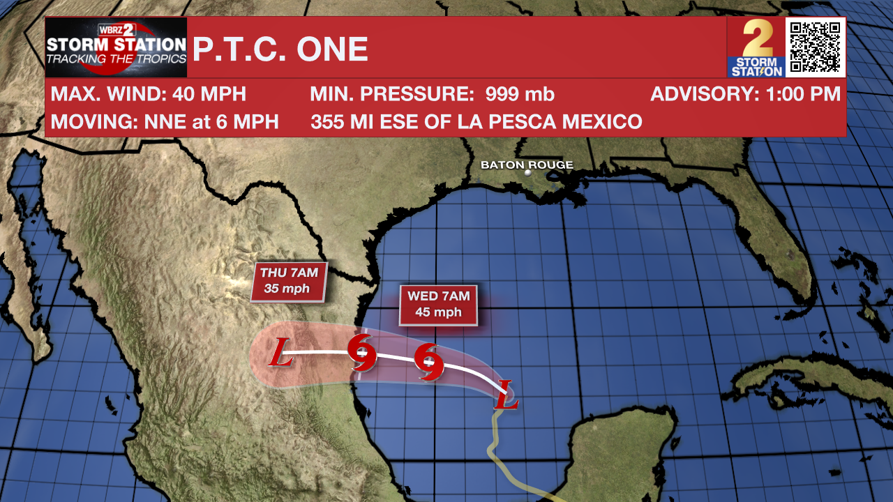
The Tropics: Potential Tropical Cyclone One is still ongoing in the Bay of Campeche. The "Potential Tropical Cyclone" term is a designation from the National Hurricane Center for systems that have yet to become tropical in nature, but will likely do so and make landfall within 48 hours. No direct impacts are anticipated for south Louisiana, but Tropical Storm Warnings are in effect for portions of northern Mexico and southern Texas. This disturbance will likely become a tropical storm by Wednesday. Once that happens, it will take the name Alberto.
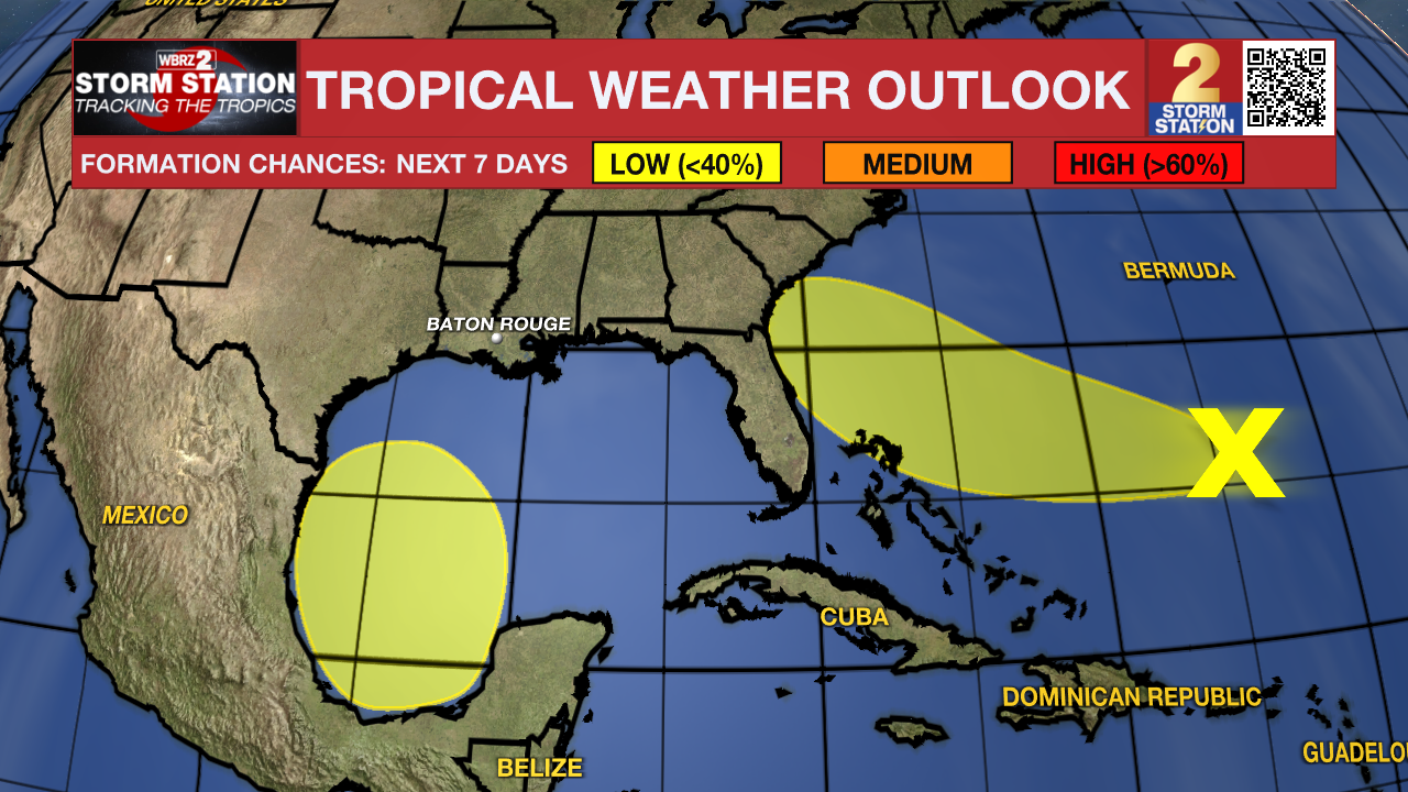
Another disturbance appears to develop over the same region occupied by Potential Tropical Cyclone One this weekend. The overall environment will be conducive for gradual development as it moves northward or northwestward into early next week. For now, that region has a low chance of tropical development this weekend and early next week.
The Storm Station is also keeping an eye on an area of showers and storms located several hundred miles east of the Bahamas. There is a small chance of gradual development of this system as it drifts westward toward the Southeast Coast. For now, no major impacts are anticipated for Louisiana.
Get the latest 7-day forecast and real time weather updates HERE.
Watch live news HERE.
– Emma Kate Cowan
The Storm Station is here for you, on every platform. Your weather updates can be found on News 2, wbrz.com, and the WBRZ WX App on your Apple or Android device. Follow WBRZ Weather on Facebook and Twitter for even more weather updates while you are on the go.
News
