

Latest Weather Blog
Sunday morning video forecast
Related Story
Temperatures will remain chilly to conclude the weekend. A big temperature swing will start tomorrow and highs in the 70's will be likely next week. Rain will also be likely.
Today & Tonight: After a cold morning start in the 20's, highs will max out around 51 degrees under mostly cloudy skies. The forecast for today has been a bit tricky. A cloud deck that was expected to move in later today has already moved in. While there might be some clearing in the mid morning, skies will go back to mostly cloudy for the afternoon and evening. Tonight, our low temperature will be around 38 degrees, and it will actually be reached around midnight or a couple hours after. Temperatures will actually slowly rise as we get closer to daybreak.
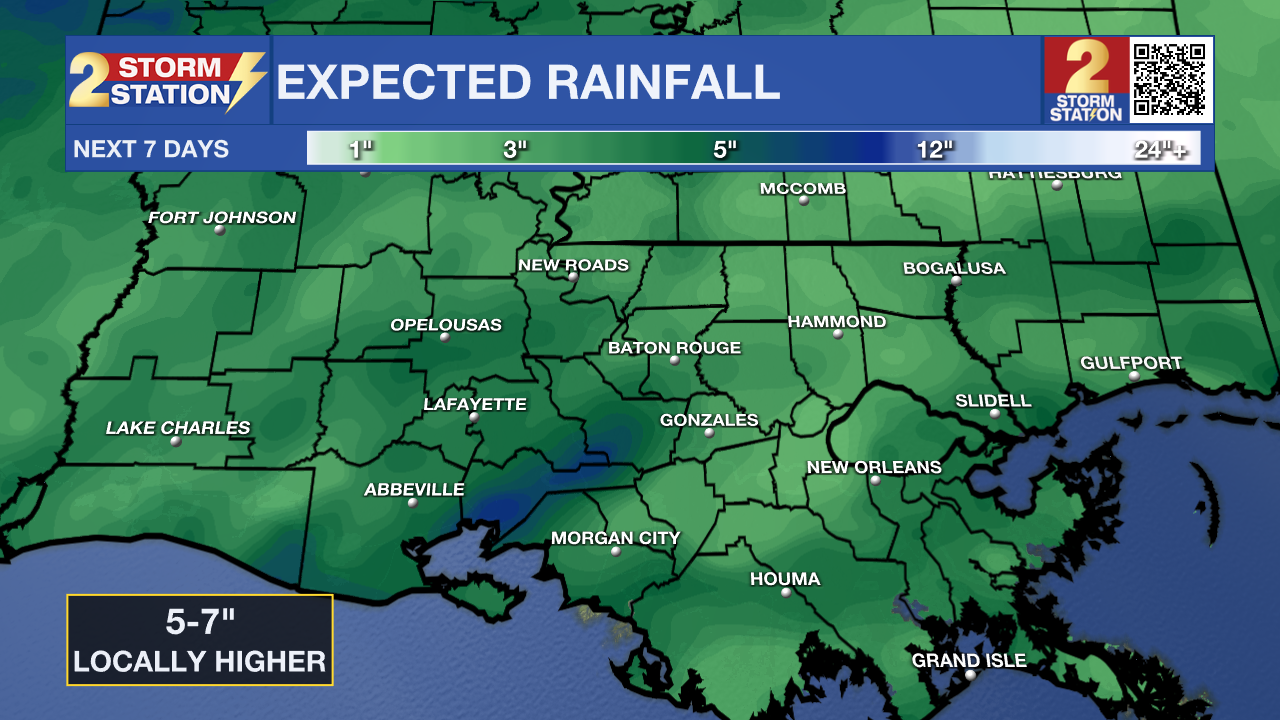
Up Next: Temperatures will warm dramatically on Monday with highs in the mid to upper 60's. It will also be mostly cloudy with some spotty showers possible. The chance of showers will begin to increase overnight. This will be the start of a very wet pattern. Rain and above average temperatures will be likely for most of next week. This rain will likely come in multiple rounds with dry periods in between. While showers are generally expected for most of this activity, Wednesday looks to be the best day for thunderstorms. Some of these thunderstorms could be on the stronger side. Most areas could expect to pick up 5-7 inches of rain in total through the end of next week.
Get the latest 7-day forecast and real time weather updates HERE.
Watch live news HERE.
– Balin
The Storm Station is here for you, on every platform. Your weather updates can be found on News 2, wbrz.com, and the WBRZ WX App on your Apple or Android device. Follow WBRZ Weather on Facebook and Twitter for even more weather updates while you are on the go.
News
