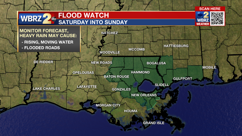
Saturday PM Forecast: More rain on the way tonight
Related Story
The SECOND round of rain will move in overnight.
THE FORECAST
Tonight & Tomorrow: After the intense rain around lunch, the second round of rain will begin to move in overnight. A FLOOD WATCH has been put in place for portions of the WBRZ viewing area. Into the evening hours a cold front will set into the area. Along the front a line of showers and storms will push through bringing more rain and the potential for severe weather overnight. We will be watching for downpours, frequent lightning, gusty winds, and hail. The time line for the second rain maker today will start around 9PM and not fully push through the WBRZ viewing area until 3AM Sunday. The storms will clear the area well before sunrise. Temperatures will start comfortable in the 60s, and daytime highs will struggle to reach the mid-70s. Northerly winds will set in behind the front setting us up for a cool and comfortable Sunday.

Up Next: Starting off your work week, temperatures will be in the upper-40s Monday morning. Skies will be mostly clear with plenty of sunshine, but temperatures will struggle to climb into the low-70s into the afternoon hours. The cool weather does not stick around for long. Temperatures will continue to climb back into the mid-80s by Wednesday. With the warmer temperatures rain will be returning back into the forecast by the end of the week. Click here to see the 7-day forecast.
The Storm Station has you covered with hour-by-hour weather tracking is available for your location on the WBRZ WX App on your Apple or Android device. Follow WBRZ Weather on Facebook and Twitter for even more weather updates and unique weather insight from the whole team!


