Saturday Evening Video Forecast
Related Story
Scattered rain is a common theme in the Storm Station forecast through Sunday. But into next week, a series of fronts will bring some minor changes.
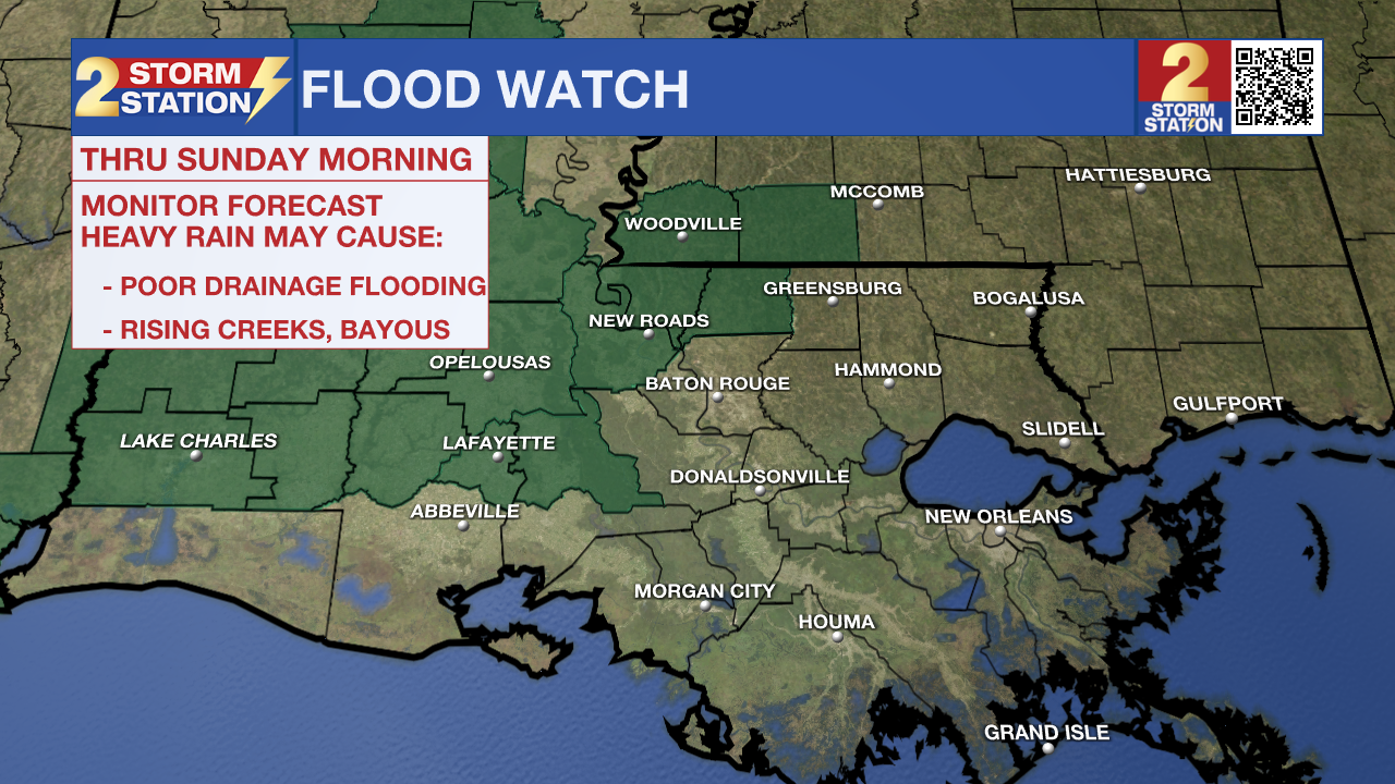
A FLOOD WATCH is in effect for East Feliciana, Pointe Coupee, and West Feliciana Parishes as well as Amite and Wilkinson Counties through Sunday morning. An axis of heavy rain set up in central Louisiana on Saturday which may clip the above parishes on Saturday night. The potential is there for up to 2-4" of rain in the watch area.
A FLOOD WATCH means conditions may develop that lead to flash flooding. Flash flooding is a very dangerous situation. Be on the lookout for threatening weather conditions and listen for later statements and possible warnings. For more on flooding safety, CLICK HERE.

Tonight & Tomorrow: Scattered showers and thunderstorms will be a fixture in Saturday night's forecast. Especially along and north of Baton Rouge, the potential exists for heavy rain in select areas. While it won't be the case in every point location, some could pick up several inches should thunderstorms repeat over the same spot. Should that occur, rain rates could be high enough to result in nuisance flooding and standing water concerns. For that reason, a Flood Watch has been issued for Pointe Coupee, East Feliciana, and West Feliciana Parishes as well as Amite and Wilkinson Counties. The Baton Rouge metro is purposefully not included in the watch as the majority of the rain should fall to the northwest. For areas along and south of Baton Rouge, rain will be more of the hit-or-miss variety. Expect another incredibly mild night with a low in the low to mid-70s.
Have the rain gear ready to go on Sunday; scattered showers and thunderstorms remain a possibility. This will especially be the case for the morning hours. One great way to stay ahead of the rain is by downloading the free Storm Station app to be notified when heavy rain or lightning is near your location. By afternoon, the shower activity will become more sparse. While a passing afternoon shower isn't out of the question, the day should end on a drier note. Despite a mostly cloudy sky, highs will still reach the low-80s which is roughly 10° above normal.
Up Next: The cold front responsible for drawing Gulf moisture inland over the weekend now appears to have enough of a push to pass through the region on Monday. As a result, things trend in a drier direction to kick off the new workweek. Drier air also arrives behind the front, which will result in a temporary break in humidity on Tuesday. However, it makes a comeback Wednesday. The boost in moisture by midweek plus an upper-level disturbance will spark an uptick in showers once again. But even that will be short-lived. The Storm Station has eyes on another cold front on Thursday. That front has the possibility of lowering highs into the upper-70 and lows into the upper-50s. While not a huge dip in temperatures, it's at least something.
Get the latest 7-day forecast and real time weather updates HERE.
Watch live news HERE.
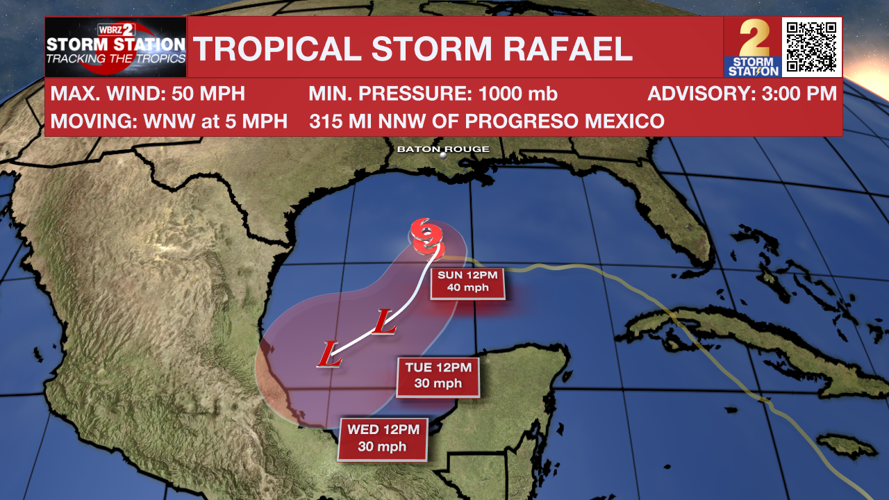
The Tropics: As of Saturday afternoon, Tropical Storm Rafael continues to struggle in the central Gulf of Mexico. The system is expected to meander through the remainder of the weekend. By next week, Rafael will become post-tropical and its remnants will drift southwest.

Meanwhile, there is a concentrated area of showers and thunderstorms a couple of hundred miles east of the central Bahamas. Gradual development of this system is possible during the next day or so before it moves into an unfavorable environment on Sunday. Regardless of development, heavy rain and gusty winds are possible as it moves generally westward across the Bahamas through Sunday.
-- Meteorologist Malcolm Byron
The Storm Station is here for you, on every platform. Your weather updates can be found on News 2, wbrz.com, and the WBRZ WX App on your Apple or Android device. Follow WBRZ Weather on Facebook and Twitter for even more weather updates while you are on the go.


