

Latest Weather Blog
Saturday evening video forecast
Related Story
New in the forecast, the chance of some thunderstorms has increased a bit for tomorrow. Activity is still expected to remain isolated. Scattered to numerous storms will be possible early next week.
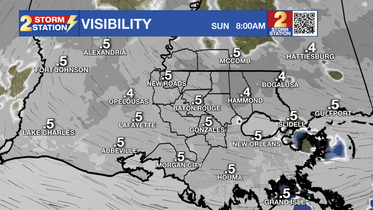
Tonight & Tomorrow: Lows will bottom out around 61 degrees under mostly cloudy skies. Dense fog will once again be a concern. Visibilities could drop down to below a quarter of a mile. The fog should start to clear up by 8-10 am. After the morning fog, another warm day is expected. Highs will top out near 80 degrees under mostly cloudy skies. Isolated showers and thunderstorms will be possible, especially in the afternoon and evening.
Up Next: Rain chances will start to increase drastically at the beginning of next week. As of now, the best chance for showers and thunderstorms appears late Monday through early Tuesday. Heavy rainfall will be possible, and any severe threat looks low at this time. A weak cold front will move through early Wednesday. While temperatures will not fall much, the front will bring in some drier air. This dry air will not last long. Yet another batch of rain is expected closer to Thursday, with the best chances on Friday. By the end of next week, 1-3” of rain is expected. Even though it is far out, a front looks like it will move through early Saturday. If this does occur, it will lower temperatures and cause a nice next weekend weather wise.
Get the latest 7-day forecast and real time weather updates HERE.
Watch live news HERE.
– Balin
The Storm Station is here for you, on every platform. Your weather updates can be found on News 2, wbrz.com, and the WBRZ WX App on your Apple or Android device. Follow WBRZ Weather on Facebook and Twitter for even more weather updates while you are on the go.
News
