

Latest Weather Blog
Monday Morning Video Forecast
Related Story
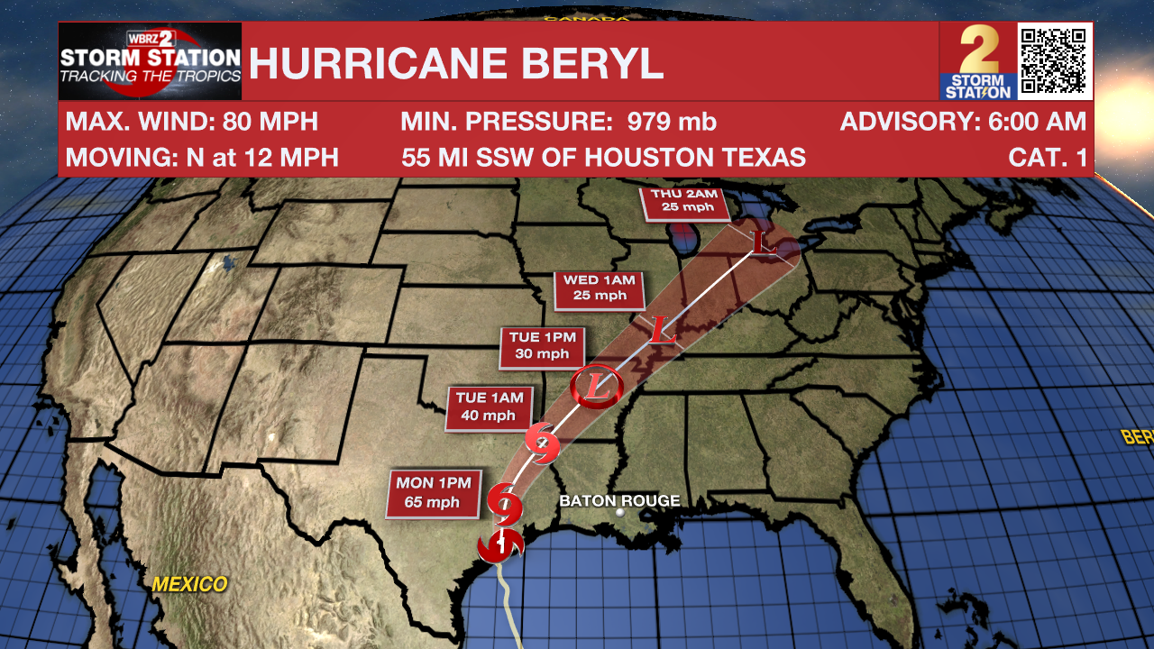
Beryl made landfall as a hurricane early Monday in Texas. It may seem counterintuitive, but the capital area's proximity to the storm will keep the region dry during the day on Monday. That chances on Monday night as a line of storms moves in from the west.
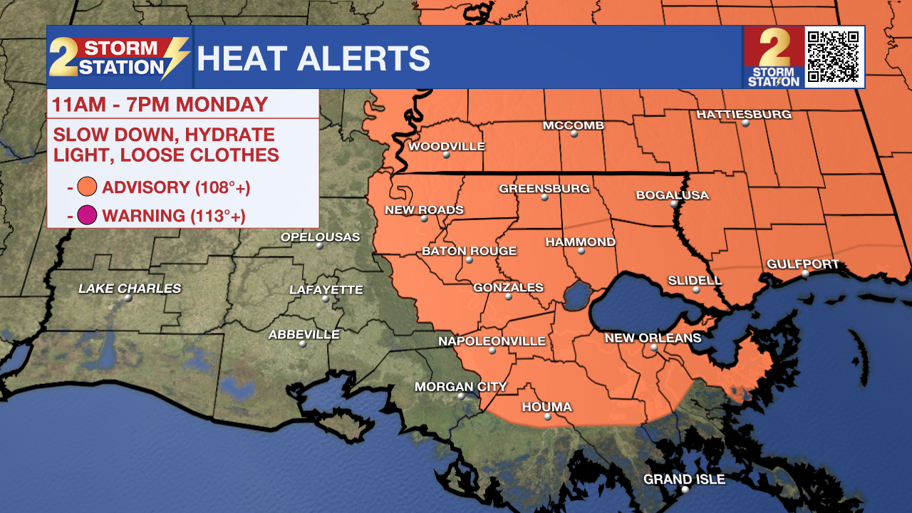
Today & Tonight: The capital area will experience another warm and muggy start on Monday. Spotty thunderstorms aren't out of the question through the day, although overall rain coverage appears somewhat limited per the latest data. Beryl plays a large role in that. The storm will rob southeast Louisiana of the necessary moisture needed to produce widespread rain. In addition, sinking air on the outer edges of Beryl will work against developing showers. So while a few storms are possible, they will have to fight negative influences. Otherwise, look for mostly cloudy skies with a high temperature in the middle-90s. With the humidity factored in, feels-like temperatures at peak heating will be pushing 110°. Another Heat Advisory has been issued as a result, so please be mindful of staying hydrated if out in the heat.
A line of showers and storms will be approaching from the west on Monday night. These will arrive after dark, with peak storm chances in the overnight hours. Some of these storms will linger for the Tuesday morning drive. Look for an overnight low in the upper-70s.
Up Next: Beryl will be well on its way to becoming post-tropical on Tuesday as it tracks along a frontal system. As the system continues to pull away, it will drive a cool front toward the capital area. Lots of available moisture will exist along and ahead of that front. This will effectively trigger a line of storms that will pass through southern Louisiana. These storms will pass through early on Tuesday. Rain coverage generally decreases as the day wears on. Be alert to heavy rainfall with this round, perhaps resulting in narrow streaks of high rain totals.
The aforementioned front will stall over the region through midweek. The position of that front is key because the best rain chances will be found to the south of it. If you're hoping for a significant cooldown from the "cool" front, little heat relief will be found. The front will slowly lift north through the rest of the week. The area will return to the typical summertime pattern (without fronts) by the weekend.
The Tropics: After making landfall early Monday morning in Texas, Beryl will quickly weaken as it interacts with land. The system will merge with a frontal system by Tuesday which will accelerate its loss of tropical characteristics. Beryl will then become post-tropical by midweek as it tracks northeast through the Midwest.
There are no other areas of concern in the Atlantic Basin over the next seven days.
Get the latest 7-day forecast and real time weather updates HERE.
Watch live news HERE.
-- Meteorologist Malcolm Byron
The Storm Station is here for you, on every platform. Your weather updates can be found on News 2, wbrz.com, and the WBRZ WX App on your Apple or Android device. Follow WBRZ Weather on Facebook and Twitter for even more weather updates while you are on the go.
News
