

Latest Weather Blog
Monday Evening Video Forecast
Related Story
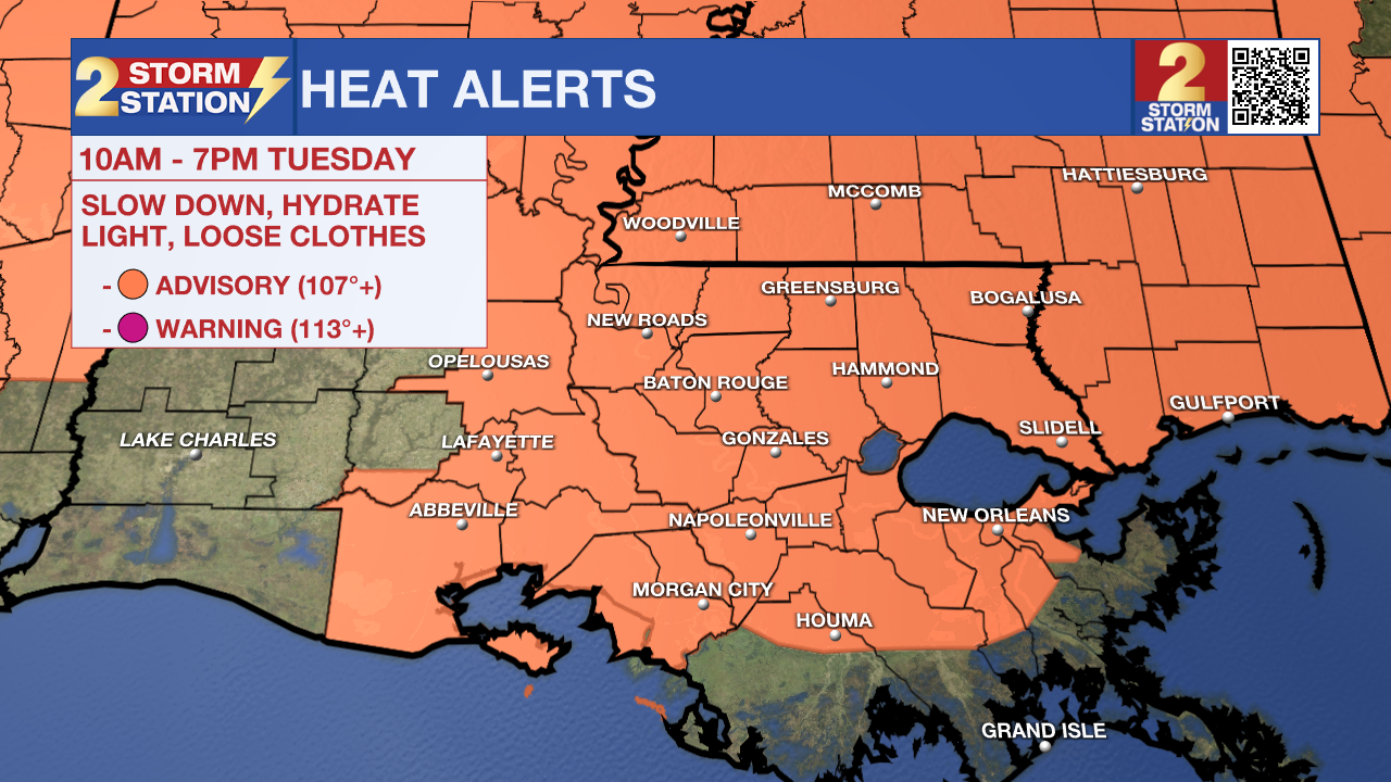
The heat shows no signs of letting up on Tuesday. With expected feels-like temperatures pushing 110°, yet another Heat Advisory has been issued. Stay hydrated and be mindful of the signs of heat exhaustion and heat stroke.
Tonight & Tomorrow: Although a stray shower or storm isn't out of the question during the early evening, those will weaken after sundown. Mostly clear skies will be left over with an overnight low in the middle to upper-70s. More of the same is expected on Tuesday. Look for a high temperature in the middle and upper-90s with the same sultry feel from recent days. With humidity factored in, feels-like temperatures will exceed 100° by late morning and push 110-111° by peak heating. Another Heat Advisory will be in effect from 10 a.m. to 7 p.m. Tuesday to account for the high heat. Drink lots of water and take frequent rest breaks if outside for an extended period. Heat illnesses can develop quickly with heat of this magnitude.
The warmth will also lead to isolated shower and storm development in the heat of the day. The isolated nature of the rain means that many will stay dry. However, lucky spots will get some heat relief.
Up Next: The hot pattern with isolated afternoon storms continues on Wednesday. However, an upper-level disturbance will arrive on Wednesday night. This will help increase rain coverage, even past sunset on Wednesday night. Those showers and storms linger into Thursday, and the increased rain coverage will help push temperatures down. That said, any "cooldown" would be fairly minor.
Long-term data clearly shows another "heat dome" overspreading the capital area over the weekend. This will push highs back into the upper-90s. While this pattern typically dries the atmosphere out, that does not appear to be the case this time. For that reason, afternoon pop-up storms remain on the Storm Station 7-Day through the weekend.
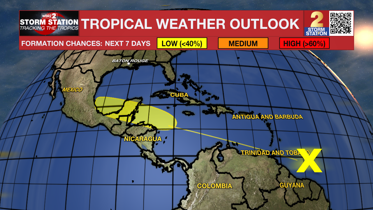
The Tropics: A tropical wave located a few hundred miles east of the Windward Islands is producing showers and thunderstorms. While development is not expected in the next few days, slow development will become possible once the wave reaches the western Caribbean late this week. For now, the system has a low chance of becoming something greater in the next week.
Get the latest 7-day forecast and real time weather updates HERE.
Watch live news HERE.
-- Meteorologist Malcolm Byron
The Storm Station is here for you, on every platform. Your weather updates can be found on News 2, wbrz.com, and the WBRZ WX App on your Apple or Android device. Follow WBRZ Weather on Facebook and Twitter for even more weather updates while you are on the go.
News
