

Latest Weather Blog
Friday evening video forecast
Related Story
Some slight modifications to the weather pattern over the weekend will influence the forecast. While tropical moisture remains abundant, the big ridge of high pressure, that can put a lid on the atmosphere and therefore precipitation, will be weakening. Additionally, the Capital Area will notice some indirect impacts from Hurricane Beryl.
Tonight & Tomorrow: Lingering showers and thunderstorms will fizzle the deeper we move into the night. However, if you have outdoor plans Friday evening, don’t be surprised if some rain is holding on longer beyond sunset than usual. Low temperatures will stay in the low 80s. With some sunshine available early on Saturday, high temperatures will race into the mid 90s for most locations. Where this occurs, feels-like temperatures could briefly top out between 105 – 110 degrees. This will be limited in spots that see showers and thunderstorms flare up first. Ultimately, scattered activity is expected to the tune of about 60 percent of the coverage area picking up measurable rain. Sunday will be a little less active with 40 percent rain coverage and therefore more locations will reach the mid to upper 90s.
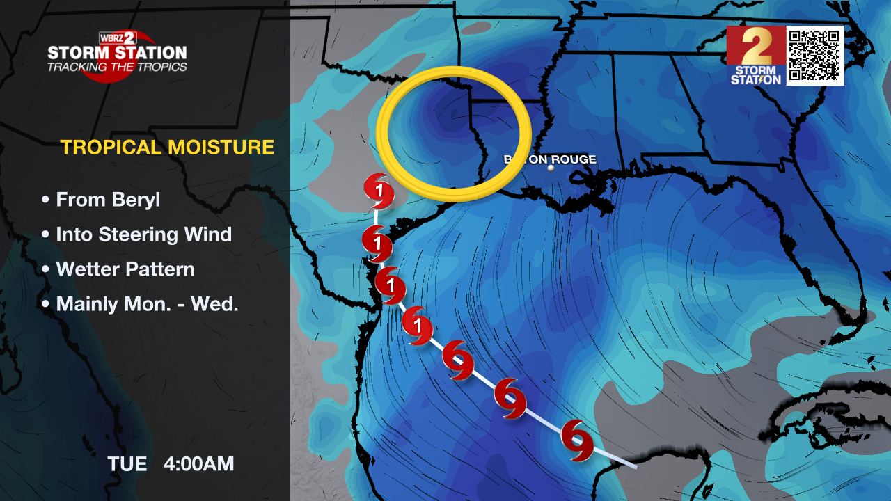
Up Next: Early next week, the same general pattern will continue with the only potential caveat being some increased moisture in the atmosphere from the tropics. Should this occur, daily rain coverage may need to trend up from the current forecast. As for temperatures, highs will remain in the low to mid 90s with lows in the upper 70s. Thermometers will be highly dependent on the onset of showers and thunderstorms each day.
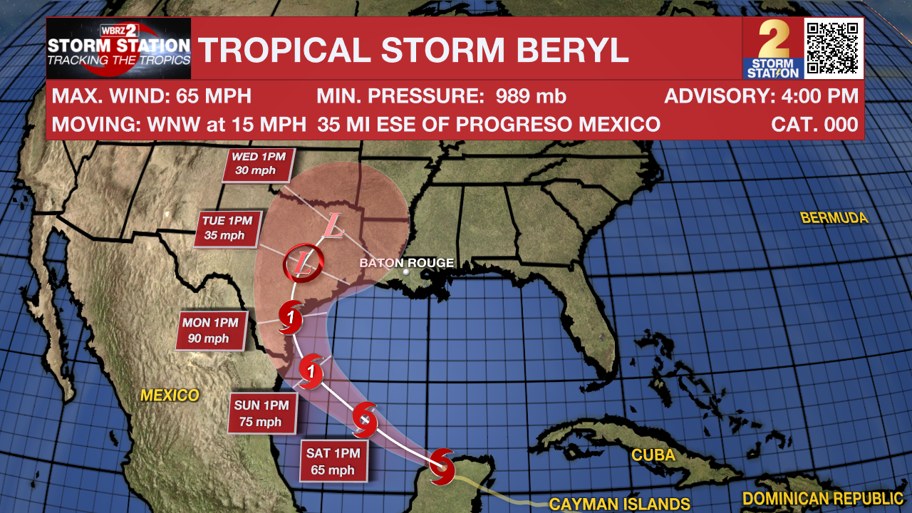
The Tropics: Tropical Storm Beryl will move back into the southern Gulf of Mexico Friday evening. A hurricane watch has been posted for the western Gulf Coast. As of 4pm Friday, Beryl had 65mph winds and was moving west-northwest at 15mph. The storm will turn northwest on Saturday with re-intensification to hurricane strength likely before a landfall in Texas on Sunday night. Areas in the hurricane watch may expect storm surge along the coast, strong winds and heavy rain.
Local Impacts: Beryl will bring some indirect impacts to the local area next week. Here is a summary:
- Rip Currents—dangerous rip currents will be possible along the Louisiana Coast and for beaches as far east as the Florida Panhandle. Extreme caution should be used in areas that are permitting swimming.
- Coastal Flooding—persistent onshore winds could lead to water inundation for immediate coastal areas around the Gulf of Mexico and the tidal lakes. Tides may run a few feet above average for several days.
- Heavy Rain—remnant moisture from the storm could end up over Louisiana and Mississippi by the middle of next week. The tropical moisture could lead to heavy thunderstorms and possible some street and poor drainage flooding.
Get the latest 7-day forecast and real time weather updates HERE.
Watch live news HERE.
– Josh
The Storm Station is here for you, on every platform. Your weather updates can be found on News 2, wbrz.com, and the WBRZ WX App on your Apple or Android device. Follow WBRZ Weather on Facebook and Twitter for even more weather updates while you are on the go.
News
