

Latest Weather Blog
Wednesday PM Forecast: Warm through New Years Day, then strong cold front arrives
The Forecast
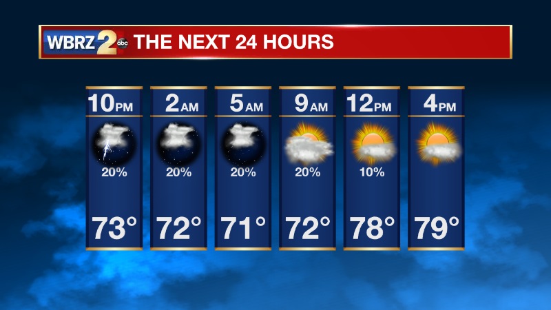
Passing showers will continue this evening and into the overnight hours.
Cloudy skies will prevent low temperatures from dropping much. Lows will likely bottom out around 70 degrees.
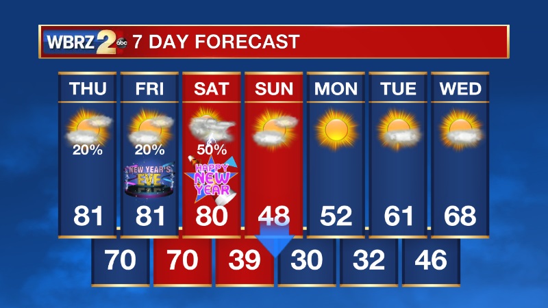
Thursday afternoon will be drier than today, with rain chances at 20%. Another record high may be tied or broken. The forecast high for tomorrow is 81 and the record is 81 which was set back in 1984.
Looking Ahead
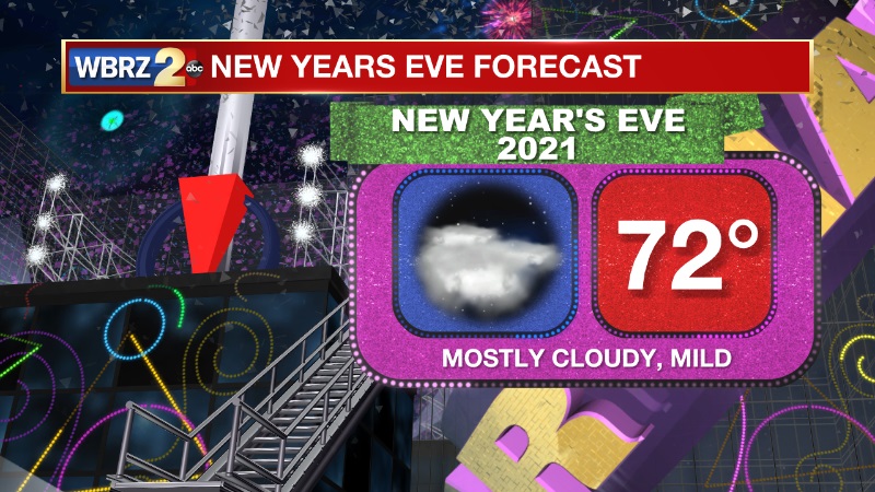
Friday's forecast will be a repeat of Thursday - mild with high temperatures in the low 80s. New Years Eve plans will be a go. Our next big cold front arrives late in the day Saturday, bringing showers and storms ahead of it. Temperatures will start to plummet on Sunday as cold air rushes in. High temperatures will only be in the 40s early Sunday morning, then fall into the 30s by Sunday evening. We will likely have a widespread light freeze across south Louisiana Monday morning.
-- Meteorologist Jake Dalton
Trending News
Remember, you can always get the forecast and a look at current radar on the free WBRZ WX app!
More News
