

Latest Weather Blog
Wednesday PM Forecast: Rain coverage expands as workweek comes to an end
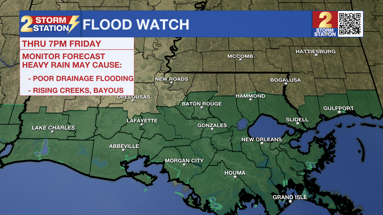
Pockets of heavy rain are expected to develop once again across portions of southeast Louisiana on Thursday and Friday. Due to the storm efficiency and threat of multiple storms running over some locations, rain could quickly overwhelm locations that are flood-prone or have poor drainage.
The National Weather Service has issued a FLOOD WATCH for all parishes along and south of I-10/12, including the city of Baton Rouge, through Friday evening. You should monitor later forecasts and be alert to possible warnings. Those living in areas prone to flooding should be prepared to take action should flooding develop and do not drive across a flooded area. About 2-4 inches of rain is expected in the watch area, though isolated higher amounts are possible.
Tonight: Scattered showers, and even a few thunderstorms, will remain possible overnight beneath a thick cloud deck. Low temperatures will stay in the mid-70s.
Thursday & Friday: Thursday, Thursday night, and Friday will be noticeably more active. Widespread rain and thunderstorms could be heavy at times. Any thunderstorms, especially those that repeat (train) over the same area, could dump a quick few inches of rain. Both the morning and afternoon commutes could contend with wet weather, so be prepared for slower drive times. Remember, if your windshield wipers are on, your headlights should be on. It will not rain all day each day, but even during breaks, mainly cloudy skies will persist with very little sun. High temperatures will stay in the low 80s. Low temperatures will be in the mid-70s.
Up Next: A weak front will start to push through from north to south Friday night, swiping the thick moisture away from the region and ending precipitation. The trends suggest some rain could linger into a few high school football games but should be wrapping up as the games do. It would be a good idea to take a poncho to your game of choice. It will be cool on Friday night with temperatures in the mid-70s.
On the other side of the front, expect lower humidity and clearing skies through Saturday. Those setting up tailgates for the first LSU and Southern home games can expect generally more comfortable conditions, but don’t be surprised if clouds are stubborn early in the day. Some sun will be out later though. Although temperatures hold steady in the 70s to start on Saturday, temperatures will climb into the upper-80s once the sun pokes out. A reinforcing shot of dry air on Sunday is likely to bring the driest and coolest air felt since early June. We might be able to classify that incoming air mass as the first taste of fall this season.
Trending News
Get the latest 7-day forecast and real time weather updates HERE.
Watch live news HERE.
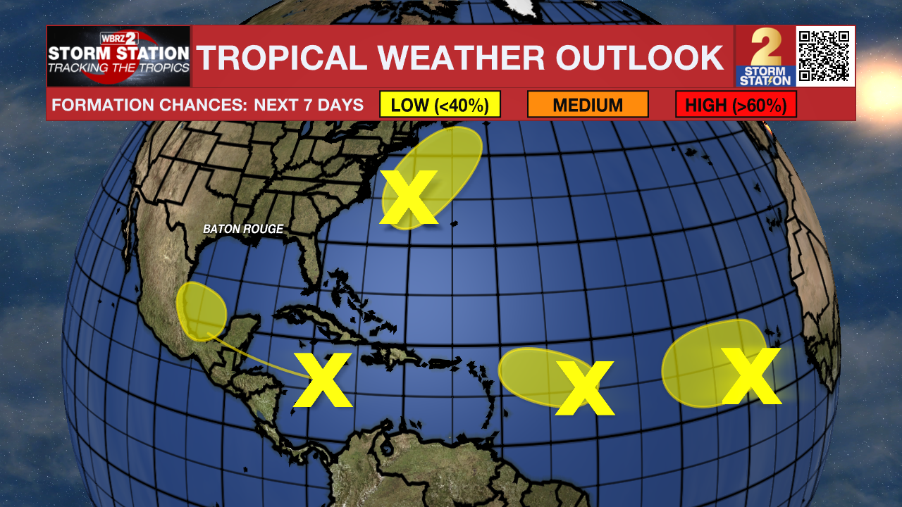
The Tropics: There are several areas of interest in the Atlantic Basin, all of which have low chances of tropical development in the next week.
A tropical wave moving quickly westward at about 20 mph is producing a broad area of thunderstorms across the central Caribbean Sea. Some development is possible into next week as the system emerges over the southwestern Gulf of Mexico. This wave poses no immediate cause for concern locally, but it is worth keeping an eye on this disturbance in the long-term.
A non-tropical area of low pressure located a few hundred miles east of North Carolina might acquire some subtropical characteristics over the next few days as it moves northeastward. Fortunately, the system will remain offshore and does not appear to be a big threat to land at this time.
Another tropical wave located over the eastern tropical Atlantic remains disorganized. Slow development of this system is possible in the coming days as it drifts northwestward.
An additional tropical wave is located farther to the west in the central tropical Atlantic. This wave also remains disorganized. Slow development is possible in the next few days. However, conditions will become less favorable for development by the end of the week.
– Josh
The Storm Station is here for you, on every platform. Your weather updates can be found on News 2, wbrz.com, and the WBRZ WX App on your Apple or Android device. Follow WBRZ Weather on Facebook and Twitter for even more weather updates while you are on the go.
More News
