

Latest Weather Blog
Wednesday PM Forecast: Gulf moisture fueling increased showers and thunderstorms
A deep pool of moisture in the atmosphere will interact with some energy generated by an upper level disturbance over the northwestern Gulf of Mexico. While this feature is not expected to significantly develop, it does appear tropical in nature. It would not be surprising to see the National Hurricane Center briefly highlight that system in future outlooks.
Tonight & Tomorrow: As usual, showers will decay after sunset with no more rain ongoing by 10pm. Skies will partially clear and low temperatures will stay in the mid to upper 70s keeping a very muggy feel. On Thursday, morning sunshine will send high temperatures into the low 90s by noon. Around that time, clouds will rapidly increase and showers and thunderstorms will blossom. Numerous showers and thunderstorms are expected to move about the region through afternoon. Some may cause brief downpours.
Up Next: There is some nuance to the forecast on Friday that could tweak the number of showers and thunderstorms able to develop. Leftover cloud cover from other areas of precipitation nearby could limit temperatures which in turn could cut into the energy available for showers and thunderstorms. The cloud cover may also limit high temperatures to the upper 80s. The Storm Station will be monitoring this trend. Saturday and Sunday, moisture and storm energy will drift slightly lower, not enough to eliminate isolated showers and thunderstorms, but enough for early sunshine and dry time to send high temperatures back into the low 90s. Through the next seven days, most locations will receive 2-4 inches of rain. To be clear, it will not rain on any one spot every single day.

If you have plans for the Labor Day Weekend, nearby coastal communities will have similar weather to the Baton Rouge area. Be alert to darkening skies as it could signal thunderstorms. Lightning could chase you inside briefly, but do not expect any washouts. For LSU Football fans traveling to Las Vegas it will be downright hot. Afternoon temperatures on gameday will soar well into the 100s and postgame temperatures will still be in the 90s.
Trending News
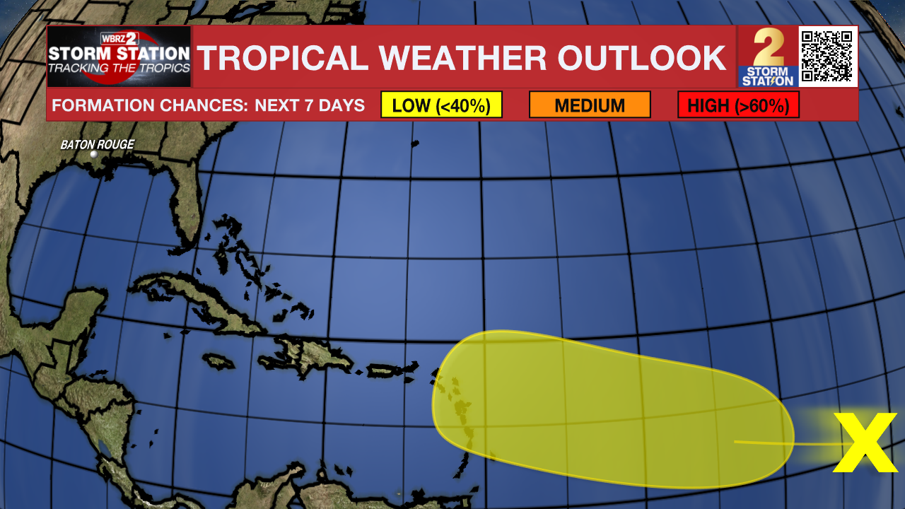
The Tropics: An area of disorganized showers over the central Tropical Atlantic is associated with a tropical wave. Some slow development of this system is possible this weekend into early next week while it moves westward to west-northwestward at 10 to 15 mph.
Get the latest 7-day forecast and real time weather updates HERE.
Watch live news HERE.
– Josh
The Storm Station is here for you, on every platform. Your weather updates can be found on News 2, wbrz.com, and the WBRZ WX App on your Apple or Android device. Follow WBRZ Weather on Facebook and Twitter for even more weather updates while you are on the go.
More News
