Wednesday PM Forecast: frosty night, then tracking two more storm systems
After a wet morning, when much of southeast Louisiana and southwest Mississippi collected about a half inch of rain, clearing skies will result in a cold and frosty night. Several more storm systems are set to impact the Storm Station Viewing Area between now and early next week.
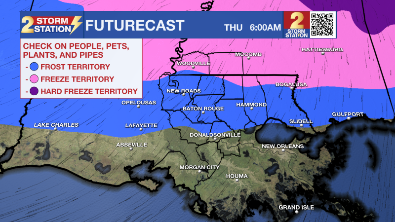
Tonight & Tomorrow: Clouds will break just in time to allow temperatures to tumble into the low 30s overnight. The only thing propping up numbers will be moisture (dew point temperatures). However, coupled with light winds, that added moisture will contribute to frost formation along and north of the interstates into daybreak. If you live north of I-10, it is a good idea to protect sensitive plants and make sure pets have a warm place too.

Thursday will offer brilliant sunshine. In catching plenty of rays, thermometers will steadily climb into the low 60s by mid afternoon.
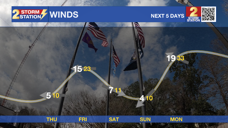
Up Next: The next rainmaker continues to show a faster timeline. Friday will begin chilly and overcast with rain overspreading the area from west to east by early afternoon. Even a few rumbles of thunder will be possible. After another inch or so, expect rain to end around nightfall. Friday will also be breezy with 15-25mph sustained winds and gusts possibly exceeding 30mph.
Trending News

If you have outdoor plans over the weekend, all appear to be in good shape with weather that would be considered seasonable for early January. Both days will be partly sunny with highs in the low to mid 60s and lows in the 40s. Make a point to pay attention to the forecast over the weekend though, because Monday will bring an added slate of impacts.

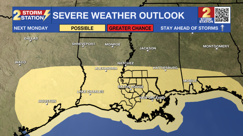
A large and strong storm system will sweep across the country. In the Capital Area, showers will be possible as early as dawn and until a cold front and associated line of rain and thunderstorms sweeps through overnight into Tuesday. In between, there will be at least a brief window of opportunity for severe weather. Once again, this system will stir up quite a bit of wind regardless of severe weather. Behind it, much cooler temperatures are expected for the middle of next week.
Get the latest 7-day forecast and real time weather updates HERE.
Watch live news HERE.
– Josh
The Storm Station is here for you, on every platform. Your weather updates can be found on News 2, wbrz.com, and the WBRZ WX App on your Apple or Android device. Follow WBRZ Weather on Facebook and Twitter for even more weather updates while you are on the go.


