

Latest Weather Blog
Wednesday AM Forecast: Windy today as we transition to a drier weather pattern
Wednesday serves as a transition day this week as we will watch tropical moisture move to the west and slightly drier air take over from the east. Through the weekend we will see more sunshine and less rain.
Today & Tonight: Elevated winds from the east early Wednesday will add a refreshing feel to the air. Conditions are not quite as muggy to start off the day as the highest atmospheric moisture amounts are now to the west of our area. Temperatures early Wednesday start off in the low to mid 70's and as we will see more sunshine today, it will help the region warm back into the low-90's this afternoon. Though we are trending drier, isolated shower activity should still be expected this afternoon, about 30% coverage anticipated for afternoon storms. Winds will remain quite breezy all day, anywhere between 10-25 mph.
St. James and Assumption parishes have been highlighted in a Wind Advisory until 7pm Wednesday evening.
Overnight, winds will begin to die down a bit and with partly cloudy conditions, temperatures will fall back into the middle 70's by daybreak Thursday.
Up Next: We will see a sunnier and drier pattern begin Thursday and stick around through the weekend. With less clouds and rain, temperatures will creep up to slightly above average temperatures each afternoon, into the middle and possible upper-90's for some. There will still be enough moisture present in the air to make things feel a bit warmer and allow for typical summertime pop-up storms to develop each day.
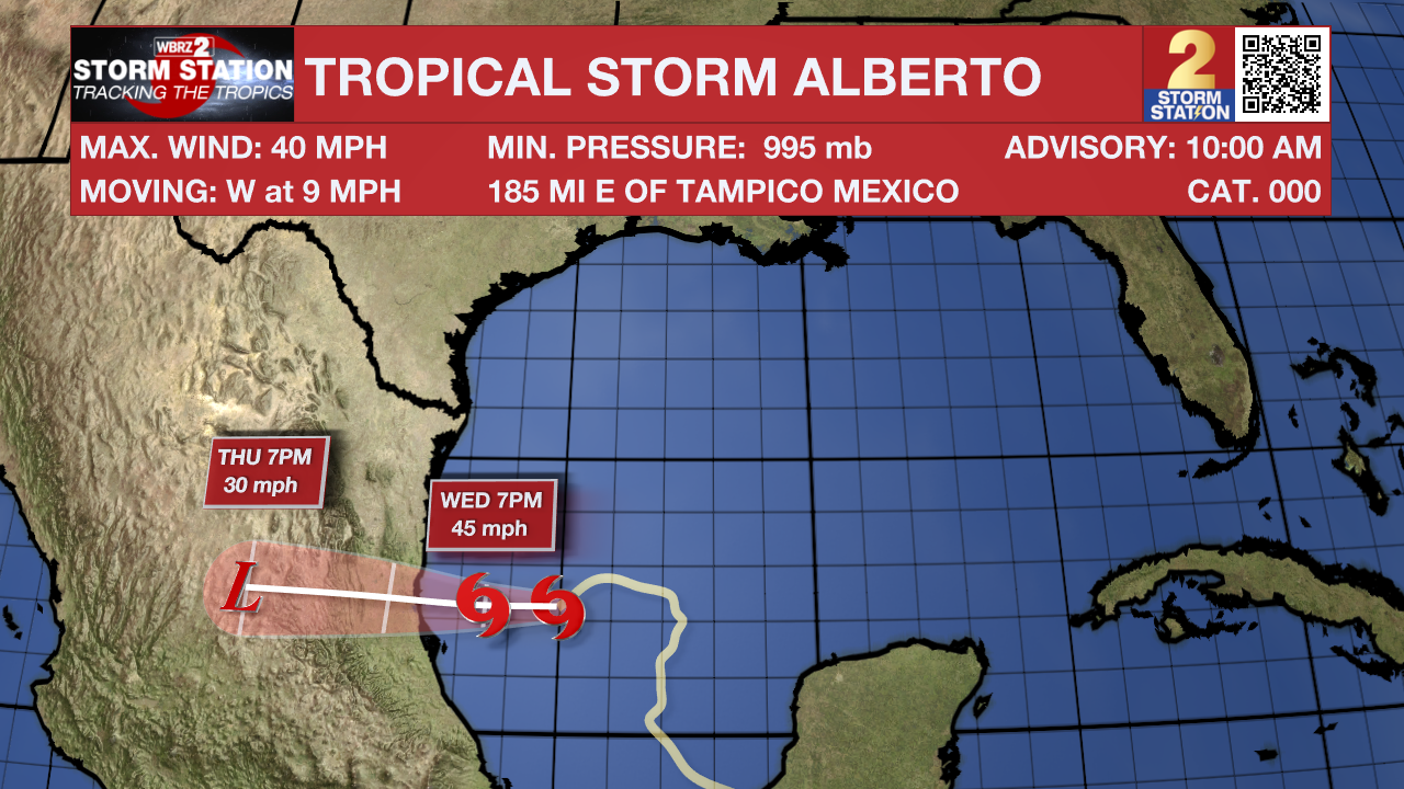
The Tropics: Tropical Storm Alberto is still ongoing in the Gulf of Mexico. No direct impacts are anticipated for south Louisiana, but Tropical Storm Warnings are in effect for portions of northern Mexico and southern Texas. This storm is tracking west around 10mph with maximum sustained winds of 40mph.
Trending News
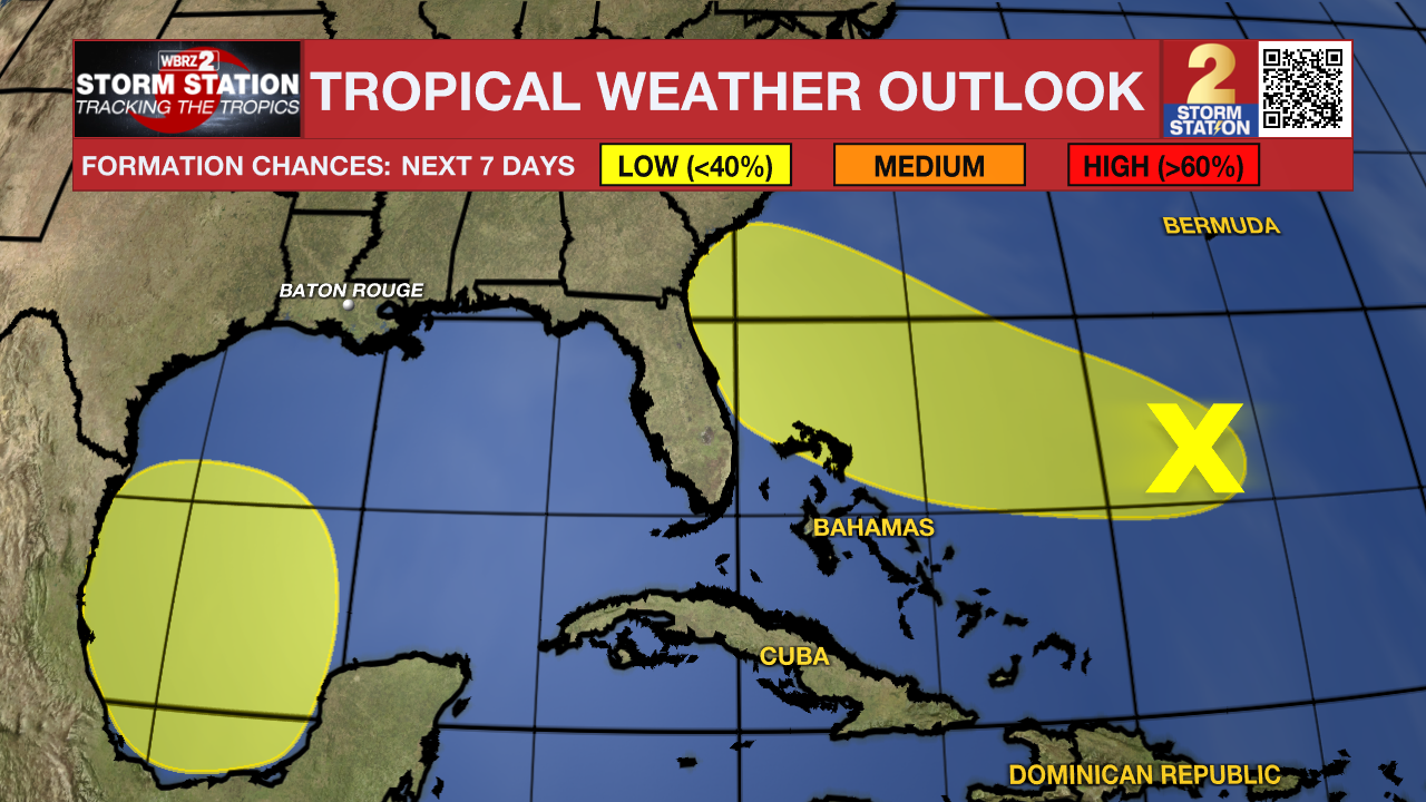
Another disturbance appears to develop over the same region occupied by Potential Tropical Cyclone One this weekend. The overall environment will be conducive for gradual development as it moves northward or northwestward into early next week. For now, that region has a low chance of tropical development this weekend and early next week.
The Storm Station is also keeping an eye on an area of showers and storms located several hundred miles east of the Bahamas. There is a small chance of gradual development of this system as it drifts westward toward the Southeast Coast. For now, no major impacts are anticipated for Louisiana.
Get the latest 7-day forecast and real time weather updates HERE.
Watch live news HERE.
– Emma Kate Cowan
The Storm Station is here for you, on every platform. Your weather updates can be found on News 2, wbrz.com, and the WBRZ WX App on your Apple or Android device. Follow WBRZ Weather on Facebook and Twitter for even more weather updates while you are on the go.
More News
