

Latest Weather Blog
Wednesday AM Forecast: Streak of very hot and dry days continues
A * HEAT ADVISORY* is in effect from 10am to 7pm Wednesday as feels-like temperatures over 108 degrees are expected across the entire Storm Station Forecast Area. Hot temperatures and high humidity may cause heat illnesses. Drink plenty of fluids, and when possible, stay in an air-conditioned rooms, avoid afternoon sun, and check up on relatives and neighbors.
Today & Tonight: The "coolest" temperatures of the day will be found right before sunrise, in the upper-70's. By mid-morning, temperatures will return to the upper-80's with triple digit temperatures expected by peak heating Wednesday afternoon. Baton Rouge will likely see a high near 101°, just one degree shy of the previous record high of 102° set back in 1921. Skies will be mostly sunny again on Wednesday, with no rain to be found in the Capital Region. Overnight conditions will stay warm and muggy with lows near 79°.
Up Next: The streak of hot and dry conditions will persist over the next week. Triple digit highs are likely Thursday and Friday with no rain to count on to cool things down. By the weekend, a few additional clouds each day will likely keep afternoon highs right below 100°, in the upper-90s with morning lows in the upper-70s. There is a very small chance for rain over the weekend, 10% of the Storm Station forecast area could see an afternoon pop-up; while the majority of the region will remain dry.
Heat alerts will likely be issued every day over the next 7, so continue to prioritize hydration and taking breaks from the heat when you can. Heat-related illnesses are known to develop easier after many grueling days in a row under extremely warm conditions.
The Tropics: Tropical Storm Debby continued to churn and dump heavy rain over portions of the Florida, Georgia, North Carolina and South Carolina. As of 5am Wednesday, Debby had maximum sustained winds of 45mph and was drifting east at 5mph located 65 miles SSE of Charleston, South Carolina. Debby is expected to produce potentially historic rainfall totals of 10 to 20 inches, with maximum amounts of 25 inches, bringing areas of catastrophic flooding across portions of the eastern half of South Carolina, and southeast North Carolina through Friday.
Trending News
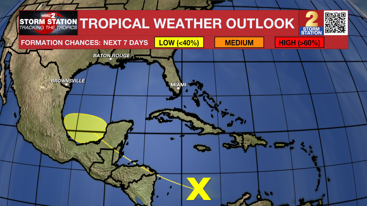
Disorganized showers and storms in the Caribbean now have a very low (10%) chance of taking on tropical characteristics over the next week.
Get the latest 7-day forecast and real time weather updates HERE.
Watch live news HERE.
– Emma Kate C.
The Storm Station is here for you, on every platform. Your weather updates can be found on News 2, wbrz.com, and the WBRZ WX App on your Apple or Android device. Follow WBRZ Weather on Facebook and Twitter for even more weather updates while you are on the go.
More News
