

Latest Weather Blog
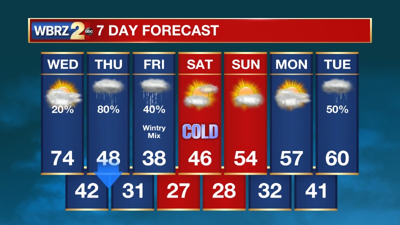
Wednesday AM Forecast: Storms tonight, wintry mix late Thursday into Friday
TODAY & TONIGHT
Most of your Wednesday will be quiet but mild with high temperatures in the mid 70s.
Tonight, a cold front will bring a line of showers and thunderstorms through the area. Most of the rain will be east of metro Baton Rouge by daybreak. One or two storms overnight could be strong, but overall, the severe weather threat is low.
LOOKING AHEAD
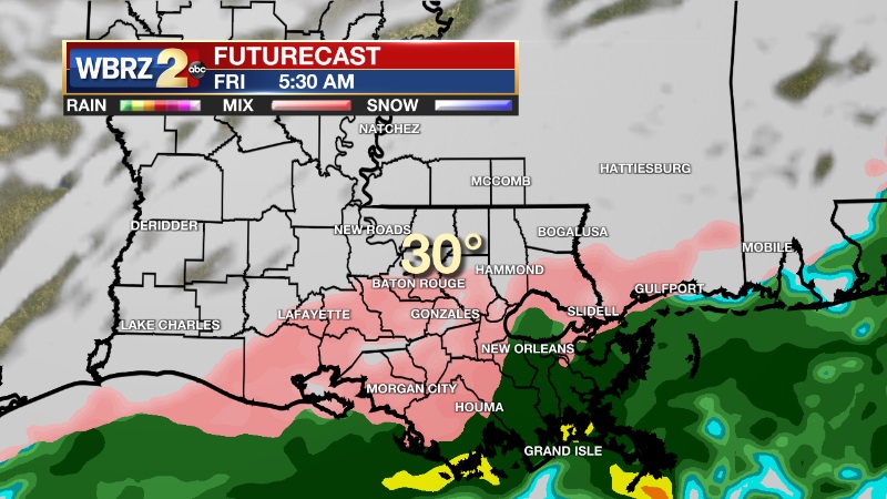
After the front passes on Thursday, another upper level disturbance will pass to our south moistening up the atmosphere. With temperatures at or near freezing Thursday night into Friday morning, any precipitation that falls may be in the form of sleet and/or freezing rain. Snow is not likely, because temperatures aloft will be too warm. Overall, ice accumulations should be light but we will need to watch for hazardous road conditions.
A very cold air mass will settle in through the weekend with at least four mornings in a row that will be below freezing.
Trending News
-- Meteorologist Jake Dalton
Your weather updates can always be found on News 2, wbrz.com, and the WBRZ WX App on your Apple or Android device. Follow WBRZ Weather on Facebook and Twitter for even more weather updates while you are on the go.
More News
