

Latest Weather Blog
Wednesday AM Forecast: First of several rounds of beneficial rain arrives today
Wednesday begins a trend of warm and rainy days. While no day looks to be a complete washout, keep raingear handy through the weekend as showers and storms will move through the region in an on-and-off manner each day.
Today & Tonight: Wednesday morning will start off warm and muggy with temperatures in the upper-70's in the Capital City. Throughout the day clouds will increase with skies becoming mostly cloudy to overcast by the afternoon hours. There will be just enough sun early in the day to warm temperatures into the lower 90's. Showers and storms developing the the gulf of Mexico early Wednesday will move northwest across the region throughout the day. Scattered thunderstorms will likely reach the Capital Area by the afternoon, with about 60% of the Storm Station area getting notable amounts of rainfall today. Some storms could contain heavier downpours and lightning during the evening commute home.
Tonight, showers and storms will dwindle to only a few spotty remnants. Temperatures under partly to mainly cloudy skies will drop into the mid-70's by early Thursday.
Up Next: If you're not lucky enough to see rain on Wednesday, no worries, many more opportunities for showers lie in the Storm Station 7-day forecast. An ample amount of moisture in the atmosphere will support scattered to numerous showers and storms Thursday and Friday. The rain and additional clouds will keep temperatures in the lower-90's and upper-80's each day. Each day will feature some dry time, especially in the mornings and late evenings, but pay close attention to the radar when heading outdoors over the next several days. Labor Day weekend will start off mostly cloudy with isolated showers around but will gradually see more sunshine as the weekend wears on. Afternoon temperatures Saturday through Monday will be in the lower 90's. Make sure to check back in with the Storm Station for a more in-depth look at your Labor Day weekend forecast as we inch closer to the holiday.
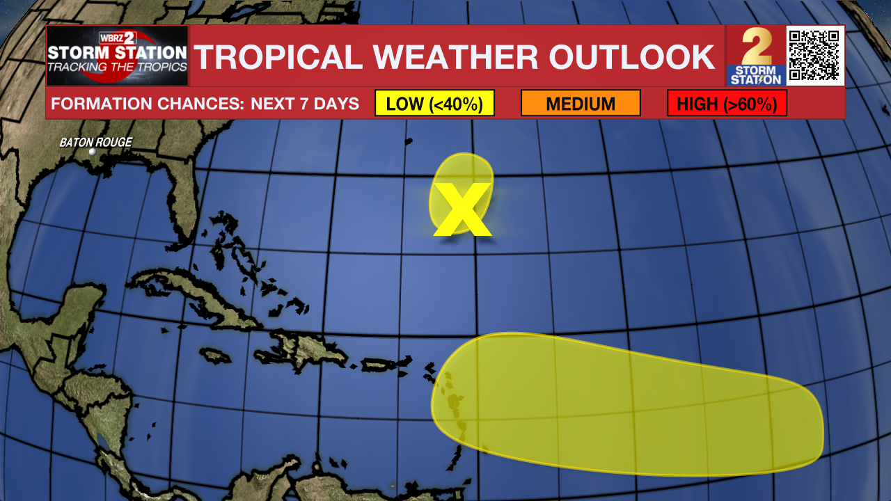
The Tropics: The National Hurricane Center has highlighted two areas of potential tropical development as of early Wednesday morning. Both hold low chances of formation and no threat to the state of Louisiana at this time. The Storm Station will continue to monitor these areas over the next week.
Trending News
Get the latest 7-day forecast and real time weather updates HERE.
Watch live news HERE.
– Emma Kate C.
The Storm Station is here for you, on every platform. Your weather updates can be found on News 2, wbrz.com, and the WBRZ WX App on your Apple or Android device. Follow WBRZ Weather on Facebook and Twitter for even more weather updates while you are on the go.
More News
