

Latest Weather Blog
Tuesday PM Forecast: tropical moisture to return better rain chances late week
October will begin with high and low temperatures about 5 degrees above average. While rain will be tough to come by at first, an uptick in showers and thunderstorms is anticipated by the weekend.
Tonight & Tomorrow: A few clouds will be in the mix during the evening hours. Overall, expect a quiet night with low temperatures in the upper 60s. Wednesday will be mostly sunny and unseasonably warm with high temperatures in the low 90s. You might notice some humidity, but it won’t make it up to summertime levels.
Up Next: Moisture will gradually build into the atmosphere on Thursday. As this happens, we’ll introduce the possibility of a spotty shower or thunderstorm after high temperatures return to the low 90s. Friday and Saturday will bring the best conditions for showers and thunderstorms within the Storm Station 7-Day Forecast. A combination of above average moisture and added instability will result in isolated to scattered showers and thunderstorms each day. Neither looks like a washout and area rain coverage will be on the order of about 40 percent, with higher chances near the coast and lower chances in southwest Mississippi. Sunday into Monday, moisture will diminish a bit as we await the arrival of a cold front early next week. This front could spell another push of much drier air and cooler temperatures.
Get the latest 7-day forecast and real time weather updates HERE.
Watch live news HERE.
Trending News
The Tropics: Tropical Storm Kirk continues to gradually intensify across the central Atlantic Ocean. Moving to the west at 10-15mph, the storm is packing winds of 70mph but is expected to strengthen into a hurricane by Wednesday and a major hurricane later this week. Fortunately, a turn to the northwest will keep Kirk out to sea where it will not pose a threat to the United States.
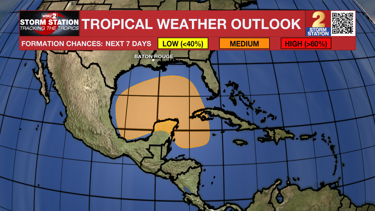
A broad trough of low pressure is producing a large area of disorganized showers and thunderstorms from the southwestern Caribbean Sea into the southern Gulf of Mexico. Environmental conditions could support some gradual development of this system, and a tropical depression could form towards the end of this week or this weekend as the broader disturbance moves fully into the Gulf of Mexico. Interests along the U.S. Gulf Coast should continue to monitor the progress of this system.
Showers and thunderstorms continue to show signs organization in association with an area of low pressure located a few hundred miles south-southwest of the Cabo Verde Islands. Environmental conditions appear conducive for further development of this system, and a tropical depression is expected to form during the next day or two while it moves slowly westward over the eastern tropical Atlantic.
– Josh
The Storm Station is here for you, on every platform. Your weather updates can be found on News 2, wbrz.com, and the WBRZ WX App on your Apple or Android device. Follow WBRZ Weather on Facebook and Twitter for even more weather updates while you are on the go.
More News
