

Latest Weather Blog
Tuesday PM Forecast: some under flood watch as next rounds of rain approach
Through Friday, an upper level trough of low pressure will create more instability (energy for rain, thunderstorms) across the central Gulf Coast. At the same time, total moisture in the atmosphere will climb to well above average level. The combination of these two features will result in numerous to widespread showers and thunderstorms each day. The ripe storm environment will also return the possibility of a low end flood risk to where some street and poor drainage issues could occur. Rain rates could be particularly high with these storms, making visibility difficult if it overlaps with any commutes.
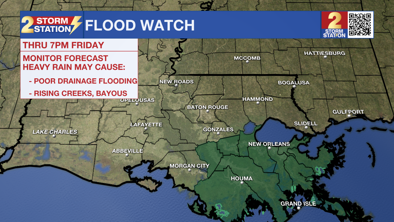
The National Weather Service has issued a FLOOD WATCH for southeastern Louisiana, including Assumption and St. James Parishes through Friday evening. Excessive runoff may result in flooding of rivers, creeks, streams, and other low-lying and flood-prone locations. Flooding may occur in poor drainage and urban areas. You should monitor later forecasts and be alert for possible Flood Warnings. Those living in areas prone to flooding should be prepared to take action should flooding develop. About 3-6 inches of rain is expected in the watch area, though isolated higher amounts are possible.
Tonight & Tomorrow: Another quiet night is ahead with some clearing in skies. Low temperatures will remain muggy in the mid 70s. Wednesday will start off similar to previous mornings this workweek. High temperatures will hit the low 90s by early afternoon. Sun will give way to increasing cloud cover and, soon after, numerous showers and thunderstorms can be expected. A few of these could be heavy perhaps slowing down the afternoon commute, so be prepared for some delays.
Rest of the Week: Thursday and Friday will be cloudy and stormy. A weak front will meander in the region and serve as an additional instigator for showers and thunderstorms. In a moisture rich atmosphere, rain could be heavy at times, and disruptive to any commute from Wednesday afternoon through Friday evening.
Trending News
This Weekend: That front will start to push through from north to south Friday night, swiping the thick moisture away from the region. This will be felt in the form of much lower humidity and noticed by skies clearing into the weekend. A reinforcing shot of dry air on Saturday is likely to bring the driest and coolest air felt since early June. We might be able to classify that incoming air mass as the first taste of fall this season.
Get the latest 7-day forecast and real time weather updates HERE.
Watch live news HERE.
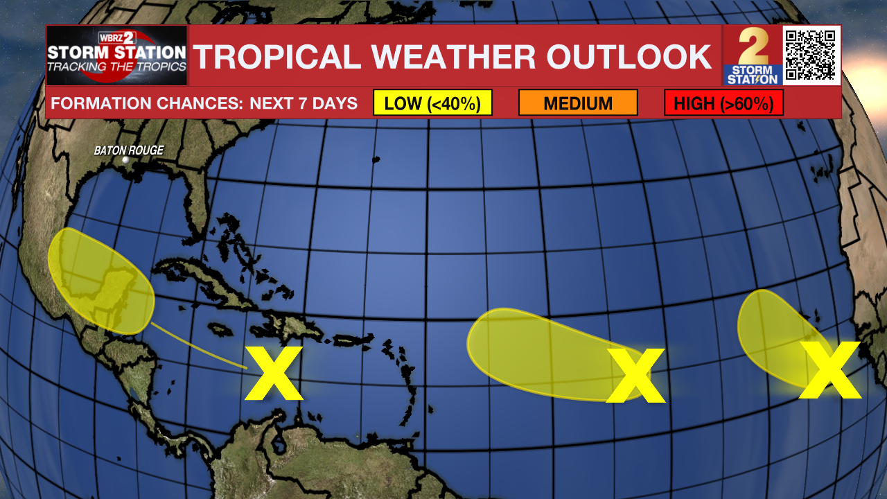
The Tropics: A tropical wave is producing disorganized showers and thunderstorms over Hispaniola and portions of the central Caribbean Sea. As this system moves westward, some development is possible when it reaches the western Caribbean Sea and the southwestern Gulf of Mexico late this week or over the weekend.
A tropical wave over the far eastern Atlantic is producing disorganized shower activity. Some slow development of this system is possible during the next few days as it moves west-northwestward or northwestward over the eastern tropical Atlantic Ocean. Environmental conditions are expected to become less conducive by the end of the week. This system could produce locally heavy rains and gusty winds across portions of the Cabo Verde Islands in a day or two.
Another tropical wave located about midway between the west coast of Africa and the Lesser Antilles is producing disorganized showers and thunderstorms. Some slow development is possible during the next couple of days while the system moves west-northwestward. By the end of the week, however, environmental conditions are expected to become unfavorable for additional development.
– Josh
The Storm Station is here for you, on every platform. Your weather updates can be found on News 2, wbrz.com, and the WBRZ WX App on your Apple or Android device. Follow WBRZ Weather on Facebook and Twitter for even more weather updates while you are on the go.
More News
