

Latest Weather Blog
Tuesday PM Forecast: Cooler air rushes in behind a strong cold front
The much-anticipated cold front plunges south on Tuesday night. Significantly cooler air rushes in behind, delivering the first legitimate fall chill to the capital region.
Tonight & Tomorrow: A cold front plunges south on Tuesday night. The cooldown will be slow and steady at first with temperatures remaining in the 70s during the evening. But overnight, temperatures drop another 20°. Look for a wake up temperature near 53° in Baton Rouge. Some neighborhoods near the state line might dip into the 40s. A northeast breeze will kick up as well, especially after midnight. Sustained wind speeds will be anywhere from 10-20 mph by daybreak. Skies will be clear, creating optimal viewing conditions for those hoping to catch another glimpse of a comet in the early evening sky.
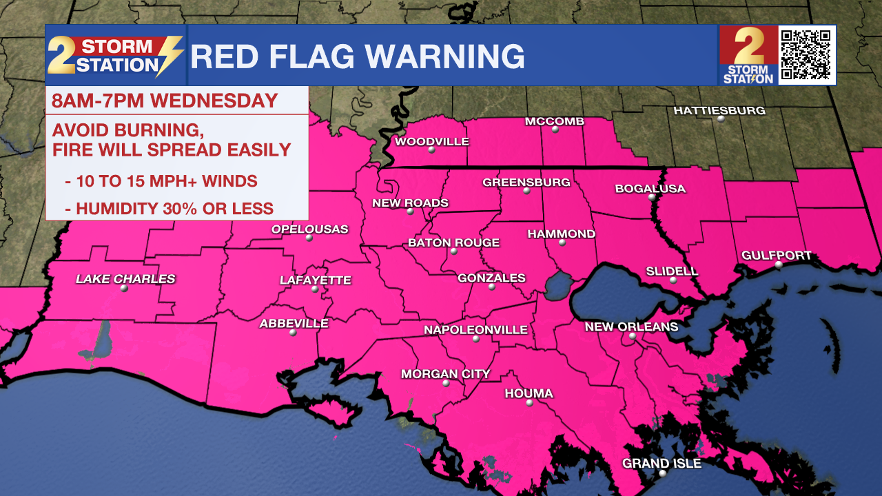
Temperatures will rebound to the mid-70s on Wednesday afternoon. But it will take time to get there. Jackets will be needed through the morning as the area stays below 65° up until lunchtime. The extra layer will also be needed in the evening as temperatures quickly fall after sunset. The air will be very dry, and the healthy breeze will remain in place. Combined with the dry soils from the recent lack of rain, there will be a risk of rapid fire spread should any ignite. A Red Flag Warning is in effect on Wednesday from 8 a.m. to 7 p.m. to account for this; outdoor burning is not advised.
Up Next: Thursday morning will be downright chilly with a low in the mid-40s in Baton Rouge. The wind will relax into Thursday, alleviating wind chill concerns. Temperatures gradually warm into the weekend. But even then, it looks rather comfortable with highs in the 80s and lows near 60°. Keep watering the lawns too, as they'll only get more parched with little to no rain expected for the next week.
Trending News
Get the latest 7-day forecast and real time weather updates HERE.
Watch live news HERE.
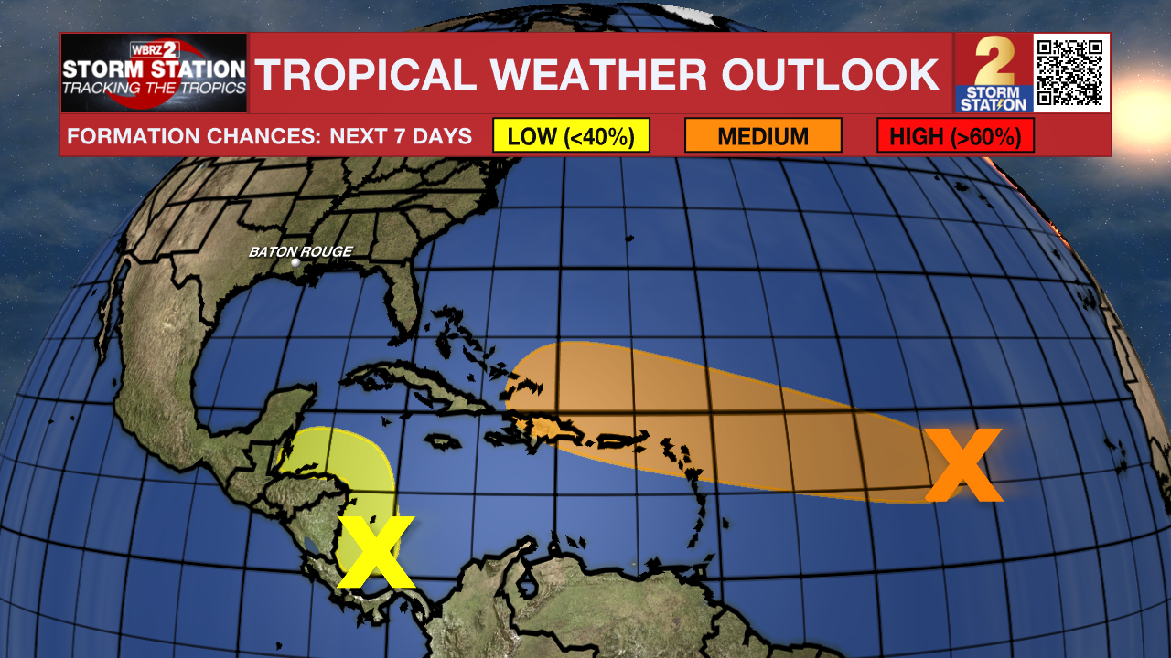
The Tropics: An area of low pressure located over the central tropical Atlantic remains disorganized. This system will move westward in the coming days. As that happens, environmental conditions will become slightly more conducive for tropical development by the middle to latter part of this week. A tropical depression could form as the system moves toward the Leeward Islands late this week.
There is another area of showers and thunderstorms in the southwestern Caribbean Sea associated with a broad area of low pressure. Gradual development of this system is possible if it can stay over water while slowly moving northwestward toward Central America. Regardless of development, locally heavy rainfall is possible across portions of Central America later this week.
-- Meteorologist Malcolm Byron
The Storm Station is here for you, on every platform. Your weather updates can be found on News 2, wbrz.com, and the WBRZ WX App on your Apple or Android device. Follow WBRZ Weather on Facebook and Twitter for even more weather updates while you are on the go.
More News
