

Latest Weather Blog
Tuesday PM Forecast: Beryl moves on, slightly drier air left in wake
In the wake of Beryl, a slightly drier air mass will push toward the central Gulf Coast for Wednesday and Thursday. In general, better rain chances will reside south of this boundary near the coast with low rain chances north of this boundary into southwest Mississippi.
Tonight & Tomorrow: Drier air in the middle levels of the atmosphere will move into the region tonight allowing clouds to break. An exception may be near the coast where some nocturnal showers and thunderstorms could persist. The drier air should mix down to the surface just enough to nudge inland low temperatures in the middle 70s. Wednesday will be seasonably warm and humid. Slightly drier air aloft will allow for some more early sunshine and cut down on the number of showers and thunderstorms, especially north of I-12. Isolated activity is still anticipated south of the interstates and near the coast. The drier air will also keep the heat index from getting out of control but high temperatures will still charge into the mid 90s.
Up Next: The boundary responsible for the briefly drier atmosphere will slowly erode on Thursday and Friday. Since it is still summer after all, heat and humidity will reign and we cannot entirely rule out rain. Both mornings will start in the mid 70s followed by afternoons in the mid 90s. The second half of the day will feature isolated to scattered showers and thunderstorms to the tune of 40-60 percent rain coverage. Over the weekend, heat will become the dominant story once again with highs in the upper 90s, lows in the upper 70s and only spotty to isolated afternoon showers and thunderstorms.
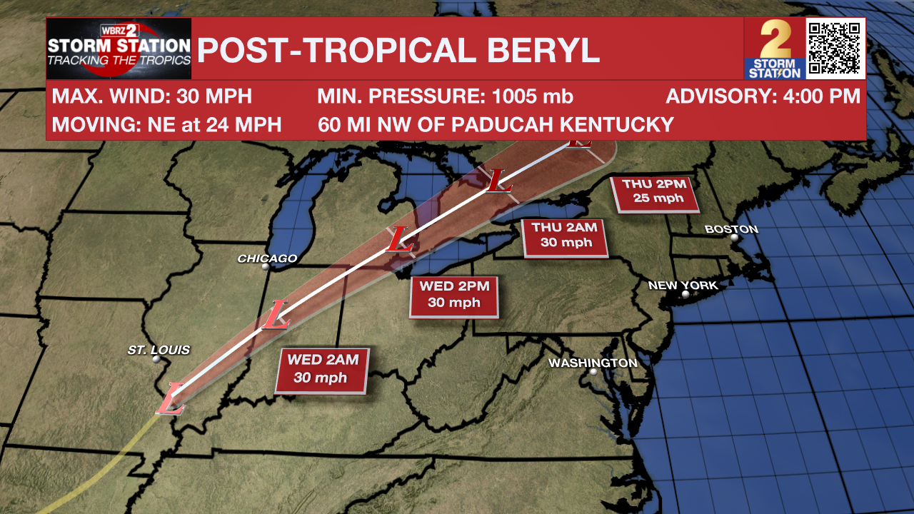
The Tropics: The remnants of Hurricane Beryl will continue moving through the Ohio Valley, Great Lakes and Northeast with heavy rain and severe weather possible through Wednesday. The rest of the Atlantic Ocean, Caribbean Sea and Gulf of Mexico are quiet for now. No tropical development is expected over the next seven days. Keep in mind, a very busy season is still projected and tropical weather researchers updated their outlook to reflect this on Tuesday.
Trending News
Get the latest 7-day forecast and real time weather updates HERE.
Watch live news HERE.
– Josh
The Storm Station is here for you, on every platform. Your weather updates can be found on News 2, wbrz.com, and the WBRZ WX App on your Apple or Android device. Follow WBRZ Weather on Facebook and Twitter for even more weather updates while you are on the go.
More News
