

Latest Weather Blog
Tuesday PM Forecast: August has been dry, but a few days with some rain are ahead
A weather pattern transition will take place on Wednesday. The number of showers and thunderstorms that develop each afternoon will begin to increase, bringing some beneficial rain to areas around Metro Baton Rouge. These areas have become abnormally dry lately, running a monthly rainfall deficit of three to four inches.
Tonight & Tomorrow: Remnant showers will be all but gone after nightfall. Skies will gradually clear and low temperatures will stay in the mid to upper-70s keeping a very muggy feel. Into Wednesday, a deep feed of moisture coming in from the Gulf of Mexico will interact with some instability in the atmosphere right over the central Gulf Coast. These factors will allow showers and thunderstorms to more easily develop as some early sunshine and heating pushes temperatures into the low-90s. Be aware that some lightning and brief downpours could be around for the drive home from work and school as well as any extracurricular activities.
Up Next: Thursday and Friday, scattered showers and thunderstorms to the tune of 40-60% rain coverage in the forecast area is expected. These thunderstorms do not look particularly threatening other than lightning to outdoor events. There is some nuance to the forecast that could tweak the number of showers and thunderstorms able to develop. Leftover cloud cover from nearby areas of precipitation could limit temperatures which in turn could cut into the energy available for showers and thunderstorms. The cloud cover may also limit high temperatures to the upper-80s for a few days. The Storm Station will be monitoring these trends. By late weekend, moisture and storm energy will drift slightly lower, but not enough to eliminate small rain chances but enough for most locations to see higher temperatures back into the low-90s.
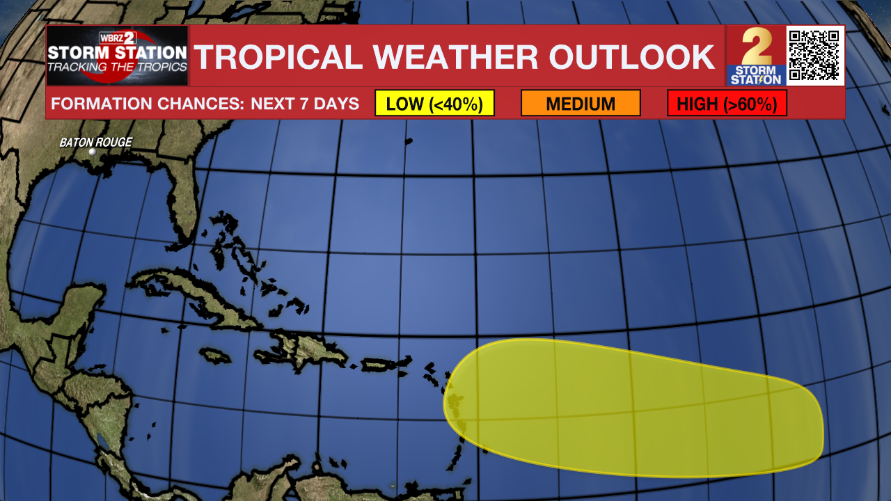
The Tropics: An area of low pressure could form in the central portion of the Tropical Atlantic in a few days. Thereafter, environmental conditions appear generally favorable for some slow development of this system this weekend into early next week as it moves westward to west-northwestward at 10 to 15 mph.
Trending News
Get the latest 7-day forecast and real time weather updates HERE.
Watch live news HERE.
– Josh
The Storm Station is here for you, on every platform. Your weather updates can be found on News 2, wbrz.com, and the WBRZ WX App on your Apple or Android device. Follow WBRZ Weather on Facebook and Twitter for even more weather updates while you are on the go.
More News
