

Latest Weather Blog
Tuesday AM Forecast: Watching for more rain and potential flood risk today
One round of rain done, now we are tracking more showers for your afternoon.
THE FORECAST
Today & Tonight: The HOT pattern is beginning to change, but rain makes a return back into the forecast. As you are stepping out of the door this morning you need to know that it will still be another hot and humid day. Starting off this morning with temperatures in the mid-70s and a few showers lingering. By the afternoon, temperatures will climb into the low-to-mid 90s, but heat index values will climb near 107°. A HEAT ADVISORY is in place again today across the WBRZ viewing area. The heat is on, but also showers and storms will be around to cool you off this afternoon.
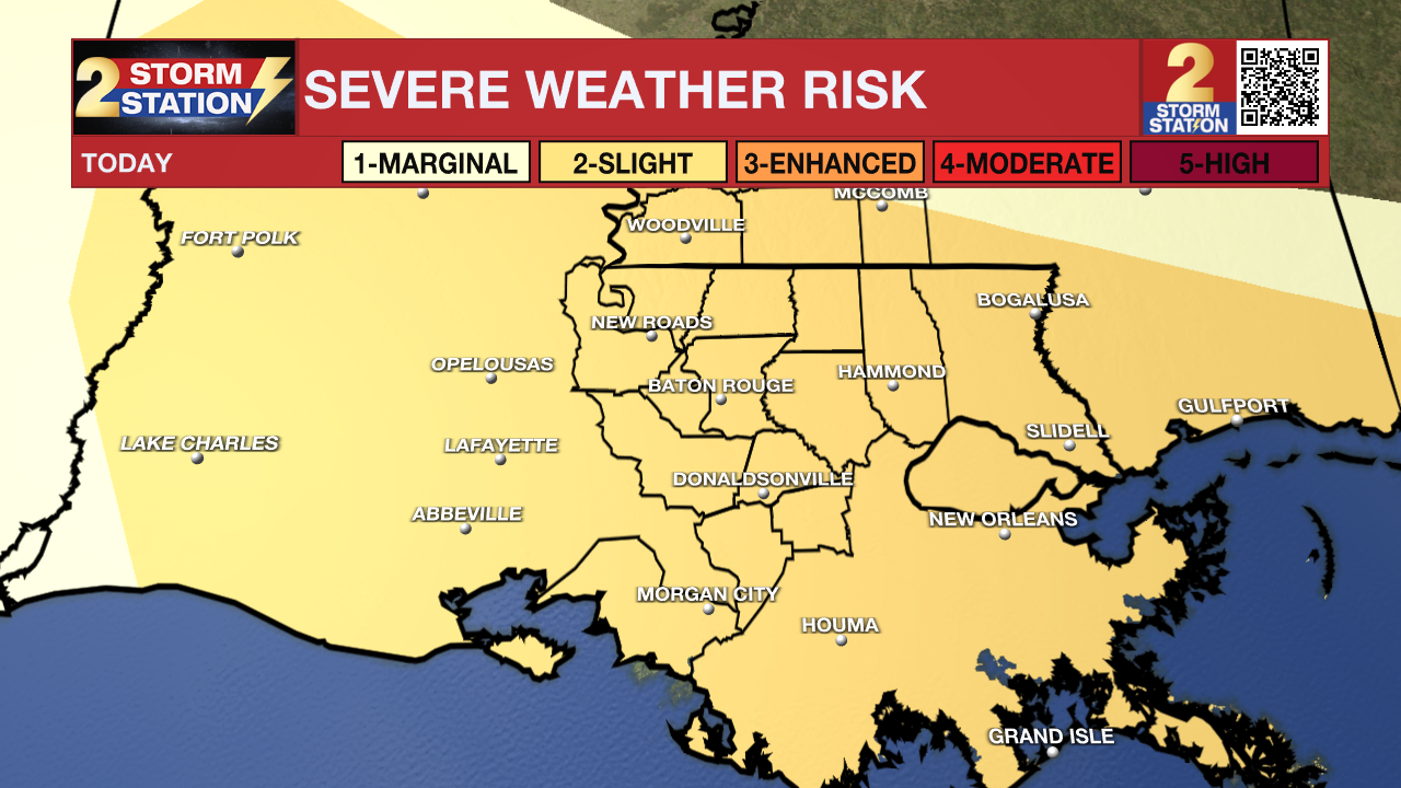
A FLOOD WATCH is in place, this means heavy rain is in the forecast and poor drainage flooding could occur. A second round of showers and storms will move through this afternoon. Heavy rain will be possible, but also a LEVEL 2 Slight risk in is place across the area. This means any rain you see you need to stay weather aware. The primary threats are for gusty winds, hail, and a spin-up tornado. The second round of rain will come in just in time for your afternoon commute and then move out as the sunsets.
Up Next: Heat has been on repeat day after day, but now some changes are setting into the forecast. Wednesday you will wake up to mostly clear skies and temperatures in the low-70s. The humidity is still there but the heat is backing off. By the afternoon, you will be sitting average for this time of year in the low-90s. A few isolated showers will be possible with a few stronger storms in the mix. Our typical summertime pattern is beginning to settle in. Through the end of the week, we will be starting each day warm and humid with temperatures in the upper-70s low-80s. Throughout the day, temperatures will climb into the low-to-mid 90s and feels like temperatures will be triple digit heat. But the string of excessive heat warnings and heat advisories will not continue. Rain will be around the area everyday. Click here to see the 7-day forecast.
Trending News
The Storm Station has you covered with hour-by-hour weather tracking is available for your location on the WBRZ WX App on your Apple or Android device. Follow WBRZ Weather on Facebook and Twitter for even more weather updates and unique weather insight from the whole team!
In the Tropics:
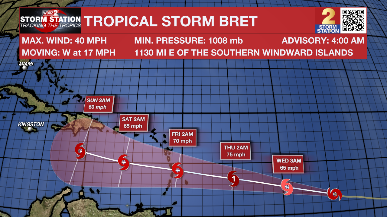
Tropical Storm Bret has formed over the central Atlantic. As of 4am Tuesday, Bret was 1130 miles east of the Windward Islands and moving to the west at 17mph with maximum sustained winds of 40mph. Bret is expected to gradually strengthen over the next few days and could become a hurricane before the end of the week as it continues westward.
In the eastern Atlantic, a tropical wave located several hundred miles south-southwest of the Cabo Verde Islands continues to produce a large area of disorganized showers and thunderstorms. Environmental conditions appear favorable for further development of this system, and there is a fifty percent chance that a tropical depression could form in a couple of days while the system moves westward at 10 to 15 mph across the eastern and central tropical Atlantic.
More News
