

Latest Weather Blog
Tuesday AM Forecast: Tracking afternoon storms, slight dip in temperatures to follow
UPDATE - 1 p.m. Tuesday: The Storm Station is keeping a close eye on a cluster of thunderstorms near the Texas-Louisiana state line. These storms will continue to move along a stationary front that is straddling southern Louisiana, plus additional storms may develop along it. This front is separating extremely humid air near the coast from less humid air to the north.
For the capital area, isolated to widely scattered showers and storms will be possible during the afternoon. Areas along and south of the stationary front will be favored to see the activity since that is where the muggiest air resides.
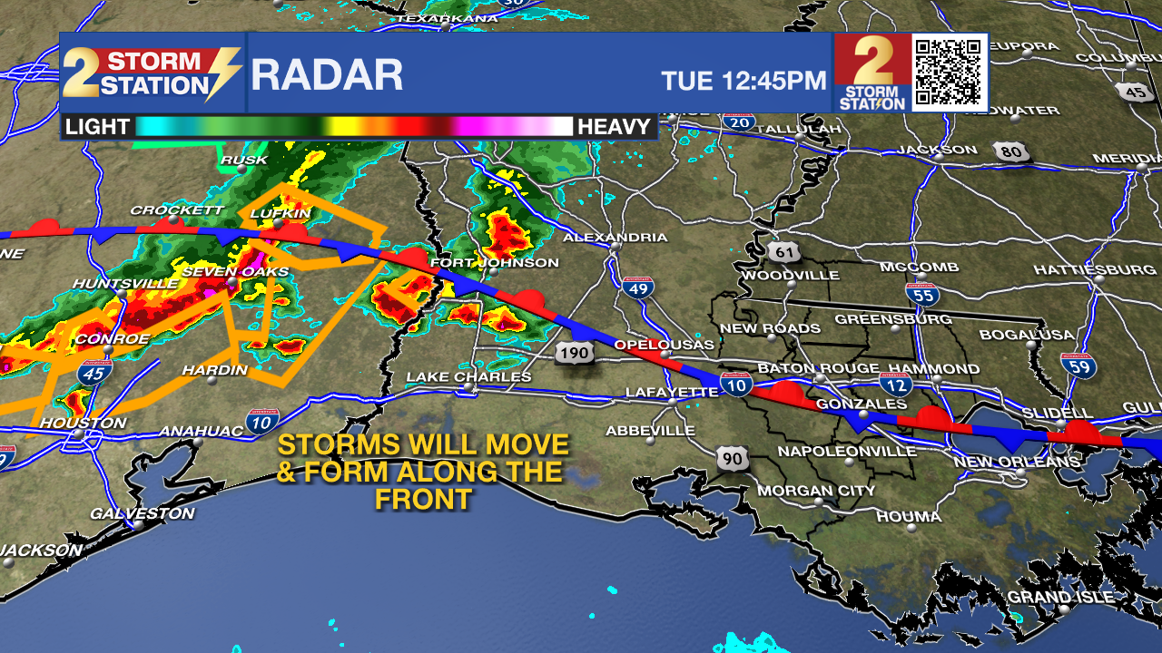
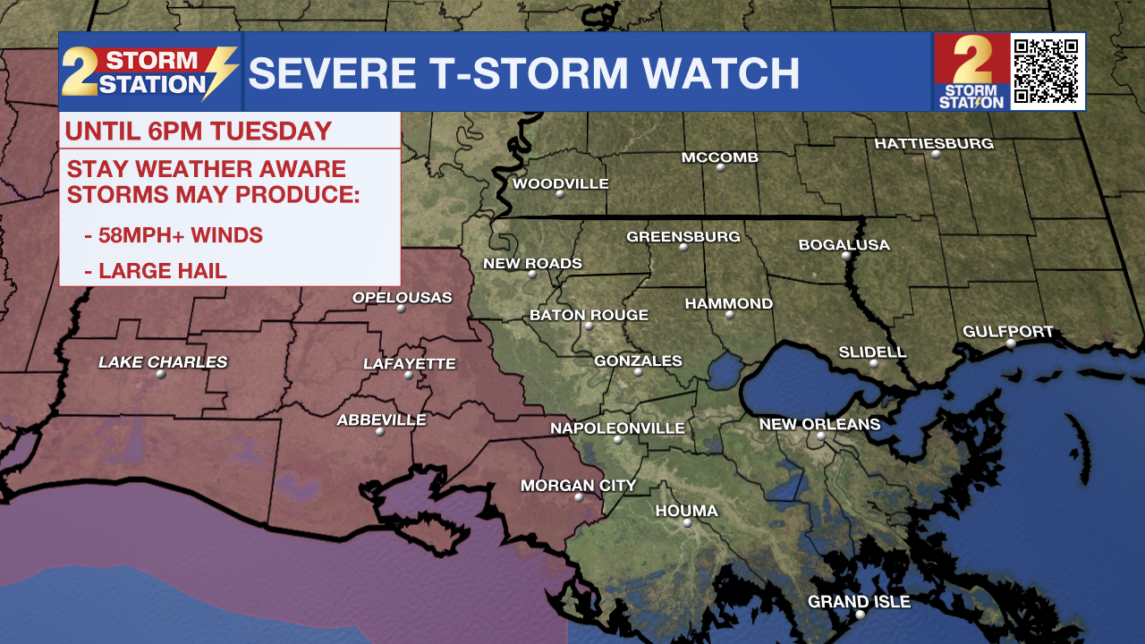
We don't expect much severe weather out of these storms, but one or two cells could be capable of strong, gusty winds. A ***SEVERE THUNDERSTORM WATCH*** has been issued for southwest Louisiana, including St. Mary Parish, until 6 p.m. Tuesday. The strongest afternoon storms are favored in the Watch area.
-- Meteorologist Malcolm Byron
Trending News
ORIGINAL STORY: After a record breaking Memorial Day in Baton Rouge, expect more heat on Tuesday. A frontal system tonight will deliver a slight dip in temperatures and humidity but also offers more shower and storm activity to end the week.
Today & Tonight: Tuesday morning temperatures around SE Louisiana will begin in the upper 70s. By mid-morning, feels-like temperatures will quickly rise into the 90s, likely back into the low-100's Tuesday afternoon. A forecasted high temperatures of 96° in Baton Rouge today sits 2 degrees shy of the previous record of 98° (1953). Partly sunny conditions Tuesday will be accompanied by a few spotty storms this afternoon, though most will remain dry.
A weak front arriving late tonight will allow temperatures overnight to dip a few degrees cooler to start off the day on Wednesday, in the low to mid 70's.
Up Next: As the weak cold front moves south and stalls across the Capital Region, a gradient of dew points will be noticeable across the area with lower values north of I-10 and very muggy conditions continuing near the coast. With the slight decrease in humidity for some, heat index values will also not be as extreme as we saw to start the week. Afternoon temperatures, while still warm, will be closer to the 90 degree mark with mornings in the low 70's through the weekend.
The frontal system will also act as a trigger for shower and thunderstorm activity through the remainder of the workweek. The front alone will not be enough to generate showers and thunderstorms though. Moisture will play a key role in developing any activity and that looks rather limited through at least Wednesday. By Thursday and Friday, just a touch more moisture in the atmosphere could cause a slight uptick in the number of showers and thunderstorms that form. Still, we split hairs with the rain coverage with most days staying in the 20-30 percent range.
Get the latest 7-day forecast and real time weather updates HERE.
Watch live news HERE.
The Tropics: For the Gulf of Mexico, Caribbean Sea and North Atlantic Ocean, all is quiet. No tropical development is expected over the next seven days.
-- Emma Kate Cowan
The Storm Station is here for you, on every platform. Your weather updates can be found on News 2, wbrz.com, and the WBRZ WX App on your Apple or Android device. Follow WBRZ Weather on Facebook and Twitter for even more weather updates while you are on the go.
More News
