

Latest Weather Blog
Tuesday AM Forecast: Record breaking heat possible all week
Afternoon highs at or above 100° each day this week could meet or beat previous record high temperatures set back over a century ago, in 1921.
Today & Tonight: With very little cloud cover and no opportunity for afternoon cooling showers, high temperatures will return to triple digits in the Capital Area Tuesday afternoon for a second consecutive day. Humidity levels will remain slightly lower than in previous weeks, however; feels-like temperatures will still climb near 108° or greater during peak heating hours, resulting in another Heat Advisory for the Capital Area. Continue to practice heat safety this week, especially those spending excessive amounts of time outdoors during afternoon hours.
To the children heading back to school in Pointe Coupee Parish today, expect a mild morning by the bust stop and very hot afternoon during any afterschool activities. Tonight, under clear skies, overnight lows will fall in to the upper-70's around the state.
Up Next: The rest of the workweek will feature much of the same pattern; mild, sunny mornings, hot, triple digit afternoons, no rain, and lots of sunshine. We will likely see many more heat alerts issued over the next 7 days despite the fact that we are dealing with lower humidity values this week. By the weekend, the Storm Station is tracking another possible push of dry air into the region, which would keep rain chances to a minimum and humidity levels relatively low for this time of year. We will still see hot temperatures in the upper-90's both Saturday and Sunday but slightly cooler morning lows in the low to middle 70s may add a refreshing feel to the day.
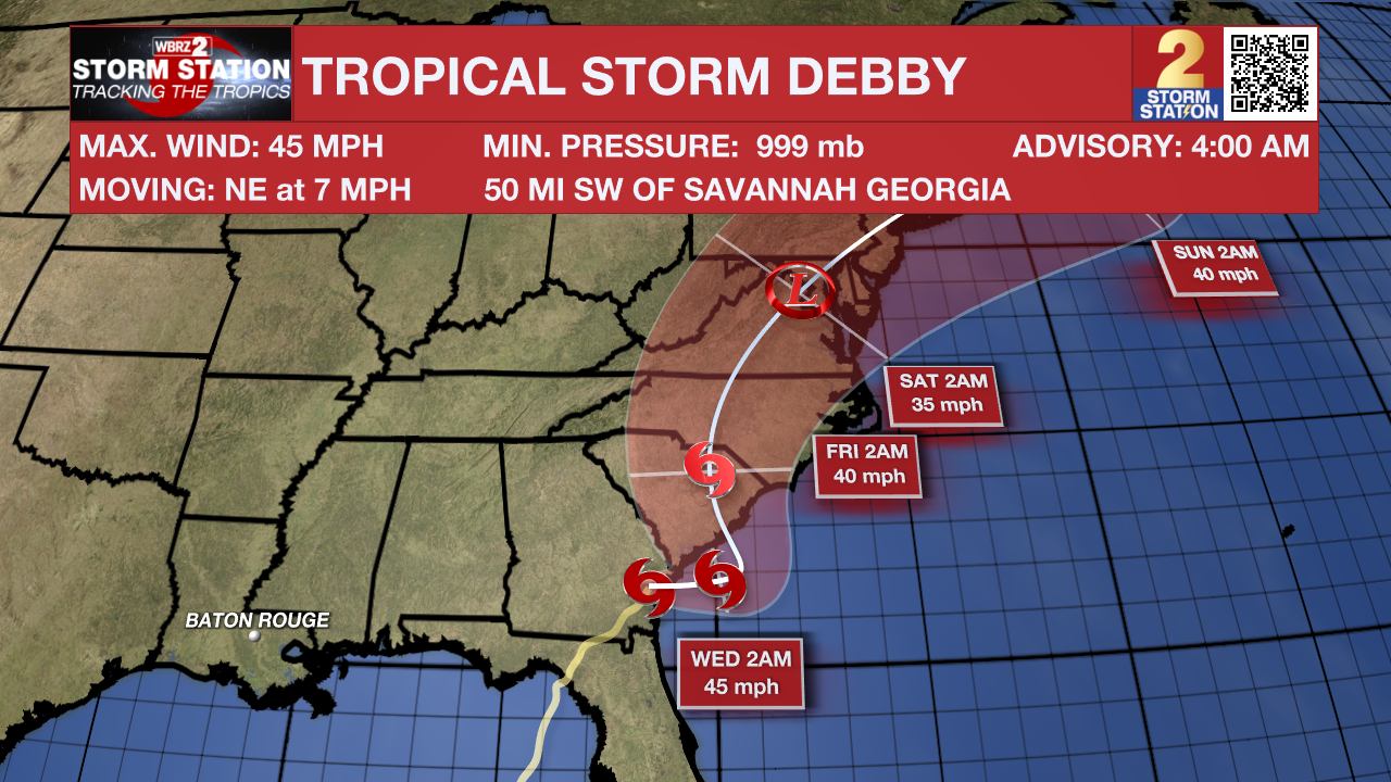
The Tropics: As of early Tuesday morning, Tropical Storm Debby is centered just southwest of Savannah, GA and will slowly continue to move NE towards the Carolina's over the next few days. The very slow movement of the storm will produce major flooding over parts of the southeast during the week before bringing more rain and storms to the northeast this weekend. Debby will not bring any direct impacts to Louisiana.
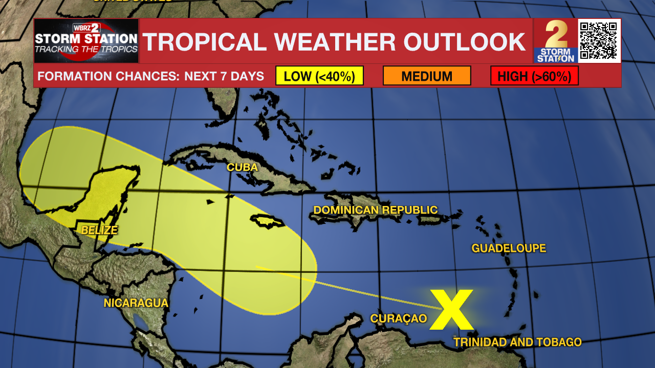
A tropical wave located west of the Windward Islands continues to produce a disorganized region of thunderstorm activity. For the time being, additional development would be slow to occur. However, conditions appear generally favorable for future development as the system moves westward into the western Caribbean Sea and southern Gulf of Mexico.
Trending News
Get the latest 7-day forecast and real time weather updates HERE.
Watch live news HERE.
- Emma Kate C.
The Storm Station is here for you, on every platform. Your weather updates can be found on News 2, wbrz.com, and the WBRZ WX App on your Apple or Android device. Follow WBRZ Weather on Facebook and Twitter for even more weather updates while you are on the go.
More News
