

Latest Weather Blog
Tuesday AM Forecast: New month, same warm and dry conditions
Heading into the final quarter of the year, temperatures remain very summertime-like and in typical October fashion, the tropics will be something to monitor daily.
Today & Tonight: Clear skies allowed temperatures to drop into the middle and upper 60's around the region overnight, giving slight relief from the heat before another warm day in southern Louisiana. Temperatures Tuesday afternoon will again heat into the low-90's with slight humidity making things feel only a few degrees above the actual temp. Conditions will remain partly sunny and mainly dry.
Tonight, temperatures will drop near 70 degrees in the Capital Area under mainly clear skies.
Up Next: Wednesday will be much like the first two days of the week with a warm afternoon in the 90's and no rain. By the latter half of the week, moisture will begin to creep back into the region, elevating rain chances slightly. The best rain coverage will be Friday and Saturday, but even then only isolated storms are expected. Afternoon highs Friday through Sunday will be in the upper-80's with a slightly muggier feel.
Get the latest 7-day forecast and real time weather updates HERE.
Watch live news HERE
Trending News
The Tropics:
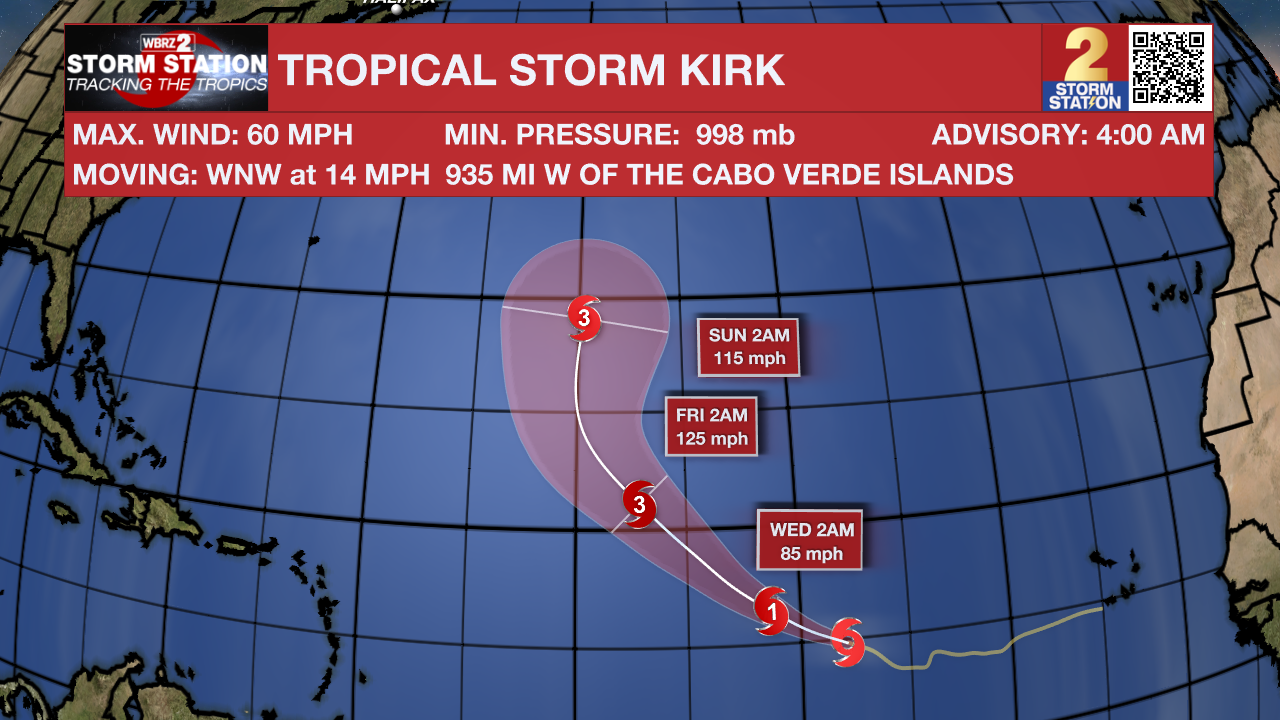
Tropical Storm Kirk is strengthening at a pretty quick pace. It has winds of 60 mph and is moving WNW at 14 mph. Kirk is forecast to strengthen into a Hurricane by mid-week as it moves northwest through the Atlantic. Future Kirk poses no direct impact to land at this time.
Isaac and Joyce are now post-tropical systems.
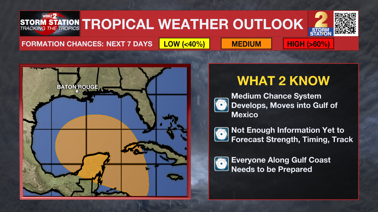
A trough of low pressure located over the southwestern Caribbean Sea continues to produce some disorganized shower and thunderstorm activity. Environmental conditions could become conducive for gradual development, and a tropical depression could form in a few days while the system is over the southern Gulf of Mexico or northwestern Caribbean Sea. Interests along the U.S. Gulf Coast should continue to monitor the progress of this system.
Showers and thunderstorms continue to increase in association with a tropical wave located a few hundred miles south of the Cabo Verde Islands. Upper-level winds appear conducive for further development, and a tropical depression is very likely to form in a few days while it moves slowly westward over the eastern tropical Atlantic.
– Emma Kate C.
The Storm Station is here for you, on every platform. Your weather updates can be found on News 2, wbrz.com, and the WBRZ WX App on your Apple or Android device. Follow WBRZ Weather on Facebook and Twitter for even more weather updates while you are on the go.
More News
