

Latest Weather Blog
Tuesday AM Forecast: High heat dominates with little relief from rain
The Louisiana heat kicks into high gear over the next few days with little to no relief from afternoon rain. Heat alerts will become the norm this week; prepare by limiting time outdoors during peak heating hours and prioritize hydration.
Today & Tonight: Tuesday morning welcomes no relief from the heat as morning lows in the upper-70s/low-80s will suit feels-like temperatures closer to the 90° mark. The heat will quickly ramp up throughout the morning once the sun dominates the skies. Afternoon temperatures will climb into the middle and upper 90's around the region, with heat index values +108°. A Heat Advisory has been placed across much of southeast Louisiana Tuesday. With high heat and humidity, the body struggles to cool off as quickly, which could lead to heat illnesses if not careful. Extra hydration and air conditioning will be your best friend today, and the remainder of the week. Conditions all day long will be mainly dry and sunny, with fair weather cumulus clouds developing as the day wears on.
Tonight, for one last time in 2024, the sun will set after 8:00pm. Once it does, temperatures will slowly fall back into the upper-70s under mostly clear skies.
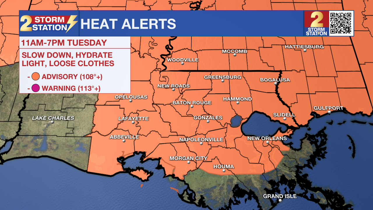
Up Next: Each day this week will be very hot. Warm mornings beginning near 80 degrees will then turn hot quickly, nearing the upper-90s each day. The high heat mixed with high gulf coast humidity amounts results in heat index values at an extreme level, which will likely prompt a heat alert each day this week. Unlike typical summer days, daily pop-up "cool-down" storms will be hard to come by this week, meaning there will basically be no relief from the heat for most. Continue to practice heat safety as we head towards the steamy month of August.
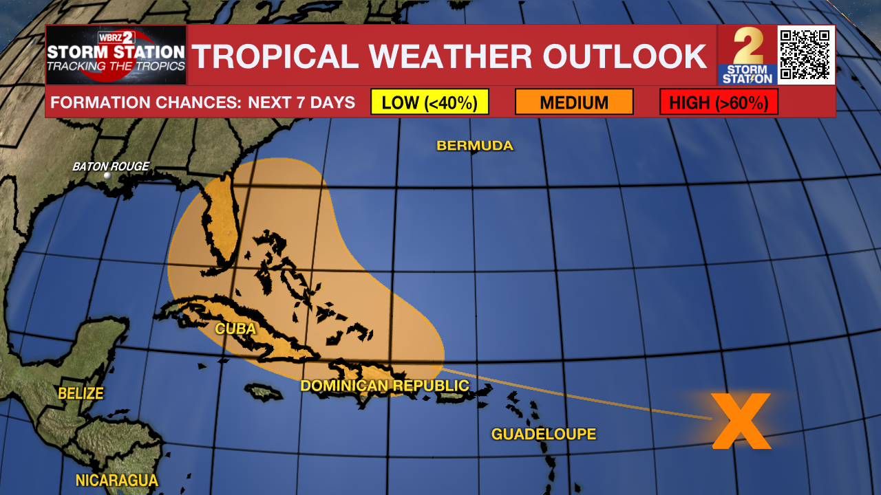
The Tropics: A disturbance over the central tropical Atlantic will interact with a tropical wave in the next day or so. Afterward, environmental conditions will become more conducive for tropical development. There is a medium (60%) chance of tropical depression formation late this week while the system pushes west toward the Greater Antilles or Bahamas. Those in the Greater Antilles, Bahamas, and southeastern U.S. should monitor the progress of this disturbance closely.
Trending News
Get the latest 7-day forecast and real time weather updates HERE.
Watch live news HERE.
- Emma Kate C.
The Storm Station is here for you, on every platform. Your weather updates can be found on News 2, wbrz.com, and the WBRZ WX App on your Apple or Android device. Follow WBRZ Weather on Facebook and Twitter for even more weather updates while you are on the go.
More News
