

Latest Weather Blog
Thursday PM Forecast: reinforcing shots of dry air could end streak of heat alerts
A * HEAT ADVISORY* is in effect from 10am to 7pm Friday for areas south of the Mississippi State Line, as feels-like temperatures over 108 degrees are expected. Hot temperatures will combine with moderate humidity and could possibly cause heat illnesses. Drink plenty of fluids, and when possible, stay in an air-conditioned rooms, avoid afternoon sun, and check up on relatives and neighbors.
Tonight & Tomorrow: A push of (slightly) drier air moving into the region will allow skies to remain clear tonight. With that, as well as light northerly winds, low temperatures will dip into he mid 70s. Though lower than previous nights, these readings are still above average. Friday will begin with full sunshine and not much change is anticipated through the afternoon. Just a few wispy clouds may pass at times. Another shot of dry air could cut into humidity and make the heat advisory conditions very borderline. All of that is just criteria though. A degree of difference will not be all that noticeable and high temperatures will be hot in the upper 90s.
Up Next: Over the weekend, one more reinforcing shot of dry air will push into the region thanks to a weak front. The dry air will keep the rain chances close to nil through Sunday and even make cloud development tough on Saturday. Finally, the dry air could result in a subtle dip in surface humidity—one that could be just enough to end the streak of heat alerts. Any reprieve will be short lived because temperatures will stay hot and, at this time of year, moisture does not stay away for long. Nasty feels-like temperatures are probable again next week. Still, rain is scarce on the Storm Station 7-Day Forecast.
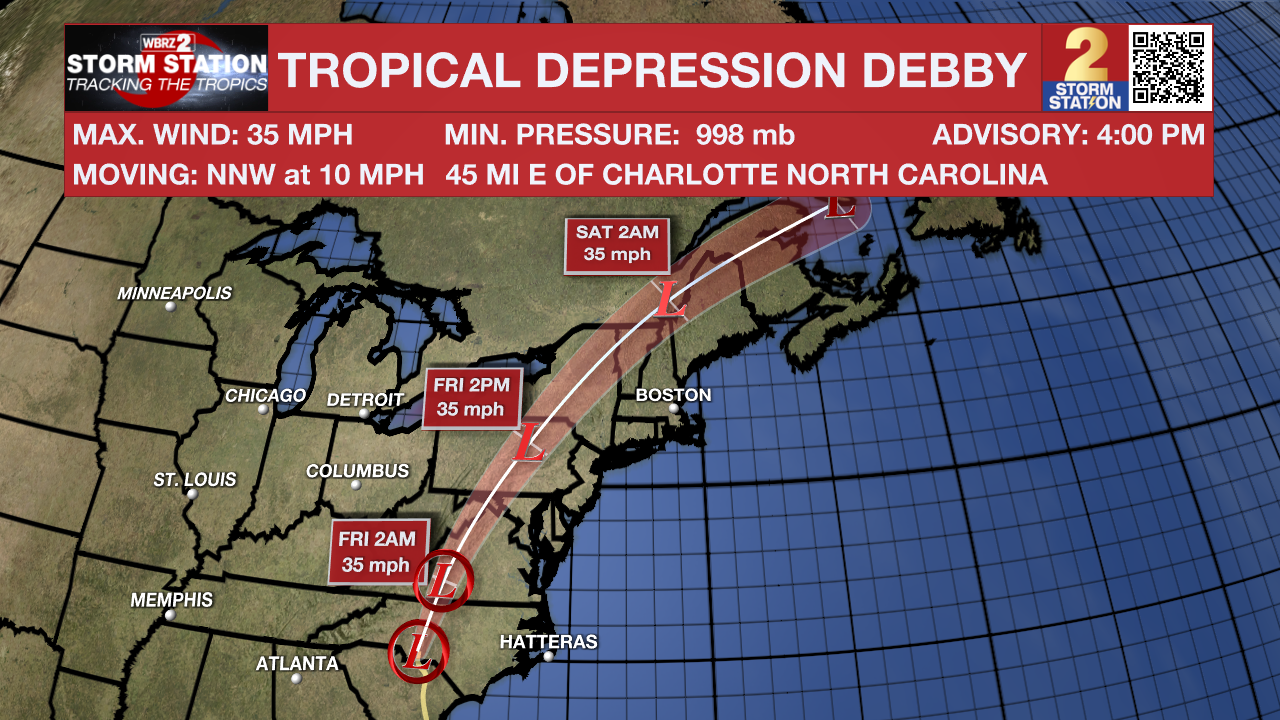
The Tropics: Tropical Depression Debby continued to churn and dump heavy rain over portions of North and South Carolina. A major flood threat will continue across those states as well as West Virginia where an additional 5-10 inches of rain is still possible. As of 4pm Thursday, maximum winds dropped to 35mph and these will continue to lessen as the storm remains inland. The remnants of Debby will accelerate to the north and then northeast through Friday and exit the United States by next week.
Trending News
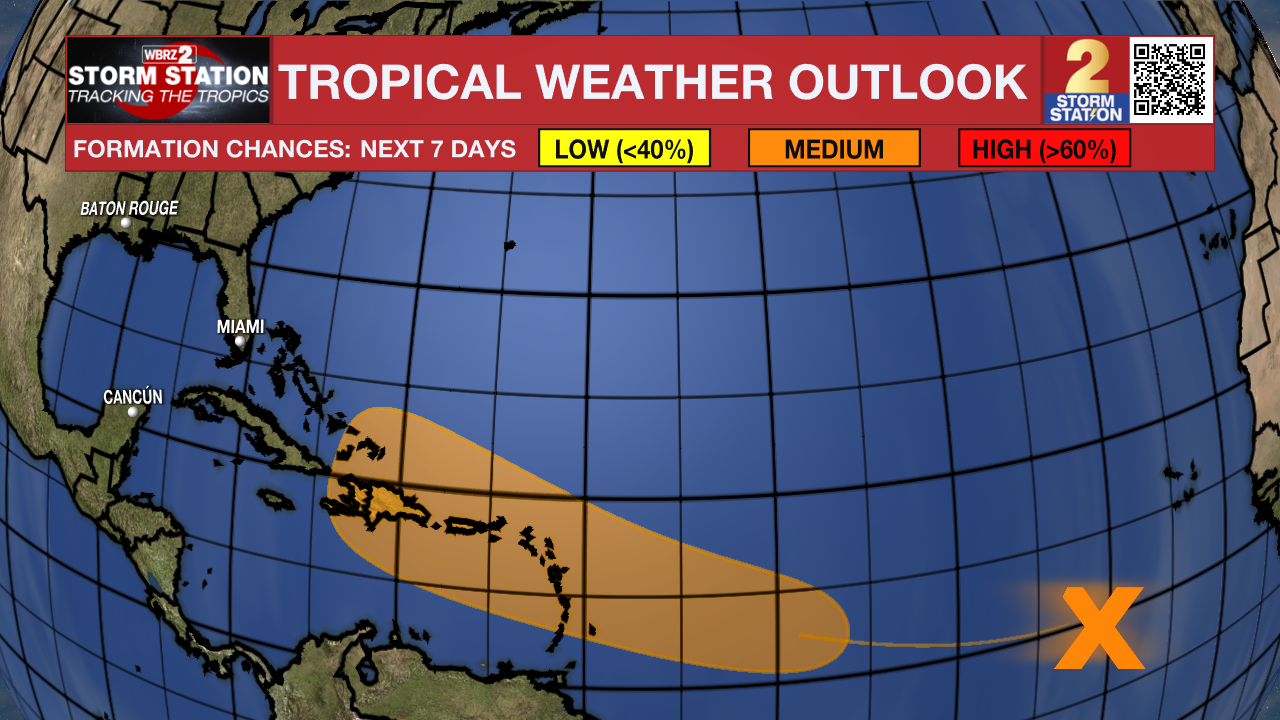
A tropical wave located over the eastern tropical Atlantic is producing widespread disorganized showers and thunderstorms. Any development of the wave should be slow to occur during the next few days while it moves westward across the central tropical Atlantic. Conditions are expected to become more conducive for development early next week, and a tropical depression could form while it approaches the Lesser Antilles.
Get the latest 7-day forecast and real time weather updates HERE.
Watch live news HERE.
– Josh
The Storm Station is here for you, on every platform. Your weather updates can be found on News 2, wbrz.com, and the WBRZ WX App on your Apple or Android device. Follow WBRZ Weather on Facebook and Twitter for even more weather updates while you are on the go.
More News
